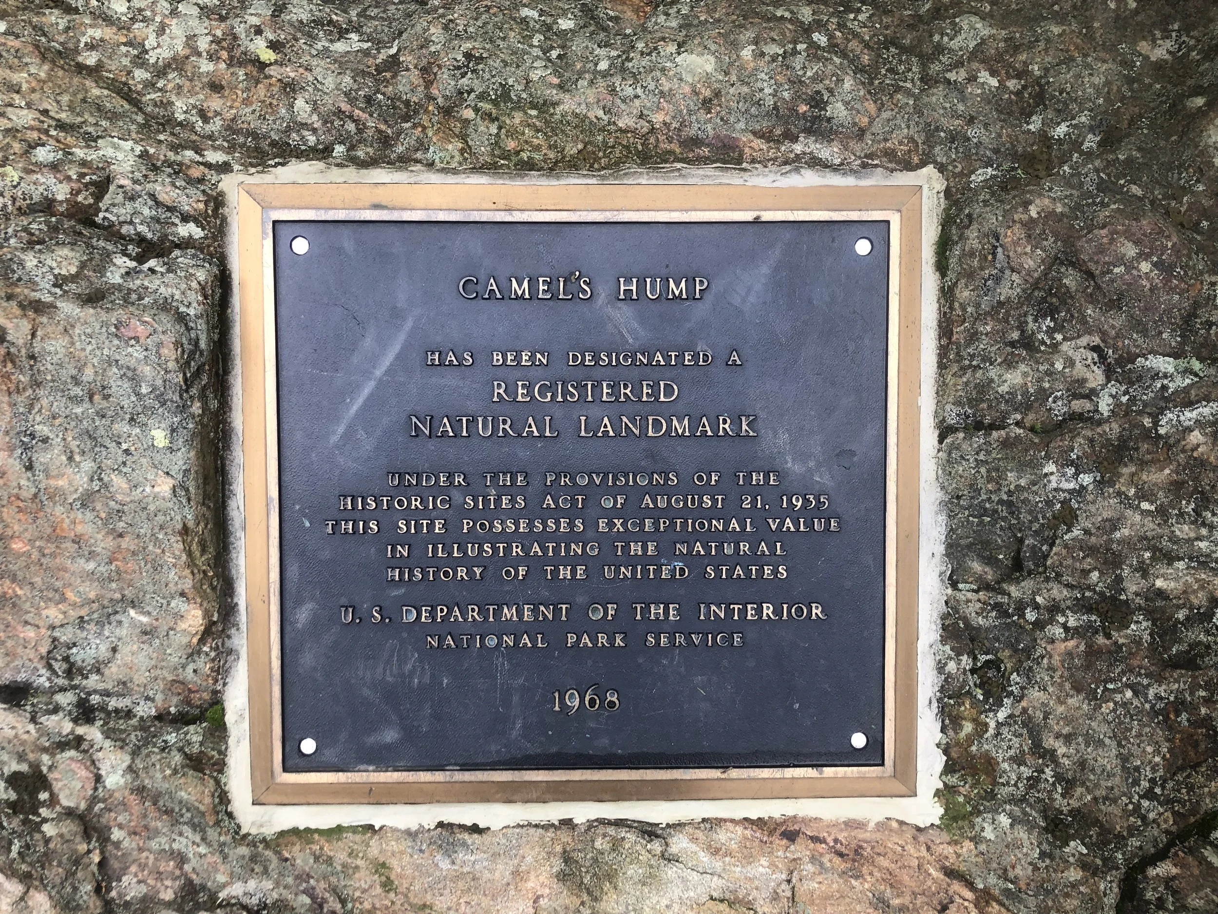
Camel's Hump (4,083')
If my dedication to this whole list thing was ever in question, let this be the day to debunk any doubts. Today, I turned 24. I also woke up at 3:50 am, loaded up my daypack, threw on my brandy-new trail runners (had to see what the Altra hype was about - happy birthday to me!), and jumped in the truck for 2 and 1/2 hours to Huntington for my 5th and final Vermont four thousand footer. I arrived at a misty 6:45 am after getting a bit turned around from spotty service and got right to work. There was only one other car in the lot of the Burrows trailhead, I figured must be a Long Trail section hiker as not many people would be hiking at this hour on a Monday morning.
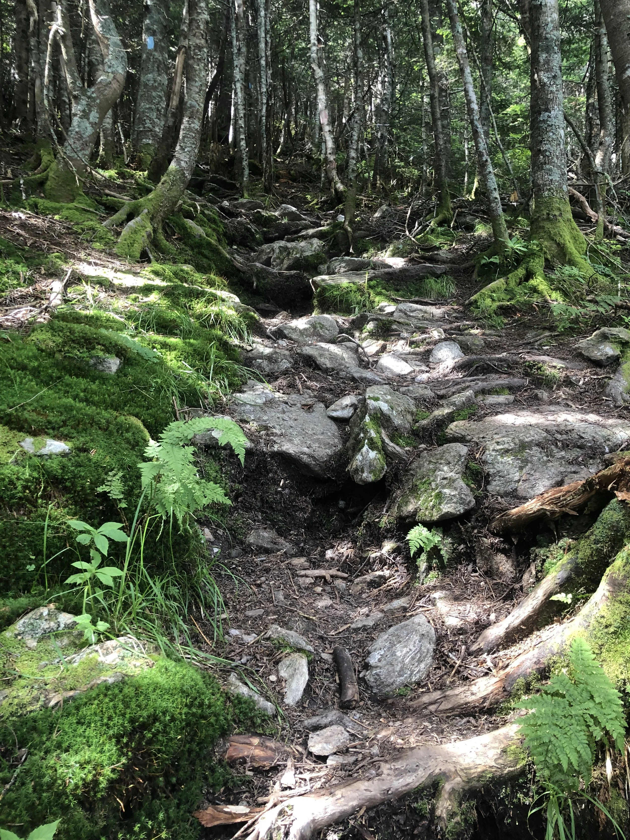
The trail seemed to split into two sides for the majority of the way; do you prefer slick rocks or twisted roots? Take your pick! I have to say, these shoes are amazing. Recently, I’d been having a hard time retiring 3 pairs of trail runners in lieu of trying out the new, trendy zero-drop shoes. The Salomon X-Mission 3s were my go-to hiker for the last 6 years and I’d busted through my last pair on my way down from Pico two days before. I’d also been noticing some radiating knee and back pain, especially coming down steep sections, so I did my research and opted to try the Altra Lone Peak 5 - arguably their most popular model. Science dictates that humans aren’t meant to be walking with a heel drop - it’s just not natural - and with most shoes featuring an average 12mm drop, it doesn’t seem like much, but that drop rocks you onto the ball of your feet and places unnecessary stress on your knees (putting my EMS Footwear Guru training to use here!) The wide toe box and super grippy soles made them infinitely more comfortable than a standard, cramped trail runner. I moving faster and more securely, especially because of how damp the air was, making everything slippery.
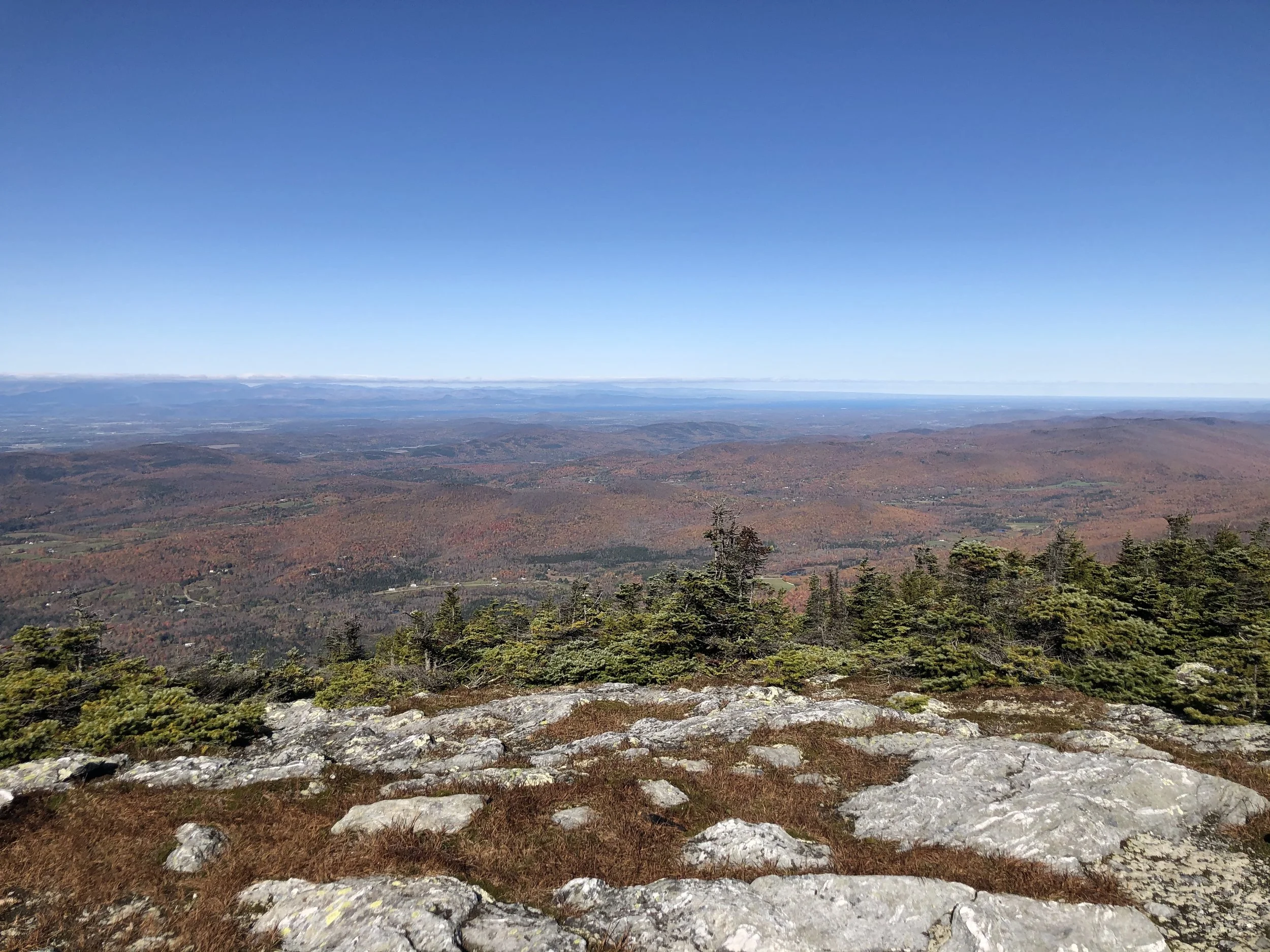
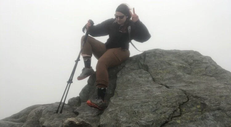
Not a soul on trail today which meant an eerie dichotomy of my nerves - so many things can go wrong when out in the wilderness - and enjoying the comfort of my own company. I set my start time, my pace, everything was up to me and I thrive given that independence. Burrows trail was incredibly straightforward; you are going straight up a mountain, it will be steep but manageable. At just over 2 miles, I joined up with the Long Trail south to reach the summit at around 8:20 am. There are supposed to be stunning views of the area and that iconic rock formation that makes The Hump, The Hump, but due to wind currents blowing wildfire smoke down through Canada from the western U.S. and seemingly imminent rain, I could hardly see 10 ft in front of me. Though disappointed, I couldn’t help but think how cool it was to be up there all alone in the mist, surrounded by salamanders just doing their thing. I put on the album I’d downloaded, Cornell 5/8/77, and stayed up there waiting out to see if the clouds would give for about an hour. It just wasn’t meant to be that day, so I somehow found those white blazes and started my climb down.
I began to see other hikers about two thirds of the way down, all of them so kind and pleasant, even for an “I hate Mondays” type of morning. The trail community in the Northeast is simply unrivaled and I’m so glad to be a part of it. I made it back to the truck around 11 and started my drive back to Clarendon, that other-worldly landscape still buzzing around in my head. The sun started to peer out as I was leaving Camel’s Hump State Park; I glanced up at where I’d just been sitting about an hour and a half prior and thought - what if I’d just started a little later, waited a little longer? No. If we’re constantly bothered with all the “what if’s”, we can never appreciate the “be here, now’s.”
Anyway, I’m off to Gringo Jack’s for some tacos and margaritas.
NH 0/48
New England 5/67
New England 6/100 Highest
Northeast 6/115


Pico Peak (3,967')
The off season had not been so good to me; after having COVID and moving out of a terrible living situation weeks before, I was back up in Vermont for my grandfather’s funeral. It’d been a long haul with my mother as his caretaker while he suffered from dementia - a lot of uncertainty remained moving forward, so mom and I took to the hills to get away and rest our minds for a while. I wanted to ease my way in after being sick so we chose Pico; it’s close and on the New England Hundred Highest list at just under four thousand feet.
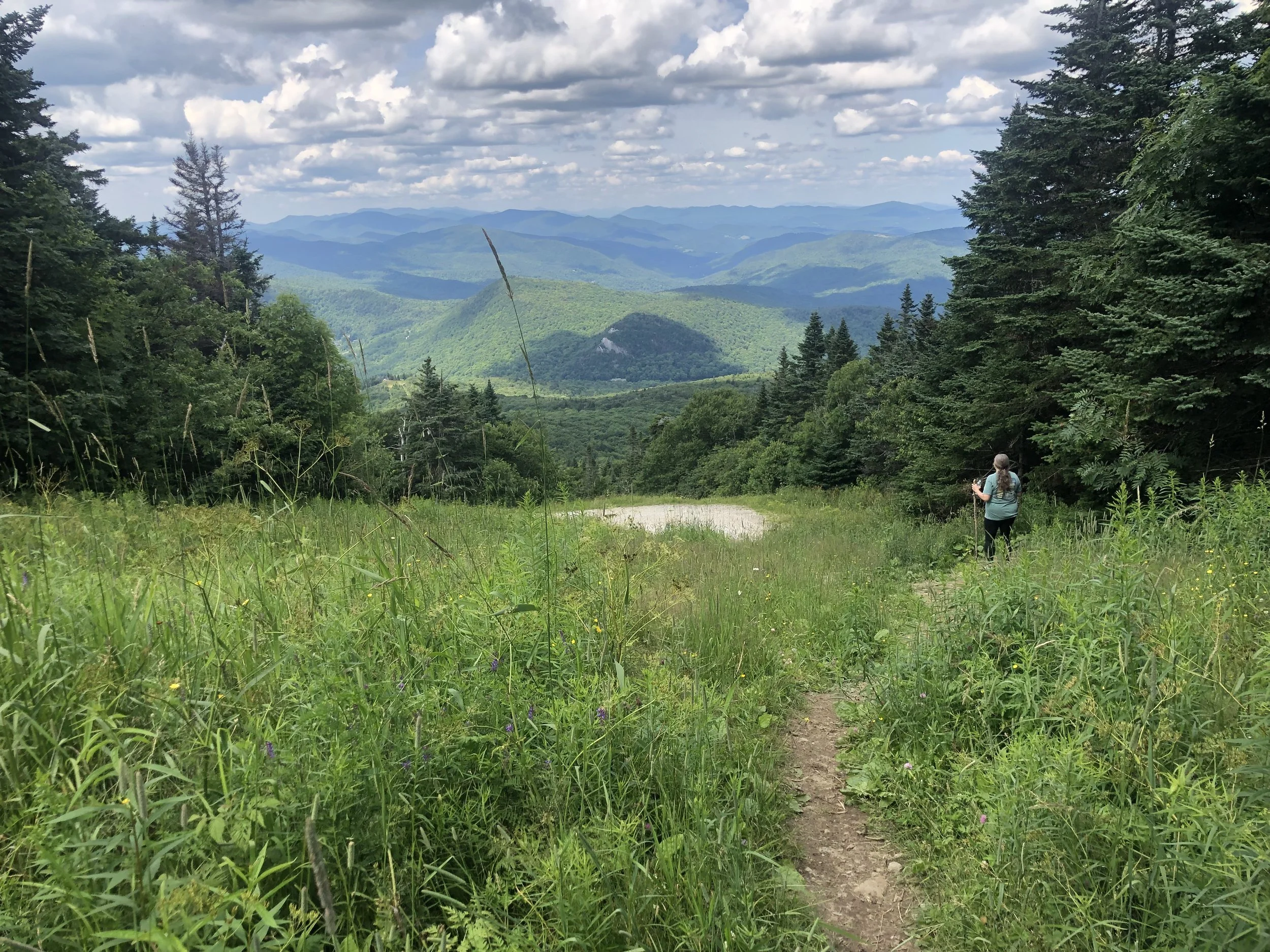
We ascended via the Sherburne Pass which meandered up from VT Rt. 4 and used to be a part of the Long Trail before it was re-routed, sharing stories of my grandfather and his love for animals and the outdoors, pondering on what the future might hold. About 2 miles in, the trail joined with a ski slope allowing for some nice views and wildflower patches. It was somber, yet serene as we basked in the quietness; I suppose life sort of is just that way, always bouncing back and forth between sunshine and hurricanes. We can’t control the weather, but I was thankful for this clear day for a change.
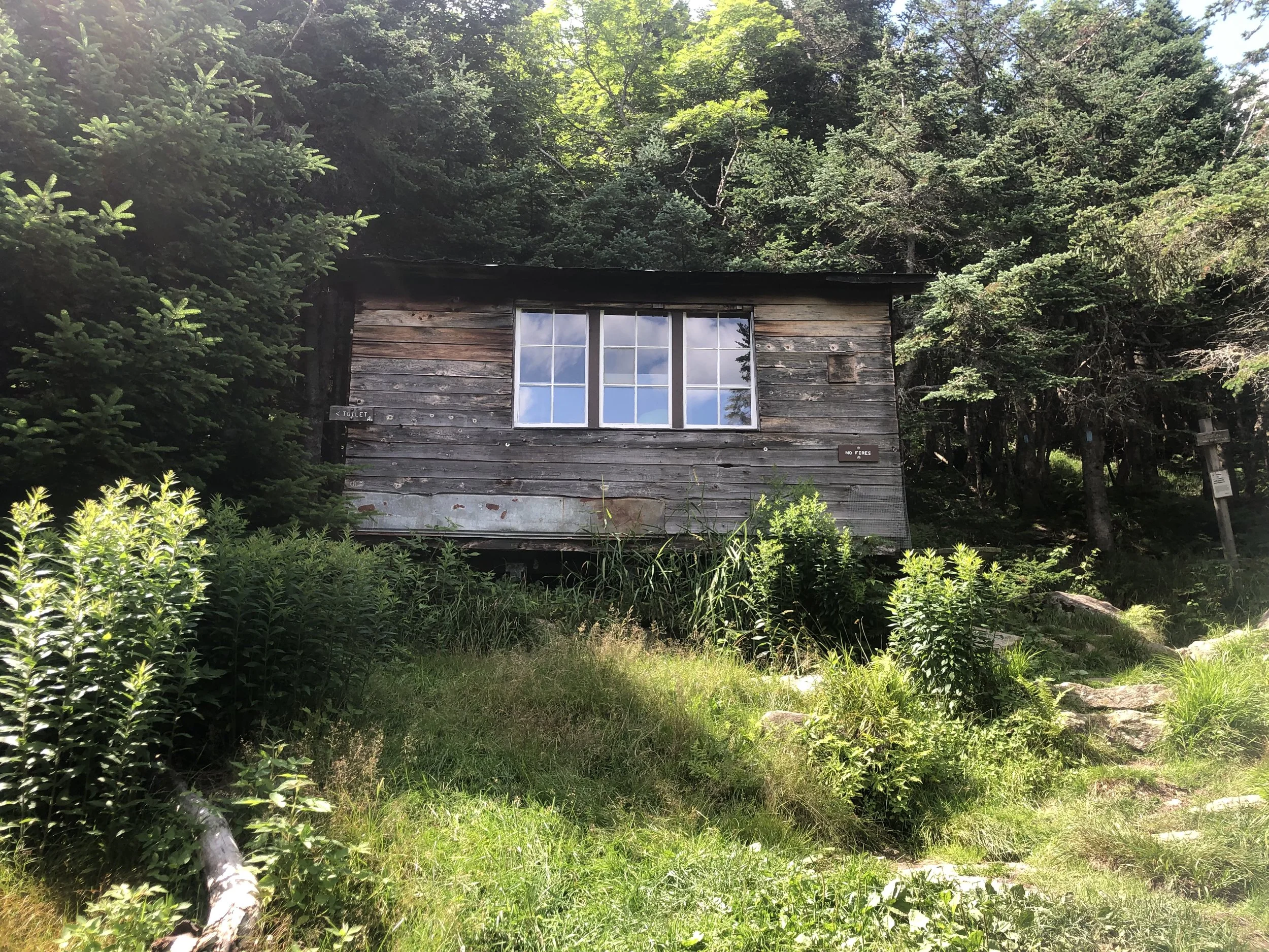
The last 1/2 mile up was the more traditional high peak terrain; lots of steeper climbing, rock scrambles, and even an immaculately maintained shelter (the Green Mountain Club chapters do such a fantastic job keeping up with trails through the state - so very thankful for all they do!) Another summit atop a ski slope that overlooked some familiar landmarks including the city of Rutland; Chittenden Reservoir, which I hiked around as a child with my mom and grandparents - quite full circle, if you ask me; and just behind the trees near the ski patrol lodge stood Killington. Had a nice conversation with an older couple with their daughter and dog from Windsor and enjoyed a snack before climbing down. Today was a peaceful day, despite it all. It got me thinking about a common saying among hikers and backpackers:
If you can’t carry it in your pack or in your soul, you probably don’t need it.
NH 0/48
New England 4/67
New England 5/100 Highest
Northeast 5/115


Mount Abraham (4,006′) and Mount Ellen (4,083′)
In true weekend warrior fashion, we booked a room last minute in Waitsfield during peak leaf-peeping season and left at 6am Saturday morning to beat the traffic heading north for our impromptu autumnal ‘Tour du Vert Mont’. Appropriately, we stopped at Drop-In Brewing in Middlebury before some boozy apple picking just down the road at Happy Valley Orchards. We ate lunch by the creek and found our way to our little ski lodge near Sugarbush Resort.
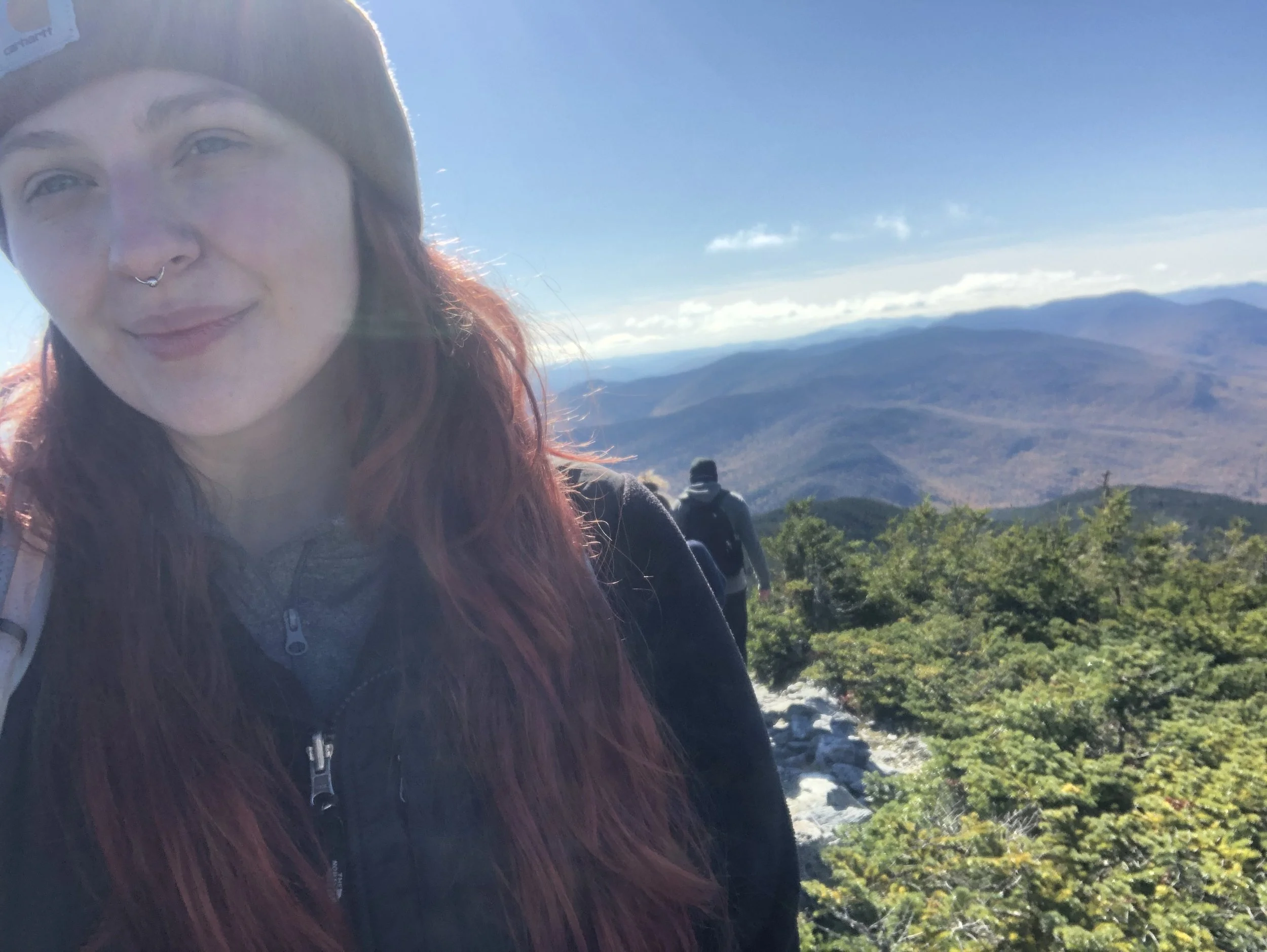
Waking up just as early the next day, we parked at Lincoln Gap and hit the Long Trail going north for a short, brisk 2.4 miles to the summit of Abraham - a very popular day hike and for good reason. It was a steep segment of trail, but the morning light peering through the trees and the creeping winter frost kept us moving. After a final push up the rock slab to the summit, we were greeted with incredible panoramic views from the top. Fire orange, deep rust reds, and golden yellows rustled through the trees overlooking the Adirondacks and Lake Champlain to the west; Green Mountain National Forest to the south; the Whites to the east; and the Canadian border to the north. I sat atop the summit in a rock circle for a while before the chill set in once again, I threw on my puffy, and continued north while my partner rested before making his way back down.
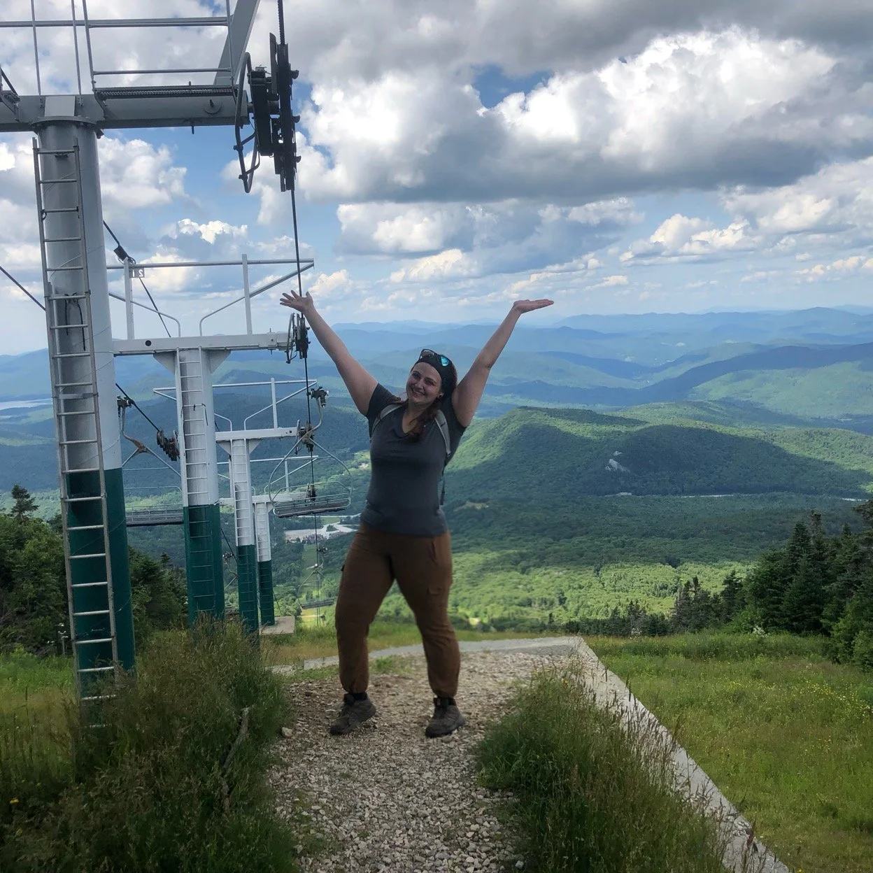
It’s a relatively flat (for northern Long Trail standards anyway) 3.3 or so miles on a ridge to Ellen, which shares its summit with Sugarbush as a ski slope. I was a bit pressed for time with dinner reservations at a brewery for 6pm, so with the wind behind me, I hurried along back under tree line in search of a glimpse at the remnants of a plane crash from the early 70s. After that, it was smooth sailing over Little Abe and Lincoln Peak before the trees opened once again and the ski lift lined the mountain. I snapped a quick photo, thanked Ellen for a picture-perfect moment, and headed back toward Abe.
The way back simply always feels longer - maybe it’s the fatigue, perhaps the wistful sadness of returning home after an adventure, but rambling down the way we came seemed an eternity. With aching knees, we found the truck, happy to have started when we did as cars from all down the eastern seaboard (and even some from the western one) dotted the dirt road up to the trailhead. My biggest peak-bagging day clocking in at 11.2 miles, wrapped up with beer cheese nachos and a (Lawson’s) Sip of Sunshine.
NH 0/48
New England 3 and 4/67
New England 3 and 4/100 Highest
Northeast 4 and 5/115