Camel's Hump (4,083')
If my dedication to this whole list thing was ever in question, let this be the day to debunk any doubts. Today, I turned 24. I also woke up at 3:50 am, loaded up my daypack, threw on my brandy-new trail runners (had to see what the Altra hype was about - happy birthday to me!), and jumped in the truck for 2 and 1/2 hours to Huntington for my 5th and final Vermont four thousand footer. I arrived at a misty 6:45 am after getting a bit turned around from spotty service and got right to work. There was only one other car in the lot of the Burrows trailhead, I figured must be a Long Trail section hiker as not many people would be hiking at this hour on a Monday morning.
The trail seemed to split into two sides for the majority of the way; do you prefer slick rocks or twisted roots? Take your pick! I have to say, these shoes are amazing. Recently, I’d been having a hard time retiring 3 pairs of trail runners in lieu of trying out the new, trendy zero-drop shoes. The Salomon X-Mission 3s were my go-to hiker for the last 6 years and I’d busted through my last pair on my way down from Pico two days before. I’d also been noticing some radiating knee and back pain, especially coming down steep sections, so I did my research and opted to try the Altra Lone Peak 5 - arguably their most popular model. Science dictates that humans aren’t meant to be walking with a heel drop - it’s just not natural - and with most shoes featuring an average 12mm drop, it doesn’t seem like much, but that drop rocks you onto the ball of your feet and places unnecessary stress on your knees (putting my EMS Footwear Guru training to use here!) The wide toe box and super grippy soles made them infinitely more comfortable than a standard, cramped trail runner. I moving faster and more securely, especially because of how damp the air was, making everything slippery.
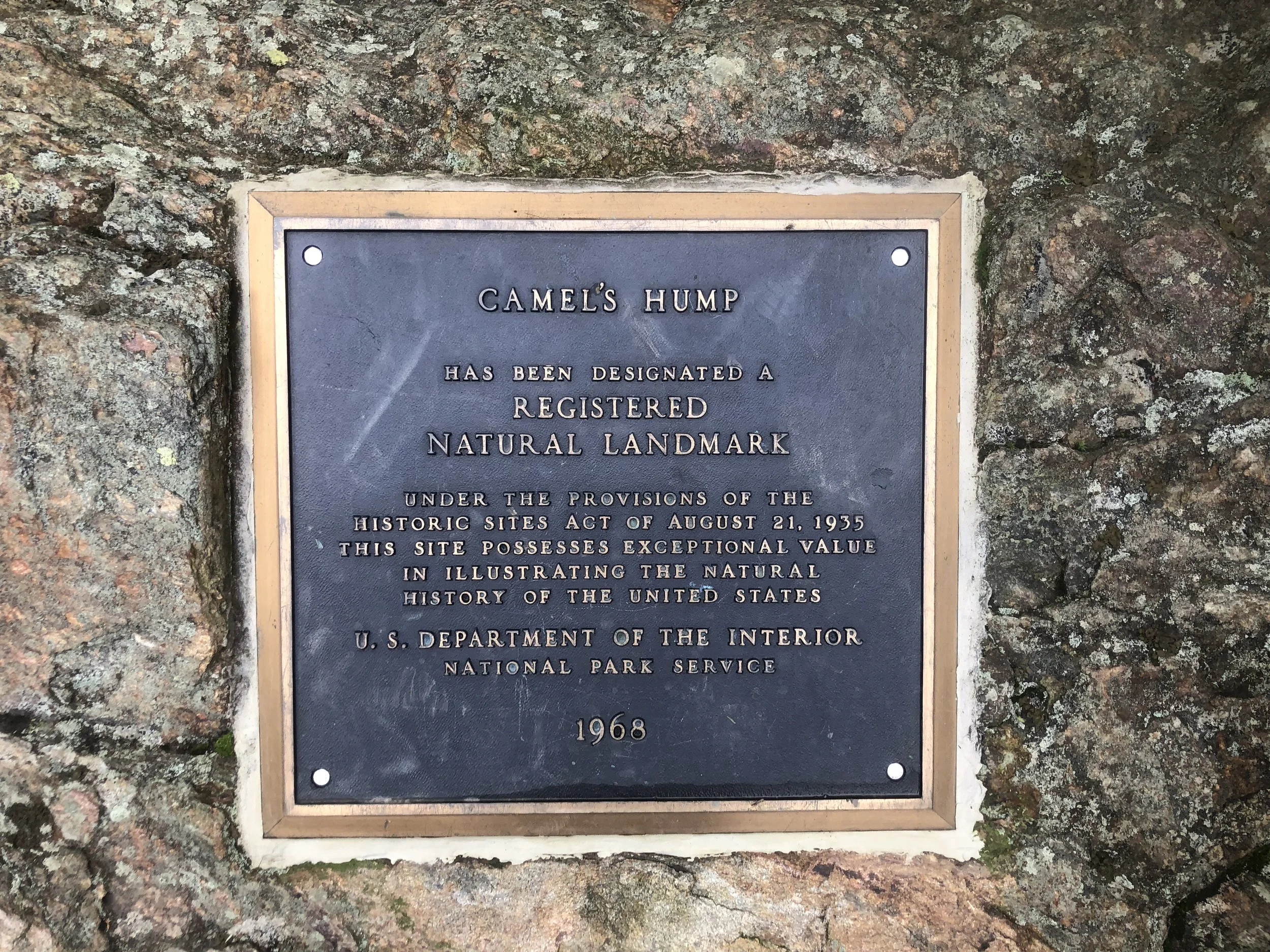
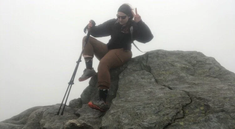
Not a soul on trail today which meant an eerie dichotomy of my nerves - so many things can go wrong when out in the wilderness - and enjoying the comfort of my own company. I set my start time, my pace, everything was up to me and I thrive given that independence. Burrows trail was incredibly straightforward; you are going straight up a mountain, it will be steep but manageable. At just over 2 miles, I joined up with the Long Trail south to reach the summit at around 8:20 am. There are supposed to be stunning views of the area and that iconic rock formation that makes The Hump, The Hump, but due to wind currents blowing wildfire smoke down through Canada from the western U.S. and seemingly imminent rain, I could hardly see 10 ft in front of me. Though disappointed, I couldn’t help but think how cool it was to be up there all alone in the mist, surrounded by salamanders just doing their thing. I put on the album I’d downloaded, Cornell 5/8/77, and stayed up there waiting out to see if the clouds would give for about an hour. It just wasn’t meant to be that day, so I somehow found those white blazes and started my climb down.
I began to see other hikers about two thirds of the way down, all of them so kind and pleasant, even for an “I hate Mondays” type of morning. The trail community in the Northeast is simply unrivaled and I’m so glad to be a part of it. I made it back to the truck around 11 and started my drive back to Clarendon, that other-worldly landscape still buzzing around in my head. The sun started to peer out as I was leaving Camel’s Hump State Park; I glanced up at where I’d just been sitting about an hour and a half prior and thought - what if I’d just started a little later, waited a little longer? No. If we’re constantly bothered with all the “what if’s”, we can never appreciate the “be here, now’s.”
Anyway, I’m off to Gringo Jack’s for some tacos and margaritas.
NH 0/48
New England 5/67
New England 6/100 Highest
Northeast 6/115


Mount Abraham (4,006′) and Mount Ellen (4,083′)
In true weekend warrior fashion, we booked a room last minute in Waitsfield during peak leaf-peeping season and left at 6am Saturday morning to beat the traffic heading north for our impromptu autumnal ‘Tour du Vert Mont’. Appropriately, we stopped at Drop-In Brewing in Middlebury before some boozy apple picking just down the road at Happy Valley Orchards. We ate lunch by the creek and found our way to our little ski lodge near Sugarbush Resort.
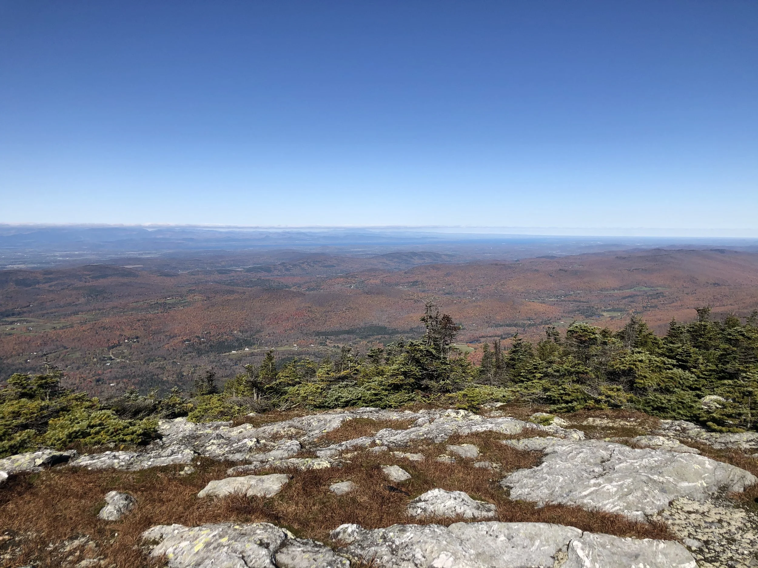
Waking up just as early the next day, we parked at Lincoln Gap and hit the Long Trail going north for a short, brisk 2.4 miles to the summit of Abraham - a very popular day hike and for good reason. It was a steep segment of trail, but the morning light peering through the trees and the creeping winter frost kept us moving. After a final push up the rock slab to the summit, we were greeted with incredible panoramic views from the top. Fire orange, deep rust reds, and golden yellows rustled through the trees overlooking the Adirondacks and Lake Champlain to the west; Green Mountain National Forest to the south; the Whites to the east; and the Canadian border to the north. I sat atop the summit in a rock circle for a while before the chill set in once again, I threw on my puffy, and continued north while my partner rested before making his way back down.
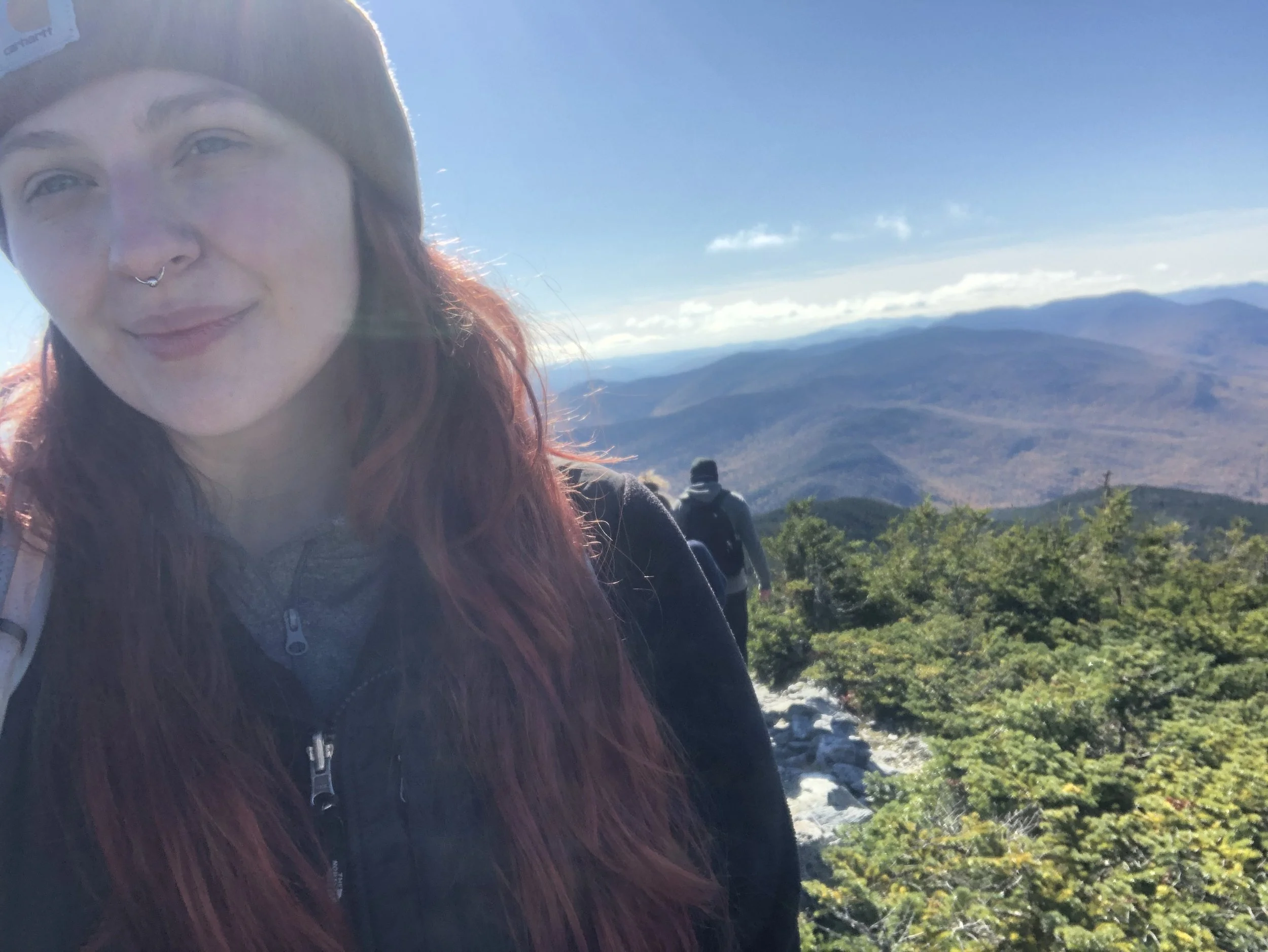
It’s a relatively flat (for northern Long Trail standards anyway) 3.3 or so miles on a ridge to Ellen, which shares its summit with Sugarbush as a ski slope. I was a bit pressed for time with dinner reservations at a brewery for 6pm, so with the wind behind me, I hurried along back under tree line in search of a glimpse at the remnants of a plane crash from the early 70s. After that, it was smooth sailing over Little Abe and Lincoln Peak before the trees opened once again and the ski lift lined the mountain. I snapped a quick photo, thanked Ellen for a picture-perfect moment, and headed back toward Abe.
The way back simply always feels longer - maybe it’s the fatigue, perhaps the wistful sadness of returning home after an adventure, but rambling down the way we came seemed an eternity. With aching knees, we found the truck, happy to have started when we did as cars from all down the eastern seaboard (and even some from the western one) dotted the dirt road up to the trailhead. My biggest peak-bagging day clocking in at 11.2 miles, wrapped up with beer cheese nachos and a (Lawson’s) Sip of Sunshine.
NH 0/48
New England 3 and 4/67
New England 3 and 4/100 Highest
Northeast 4 and 5/115


Killington Peak (4,229')
A quick trip up to visit my mom for Labor Day weekend meant poking around for something to do right in her theoretical backyard. My grandfather was born in West Rutland and eventually made his way back semi-permanently to build a vacation home in Clarendon in the early 1970s with Killington ski resorts right around 20 mins away. While I’ve never been skiing (definitely someday!), my mom had hit the slopes there dozens of times. No one in my family, however, had ever hiked up it. I somehow convinced my mom it would be a good idea to come with me.
We started around 9:30 am up the Bucklin trail, the sloping first 2 miles were misleading for what was to come as it was straight up from there. As we climbed, the trail conjoined with a grassy summer ski path - I’m not sure if the lack of roots and rocks made the ascent easier or harder, but it was a welcome change of pace as we began to see the cascading green and lots of familiar places like VT Rt. 4 and Killington village. Nearing the top, there’s a wooden stairway up to where the trail meets the gondola where visitors can take a ride to the restaurant and tourism center around a third of a mile down from the actual summit which is only accessible by a rocky spur trail.
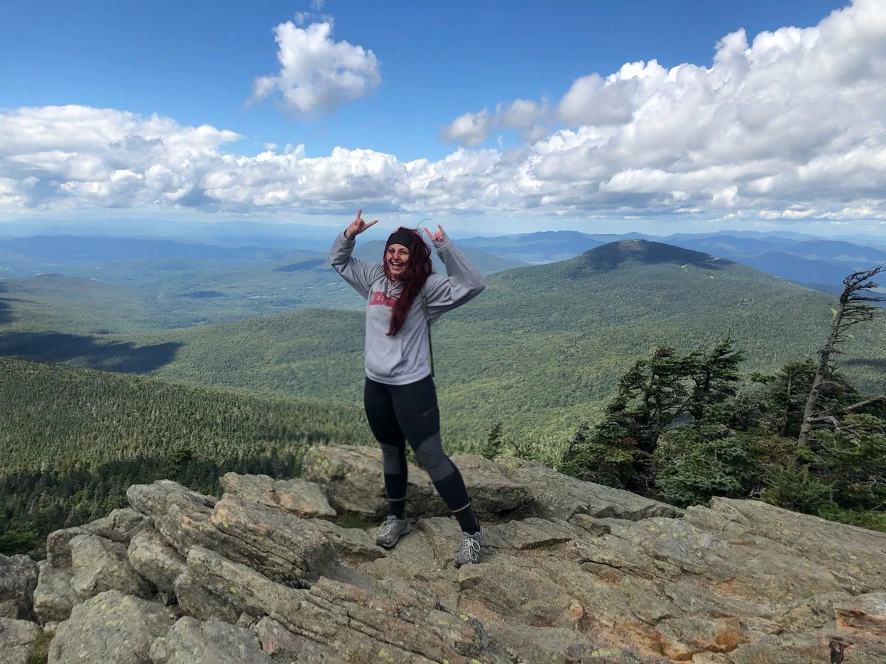
It was a windy, chilly bluebird day and it meant so much to be able to share it with my mom. We spent around 20 minutes at the top admiring the near 360°, wishing the fire tower was still accessible to climb up and smiling over the fact that this was my mom’s first ever four thousand footer. She didn’t need to check off any lists, but I could tell the trip meant a lot to her too. I’m so thankful to have her as a mom - she has inspired and fostered my independence, love of the outdoors, and so many other positive qualities I’ve found in myself. We exchanged pictures and spoke with a few other hikers, then headed back towards the lodge and back down to the parking lot. That night, we cooked veggie burgers out on the grill and raised a pint of The Shed Mountain Ale by the fire pit - it doesn’t get much better than that.
NH 0/48
New England 2/67
New England 2/100 Highest
Northeast 3/115


Mount Mansfield (4,395′)
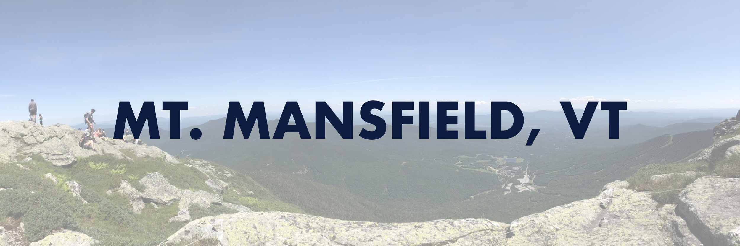
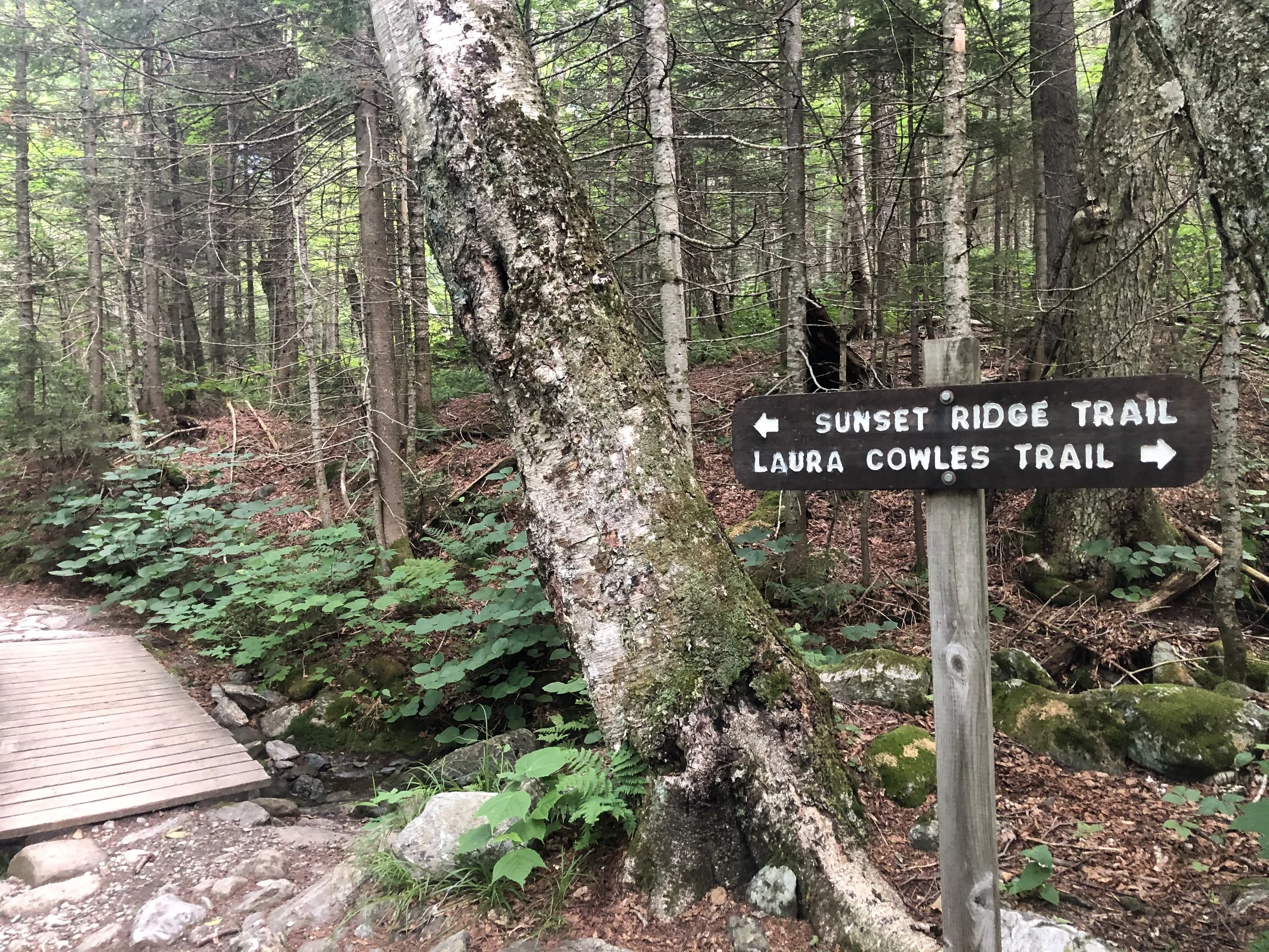
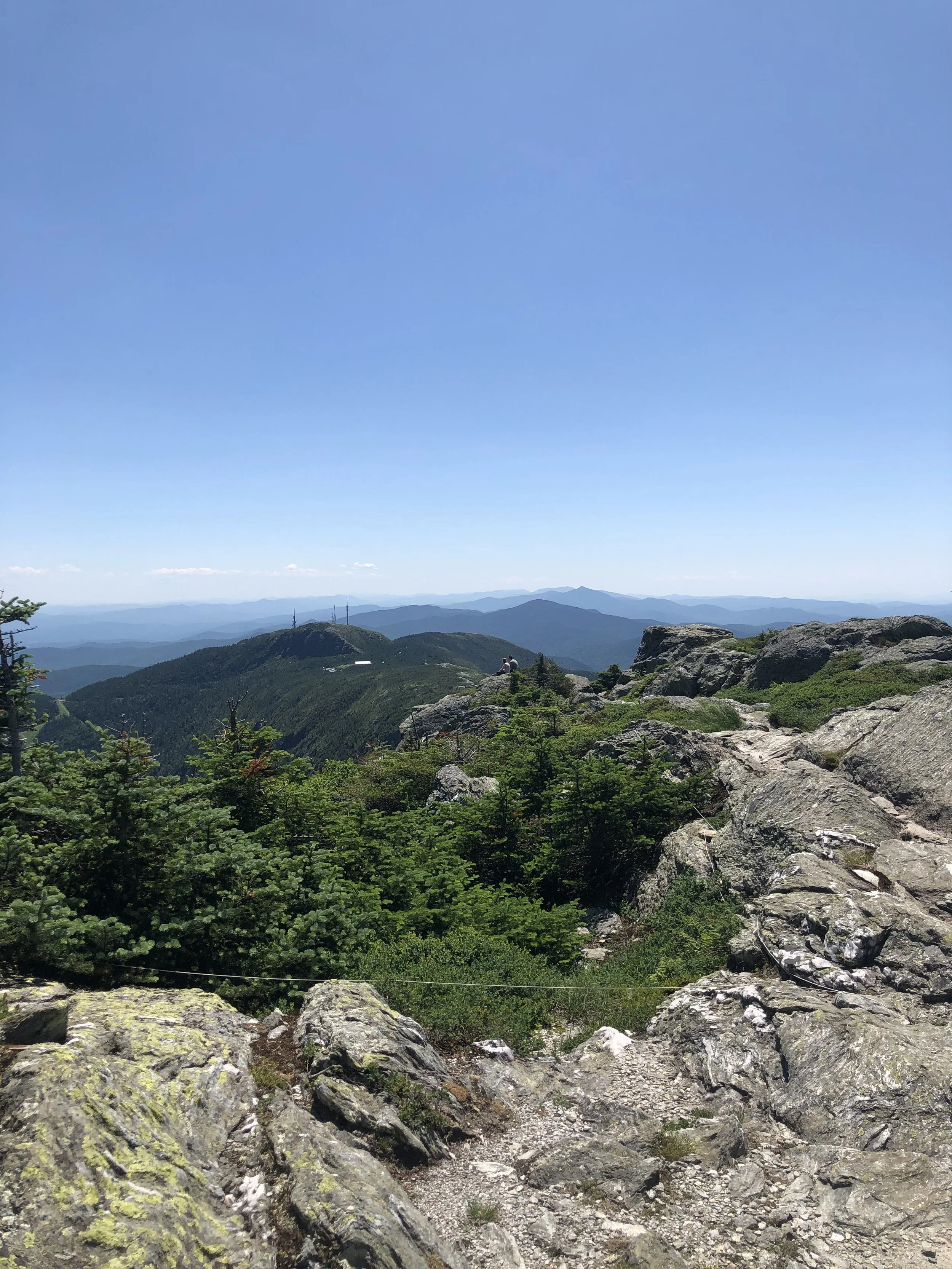
I’d be lying if I said with 100% certainty I knew what I was getting myself into. After a day of researching, much of it from others’ recommendations in a Facebook group, I made my way from my mom’s place outside of Rutland, VT up to Underhill State Park around 2 hours away. I decided to ascend via the Laura Cowles trail starting around 8:30 am - this was the shorter and steeper 2.6 mi route directly up to The Chin, the highest point of the mountain.
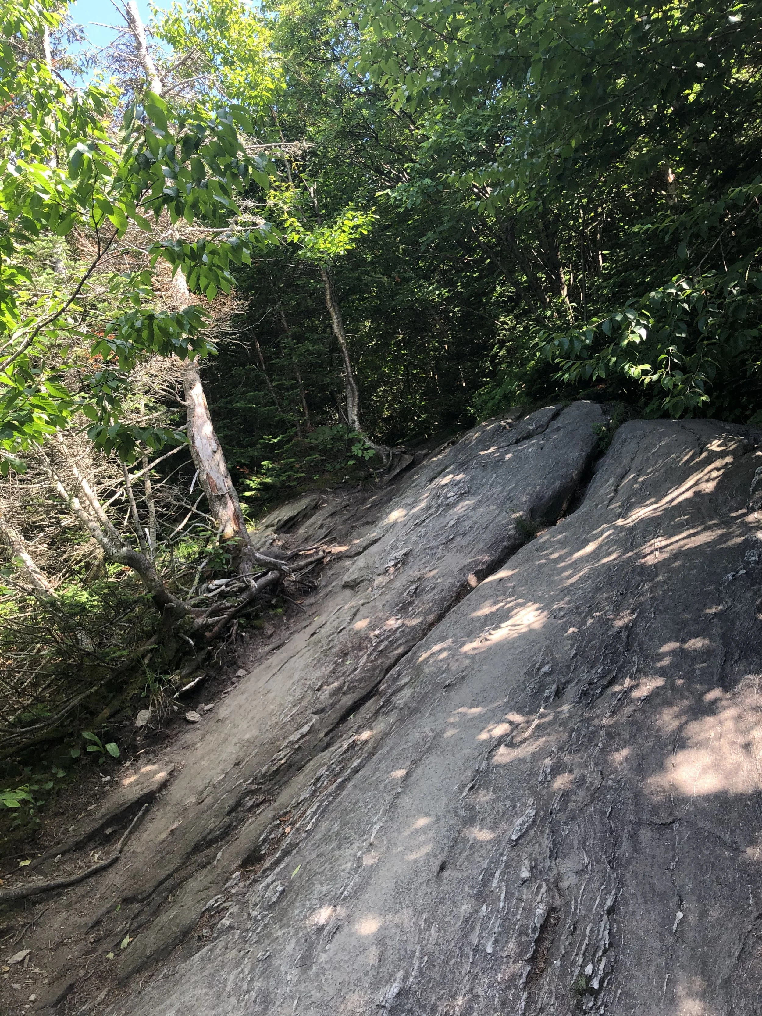
The first mile or so of trail is an old logging road, which felt pretty gentle. Once officially on the Laura Cowles trail, the terrain became more and more rugged the way up. Roots, slabs of granite, small boulder fields - it felt like a big outdoor playground. Soon, the trees grew smaller and smaller until they practically disappeared for the last 3/4 of a mile to the summit. This was my first time entering the Alpine Zone, a biome that exists in higher elevations with fragile vegetation that takes years to grow and seconds of misplaced footsteps to be totally destroyed.
There was something about crawling up that rock scramble nearing the top that just made me feel small and insignificant, but not in a negative way. I was just grateful and humbled by the fact I was able to exist under those conditions in that moment. A ‘Carole King’ sense of feeling the earth move beneath your feet, it just keeps turning while we’re all trying to get somewhere because we’re human and that’s what we do. Despite the scorching July heat, sun exposure, and (what I would later find out to be) expired sunscreen, I pushed on and joined up with the Long Trail (LT) to summit Mansfield. Along the LT were the additional prominences of the mountain; to the north, the Adam’s Apple and to the south, the Nose and the Forehead.
I can’t say it was an emotional event, I’m just not that kind of person. I was exhausted and low on water, so I laid down on a rock and basked in the late morning sun like a lizard, content and feeling as though I was simply meant to be there. I snacked on half a protein bar, took some photos, peered down at (from where I was standing) the small town of Stowe, and began my descent down the Sunset Ridge trail. My legs felt like jello and I was ‘lobstah’ red upon returning to the car from my day above tree line, but I was filled with such immense pride in my accomplishment. I stopped at a packie on the way back and celebrated with a Snickers bar, Dilly Bites, and a cold Long Trail Ale - that’s just the hiker way - and began planning my next trip.
NH 0/48
New England 1/5
New England 1/100 Highest
Northeast 1/115