Equinox Mountain (3,855′)
For the record, September sucks.
This summer, I’ve been bouncing back and forth between my to expensive and time consuming hobbies; horses and running away to the mountains to go hiking. A day after my last big hike, I lost my heart horse who I’d owned and loved for nearly a decade to a horrible colic incident. Everything that I could have done, I did, but it still wasn’t enough. I’m angry. I’m heartbroken. I’m sick to my stomach over it and nothing could really make it any better. I can’t sleep, I can’t eat, people think I’m crazy because “he’s just a horse” - it’s more than telling when I hear that last line. There’s nothing comparable to the relationship between horse and rider. It’s losing something you couldn’t communicate with in words, yet still entrusted your life to. Perhaps then they’d get it.
I figured a trip out to the woods to sort my mind would do me some good.
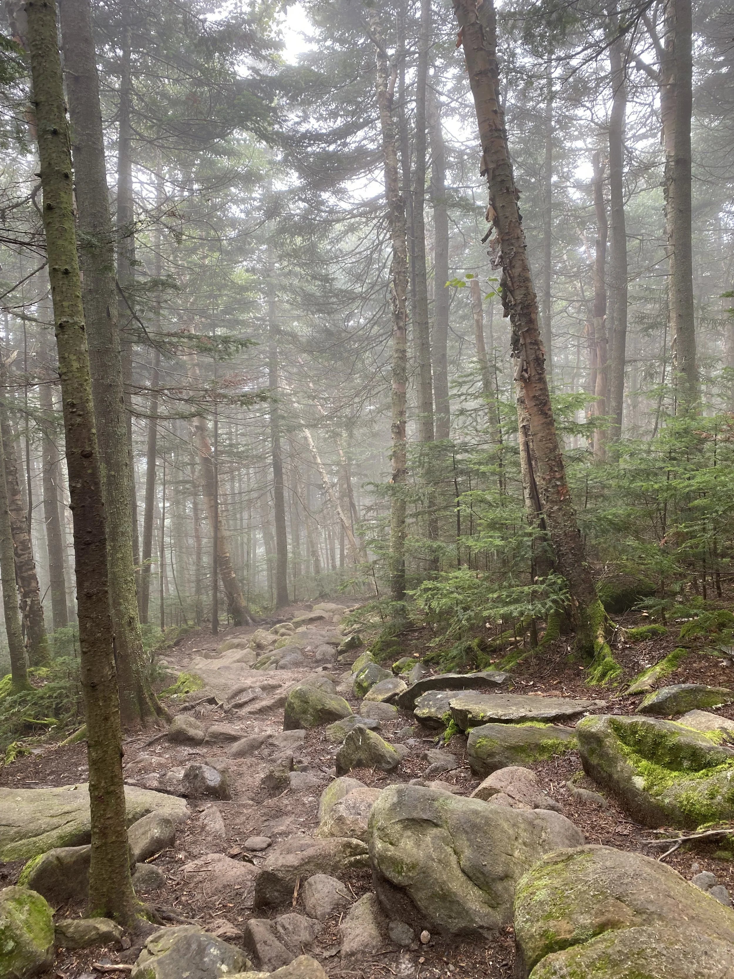
I begrudgingly got out of bed around 10 am (I’m not one to sleep late, but the last week had been too difficult to bear staying awake for longer than I absolutely needed to be), got dressed, threw on shoes, and headed down to Manchester Center with my partner. We got to the parking lot around 11 am and started hiking. I wasn’t necessarily looking forward to checking anything off my list, but at least I’d feel like I accomplished something, anything. The Summit trail started off on a wide, switchbacked logging road and quickly turned steep and rocky after a small stream crossing. My partner had been complaining of some knee pain so, ready to bail as this trip was just not doing it for me, I asked if he’d like to turn around and head back. He said no, so we continued on as the trail narrowed and we began seeing a change in scenery, from fading maples to vivid pines and ferns.
The last 0.25 mi to the top was oddly civilized; old radio towers, wires, eventually happening upon the notable Carthusian Monastery accessible via auto road from Skyline Drive below. It’s an incredibly odd feeling to emerge from the woods covered in sweat and mud only to be faced with a horde of people dressed in their Sunday’s best. And of course, every “you HIKED up here?” - maybe we were the crazy ones. So many times I go to the mountains for some silence, when my head is rushing and I can’t turn it off. Today was just not that day and sometimes, you don’t get those answers you were looking for.
My partner’s knee pain had only worsened from the steep decline. It was a hellish 4 hours back down to the car with me doing my best to support him mentally and physically while we clambered back down by light of headlamps and the lunar light peering overhead in the trees. Did we do everything right? Probably not, but sometimes you can only do the best you can in that moment. It made me think of grief - living without really existing, survival mode, not always doing everything the right way, but in your own way to keep your head above water. We sat under the moon in the bed of the pickup truck, each with a massive Bud Light Seltzer in our hands and Chinese takeout in our laps. We were banged up, but still proved to ourselves if we can still find a way to laugh even in those darkest moments; well, I guess we’re doin’ alright.
NH 3/48
New England 8/67
New England 11/100 Highest
Northeast 10/115


Mendon Peak (3,840′)
Directional navigation has always made sense to me, and I’ve truly always had a knack for it, especially on road trips. It’s not all that complicated. Begin with positioning the sun - in the Northern Hemisphere, the sun’s highest point in a given day is directly south, you just have to visualize the projected arc. Once you have that, the other cardinal directions are easily realized. I’ve read a lot of maps; roadways, topographical, etc. Maybe I’ve just gotten good at navigational awareness, but I will never claim to be perfect. This trail certainly gave me a run for my money.
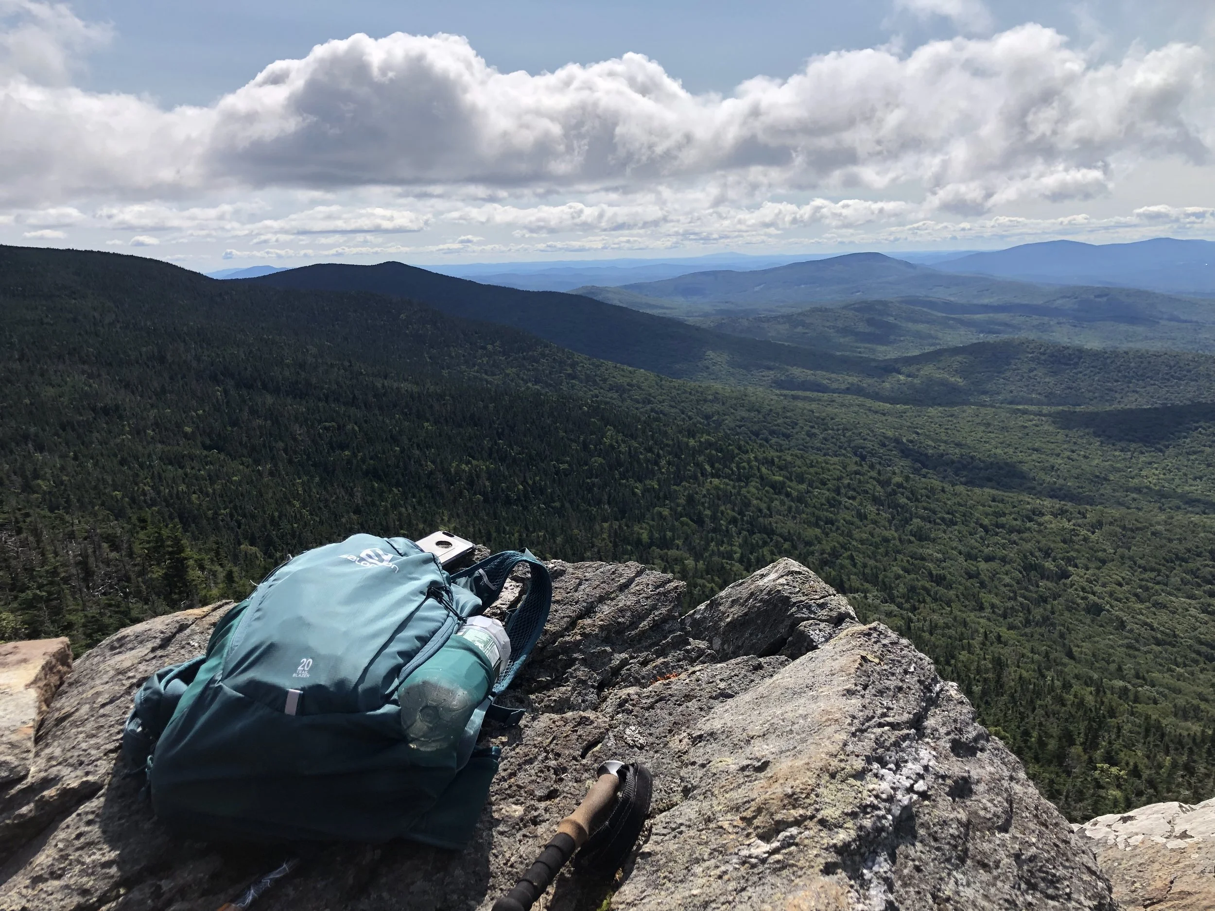
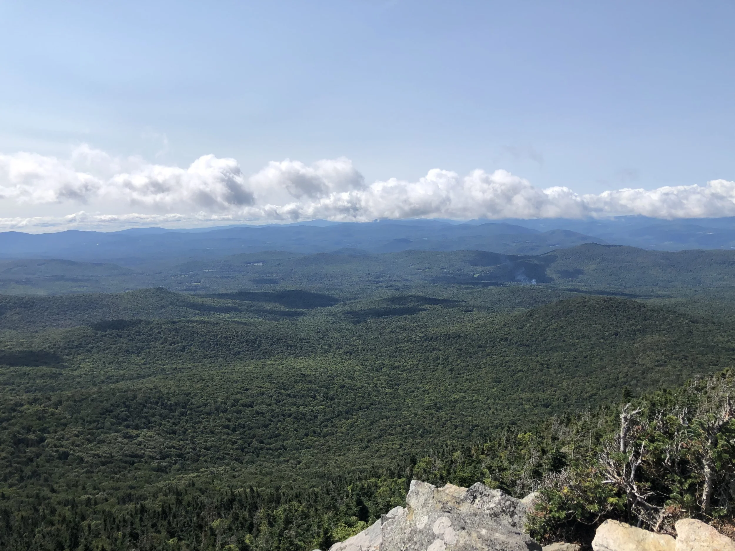
The Mendon Peak trail, though not much of a trail as I’d come to find out, shares a parking area with the Bucklin trail I used to hike Killington a year prior. A longer mileage hike for a single, smaller peak at around 10 miles, the first mile is a relatively flat logging road until you reach a fork. From there, things get a bit tricky with multiple turns coming up quickly, around every 0.25-0.65 mi. Nothing is marked and I found myself searching for the brook crossings I read about in the guide book before leaving for this hike. At some point, I’d gotten off track, resulting in a 2 mile bushwack to get back on trail. Exhausted, mostly from nerves as this is a very remote trail, I finally found the brook I should have woven over several times and continued on.
From there, the trail is a series of steep switchbacks up to the peak - I would say these would be welcome, as switchbacks are fairly uncommon in New England, but the added distance was frustrating and I was running out of battery life from trying to find my way back on trail. The last mile to the top is, once again, completely unmarked and in a more open forest so it was really easy to lose your way. The actual summit is wooded, but there is a nice overlook slightly northwest from the sign where I recognized the Killington fire tower and Pico Peak. Should I have brought a backup battery charger? Sure. Should I have brought a paper map? Maybe, though it might not have even been that helpful since there really was no trail. Learn from my mistakes and always have a backup to your choice of navigation just in case.
After a quick snack on the overlook, I bolted back down the mountain - the correct way this time - and made it back to the truck before my phone died. Between the bushwacking and wandering around to find the trail, I hiked almost a half marathon today. Needless to say, I was happy to make it back home.
NH 3/48
New England 8/67
New England 10/100 Highest
Northeast 9/115


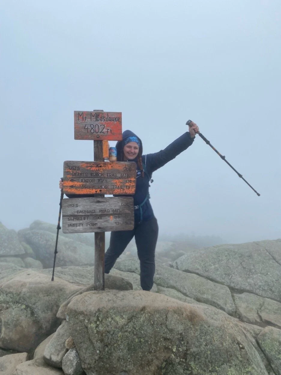
Mount Moosilauke (4,802')
Our first trip of back to back hiking to make the most of the drive didn’t come without any concerns. I was strategic in my planning and chose a second hike that would hopefully not cause our legs to fall off from sheer exhaustion after the 9-ish miles yesterday and I believe I picked the right one. My partner was never a huge hiker, but has always been supportive of my goal (although insignificant to him) so the fact that this became his favorite mountain we’ve hiked felt even more justified.
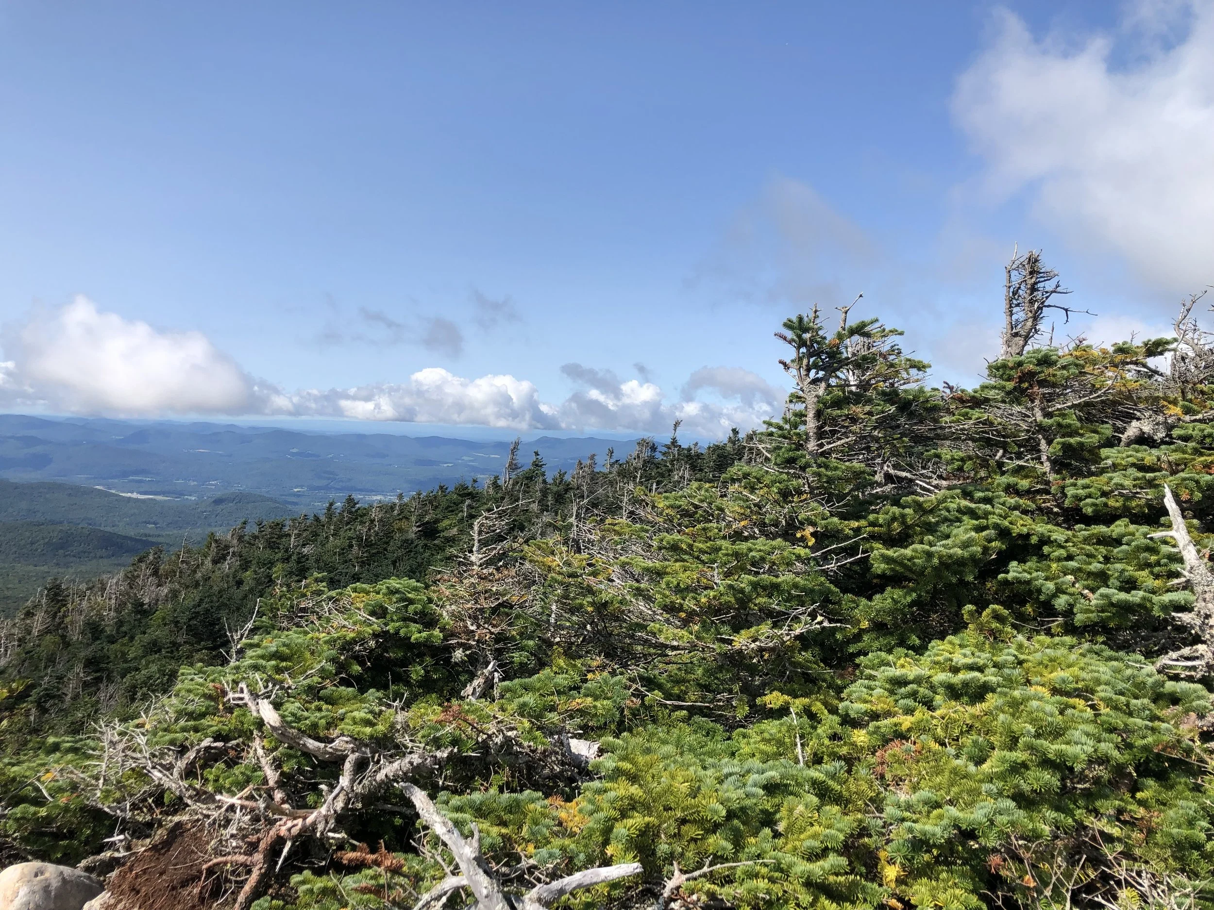
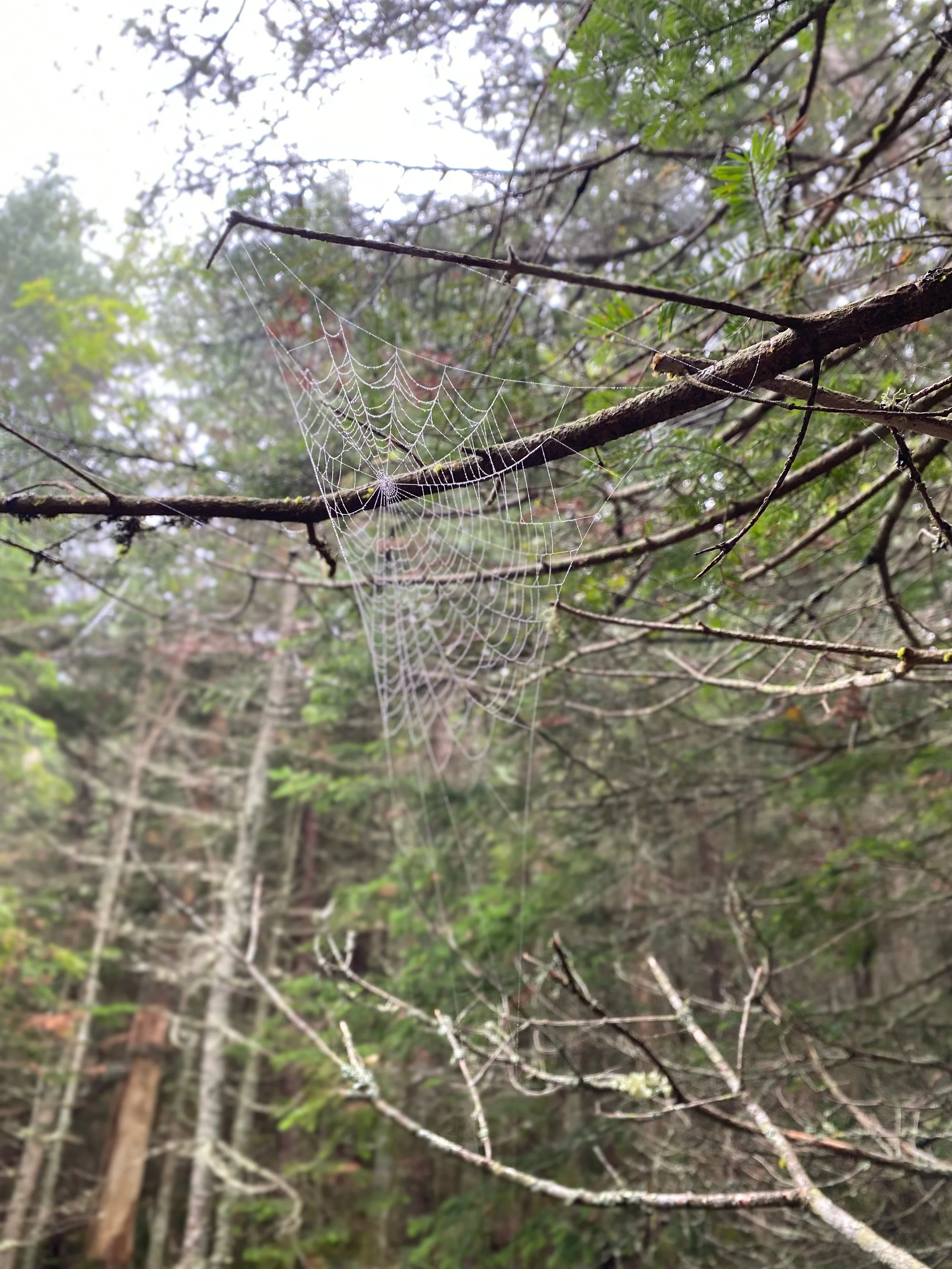
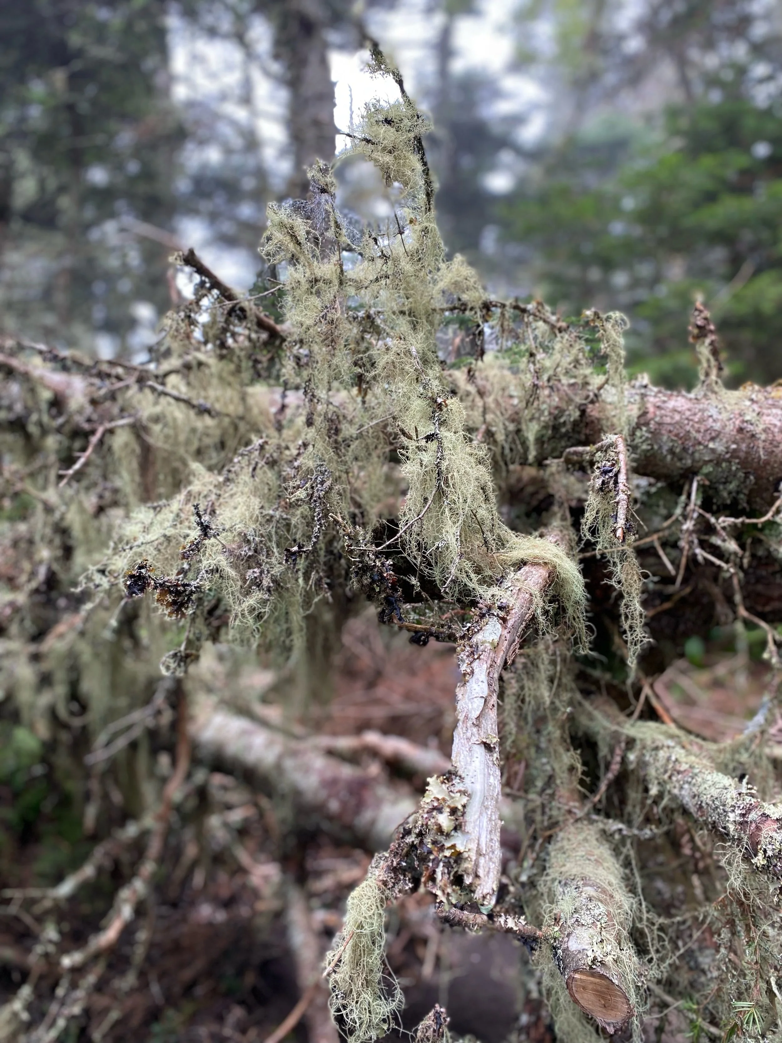
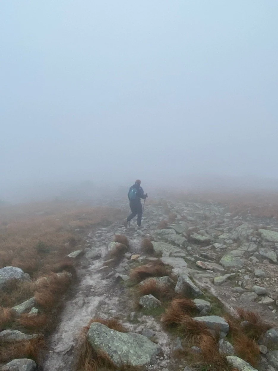
The day didn’t look particularly inviting for a scenic summit, I seem to attract the clouds, but the iconic sign atop ‘The Moose’ and perhaps even more iconic propensity for poor weather seemed fitting for our first trip up. We ascended via the Gorge Brook trail, the roaring water serving as a sort of calming soundscape. For what we’d accomplished yesterday, we were moving fairly quickly, though the trail was quite forgiving with only a few high-grade steep portions towards the top. For the most part, we fell silent and took in all the sights and sounds of the forest. As far as the White Mountain four thousand footers go, though well-traveled, Moosilauke stands alone in its own remote section of the Whites. My partner has a better phone camera than I do, so I played around in portrait mode capturing the quiet things that no one ever really knows are there. Moss, lichen, and spiderwebs coated the trees like lace; they gripped onto water droplets from the misty morning air.
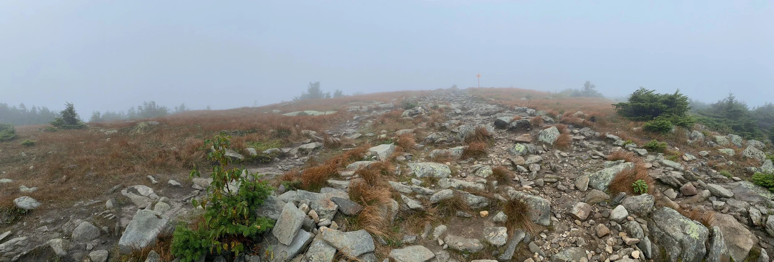
Entering the alpine zone I was met with the most refreshing, delectable smell I lack the words to describe. Zippy evergreen pine; sweet, sticky syrup; the earthy decay of the forest floor - I wish I could have collected it in a jar and made it into a candle I could burn for the rest of my days. It had been quite some time since I’d been on a truly bald summit, trodding over rock piles through the haze. At the summit sign, I popped open an appropriately named Cloud Walker IPA and exchanged some pleasantries with a few AT thru-hikers gearing up for the Whites.
The descent was equally peaceful, despite the breeze growing stronger, whispering through the alpine grasses. Ferns and branches billowed in the wind, needles cascaded to the forest floor. It was pure sensory satisfaction today in every detail and it’s pretty incredible to think that Mama Nature made it all herself. I understand the appeal of the White Mountains; the polarity of the woods wrapping its coniferous arms around you versus the barren but beautiful ‘Life on Mars’-esque nature of the open summit. Nonetheless, I felt so at home. As we crossed the bridge back to the Ravine Lodge, I wondered if perhaps in another life I had been there before. Perhaps, I was just there to visit an old friend.
NH 3/48
New England 8/67
New England 9/100 Highest
Northeast 9/115

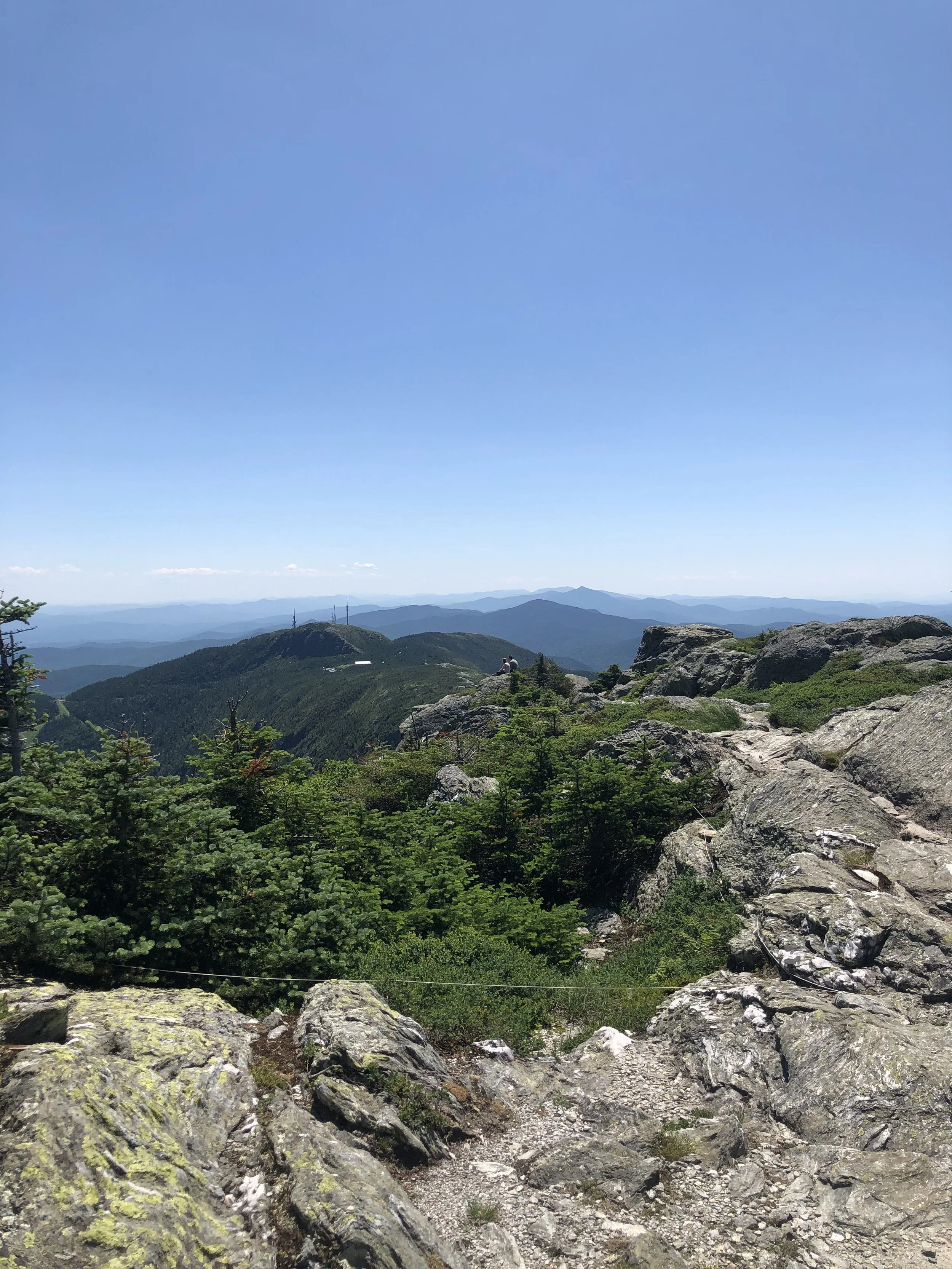
Mount Mansfield (4,395′)
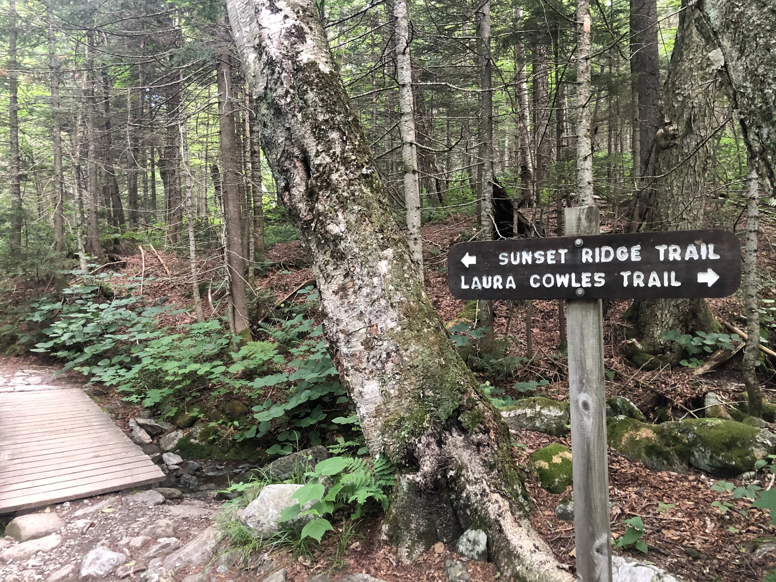
I’d be lying if I said with 100% certainty I knew what I was getting myself into. After a day of researching, much of it from others’ recommendations in a Facebook group, I made my way from my mom’s place outside of Rutland, VT up to Underhill State Park around 2 hours away. I decided to ascend via the Laura Cowles trail starting around 8:30 am - this was the shorter and steeper 2.6 mi route directly up to The Chin, the highest point of the mountain.
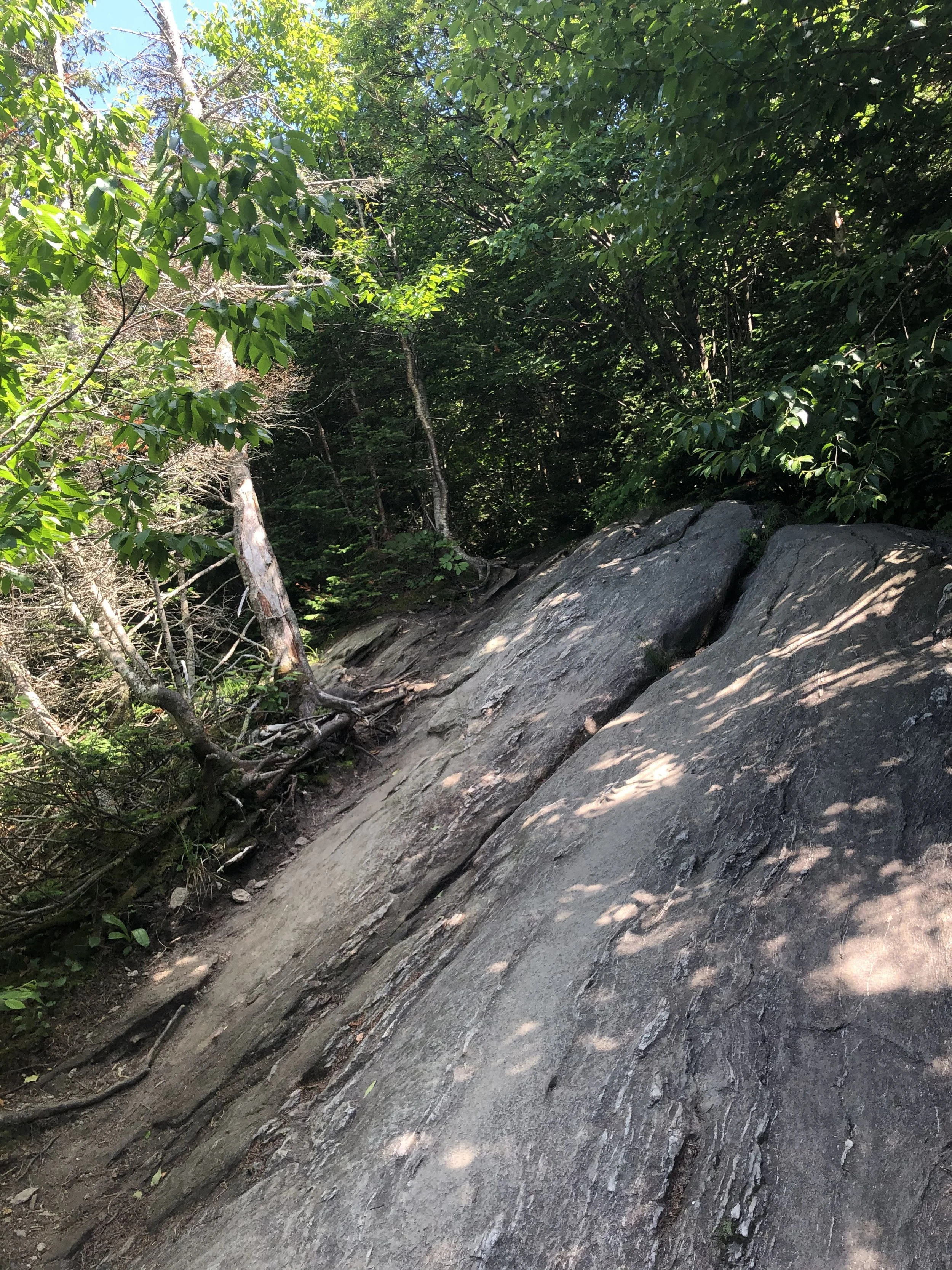
The first mile or so of trail is an old logging road, which felt pretty gentle. Once officially on the Laura Cowles trail, the terrain became more and more rugged the way up. Roots, slabs of granite, small boulder fields - it felt like a big outdoor playground. Soon, the trees grew smaller and smaller until they practically disappeared for the last 3/4 of a mile to the summit. This was my first time entering the Alpine Zone, a biome that exists in higher elevations with fragile vegetation that takes years to grow and seconds of misplaced footsteps to be totally destroyed.
There was something about crawling up that rock scramble nearing the top that just made me feel small and insignificant, but not in a negative way. I was just grateful and humbled by the fact I was able to exist under those conditions in that moment. A ‘Carole King’ sense of feeling the earth move beneath your feet, it just keeps turning while we’re all trying to get somewhere because we’re human and that’s what we do. Despite the scorching July heat, sun exposure, and (what I would later find out to be) expired sunscreen, I pushed on and joined up with the Long Trail (LT) to summit Mansfield. Along the LT were the additional prominences of the mountain; to the north, the Adam’s Apple and to the south, the Nose and the Forehead.
I can’t say it was an emotional event, I’m just not that kind of person. I was exhausted and low on water, so I laid down on a rock and basked in the late morning sun like a lizard, content and feeling as though I was simply meant to be there. I snacked on half a protein bar, took some photos, peered down at (from where I was standing) the small town of Stowe, and began my descent down the Sunset Ridge trail. My legs felt like jello and I was ‘lobstah’ red upon returning to the car from my day above tree line, but I was filled with such immense pride in my accomplishment. I stopped at a packie on the way back and celebrated with a Snickers bar, Dilly Bites, and a cold Long Trail Ale - that’s just the hiker way - and began planning my next trip.
NH 0/48
New England 1/5
New England 1/100 Highest
Northeast 1/115