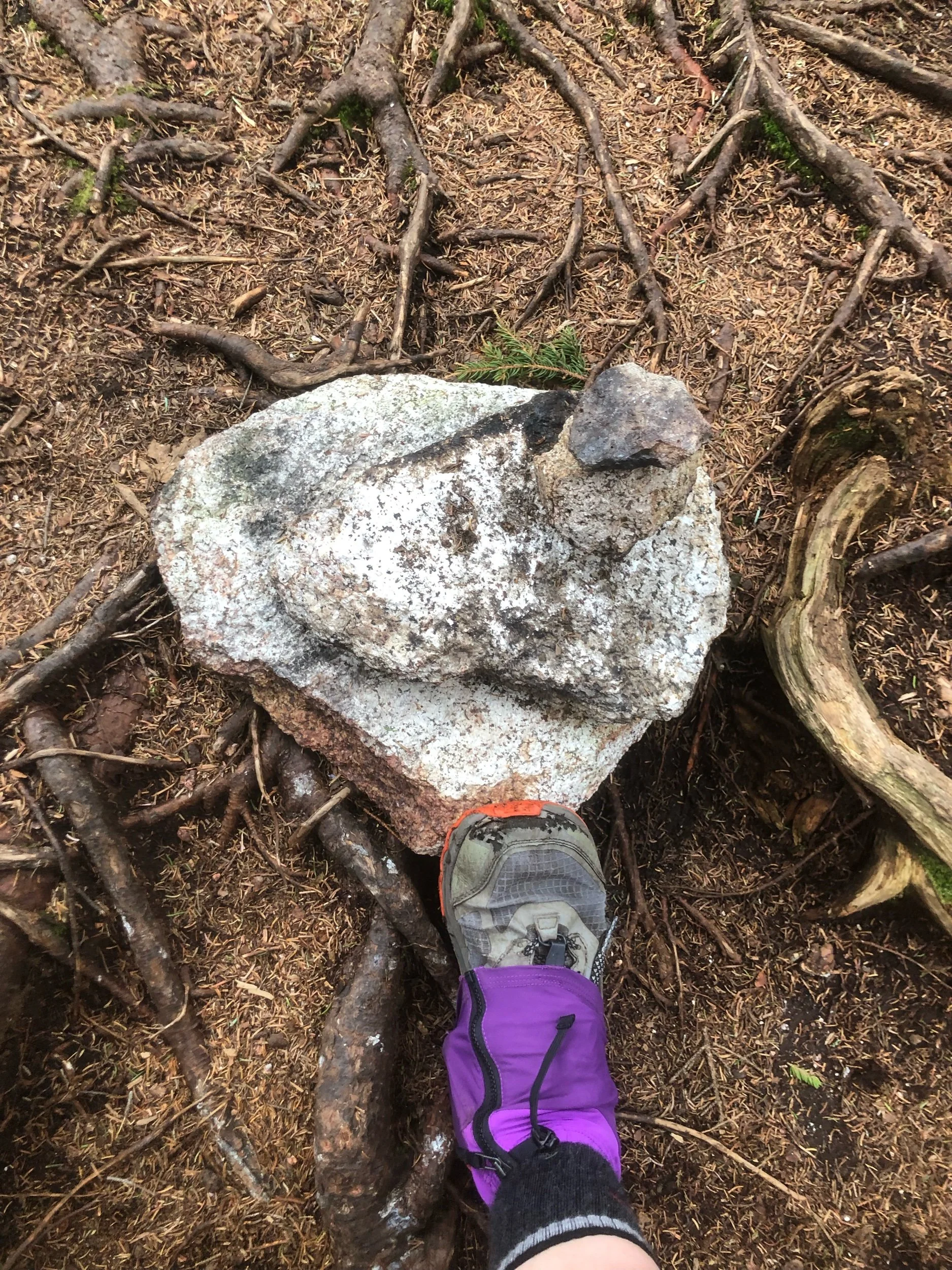
Zealand Mountain (4,260'), West Bond (4,540'), Mount Bond (4,698'), and Bondcliff (4,265')
What an incredible trip. It’s truly much easier to describe this as an experience over just a day hike. When I met my friend Kailee on the Kinsmans last month, I had no idea if we’d ever be able to hike together again. She was in NH on travel work assignment, we were heading into winter, and let’s face it - the Whites aren’t exactly around the corner for me. Nonetheless, when presented with a November weekend in the 70s.. sometimes you’ve just got to play hooky and get out into the mountains. This was pretty impulsive and I didn’t have the funds for an AirBNB, so car camping at one of the only two open campgrounds during the off season it was.
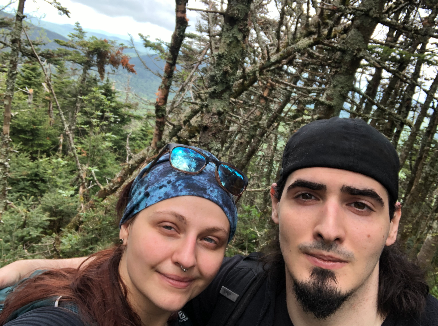
Due to the length of this hike (about 22 miles), we’d require a car spot. We left my truck at the Lincoln Woods trailhead around 6:45 am and took Kailee’s van 45 mins north to the Zealand trailhead near Crawford Notch. In the parking lot, I recognized a familiar face - someone I’d met on my very first hike in NH last summer. He and his group were also headed out for a Zealand-Bonds Traverse, a couple was finishing their 48 on Bondcliff. They were all so welcoming, we ended up leap-frogging and chatting with them them the whole way. It truly is like simply bumping into people around town you know in the White Mountains on the off season.
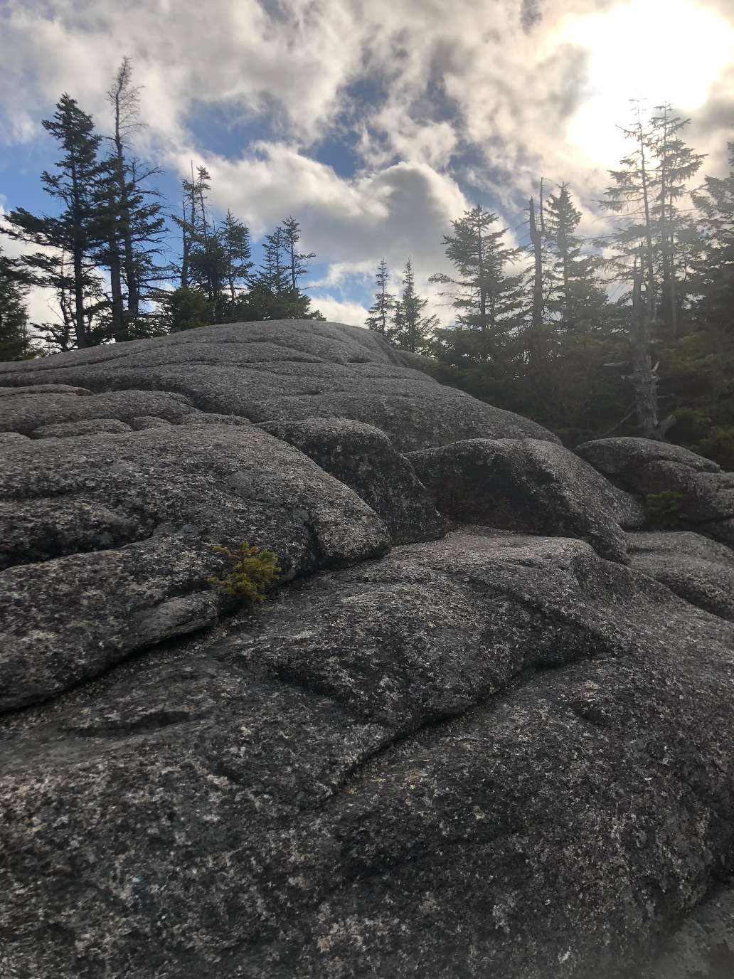
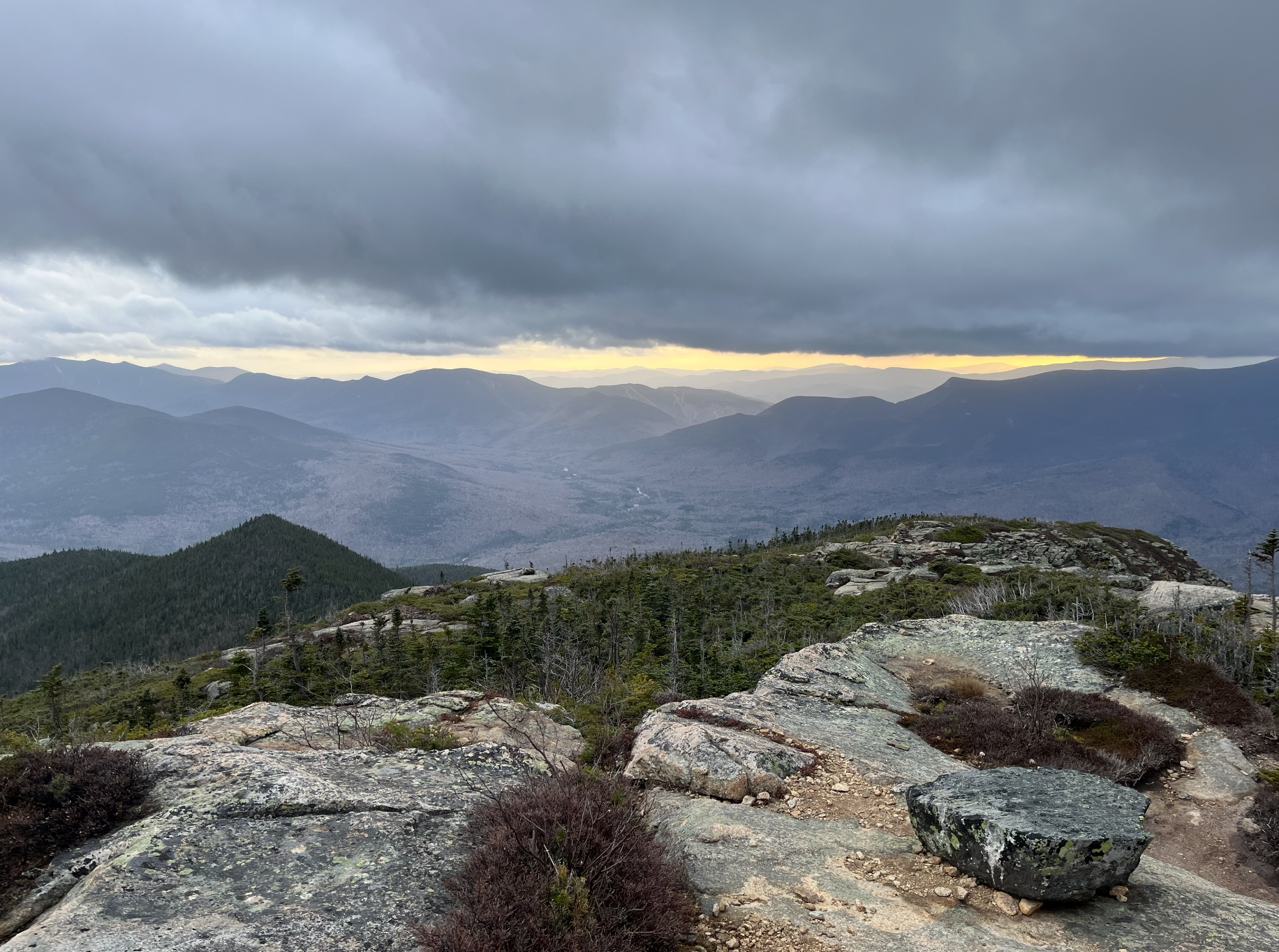
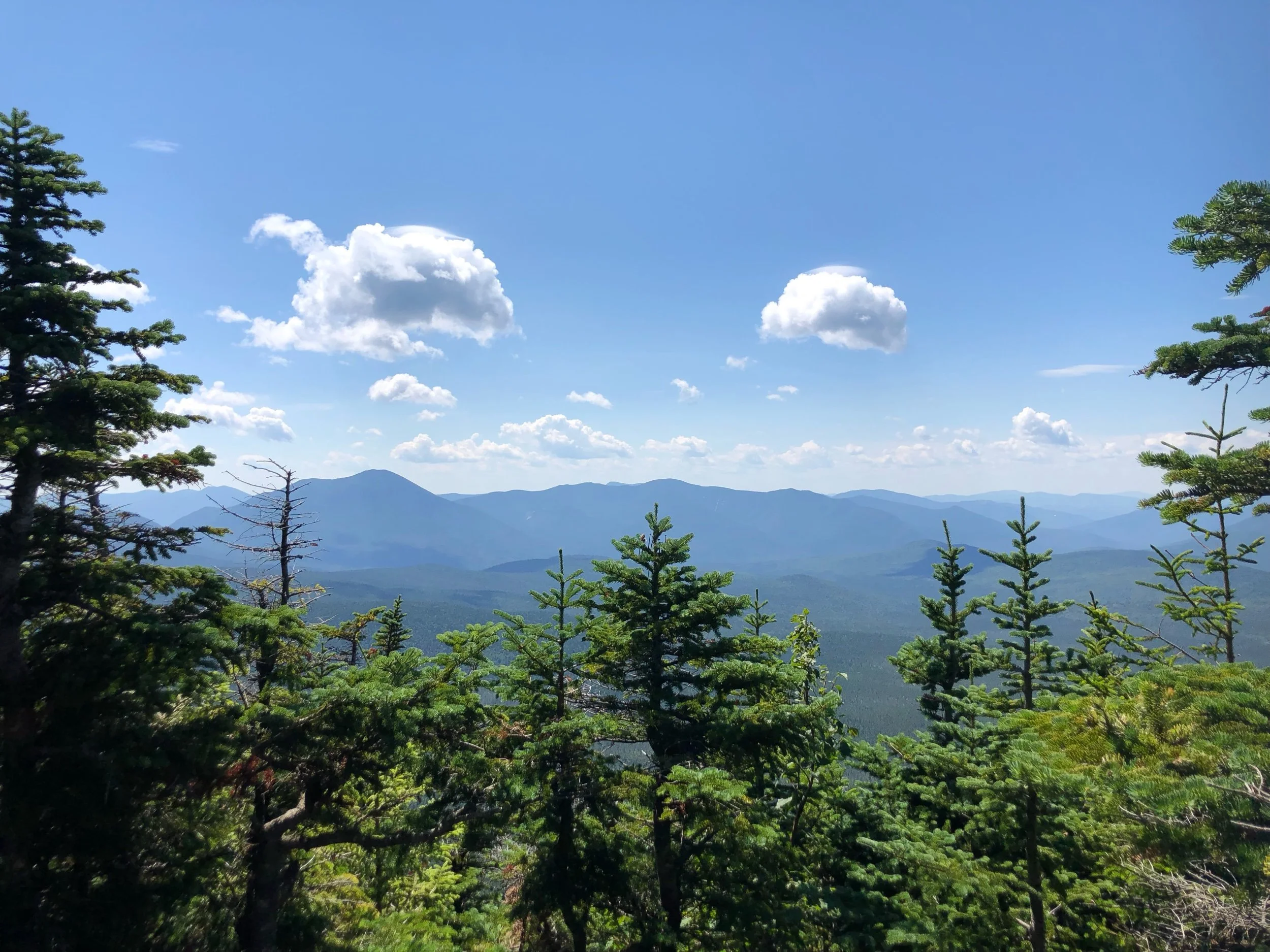
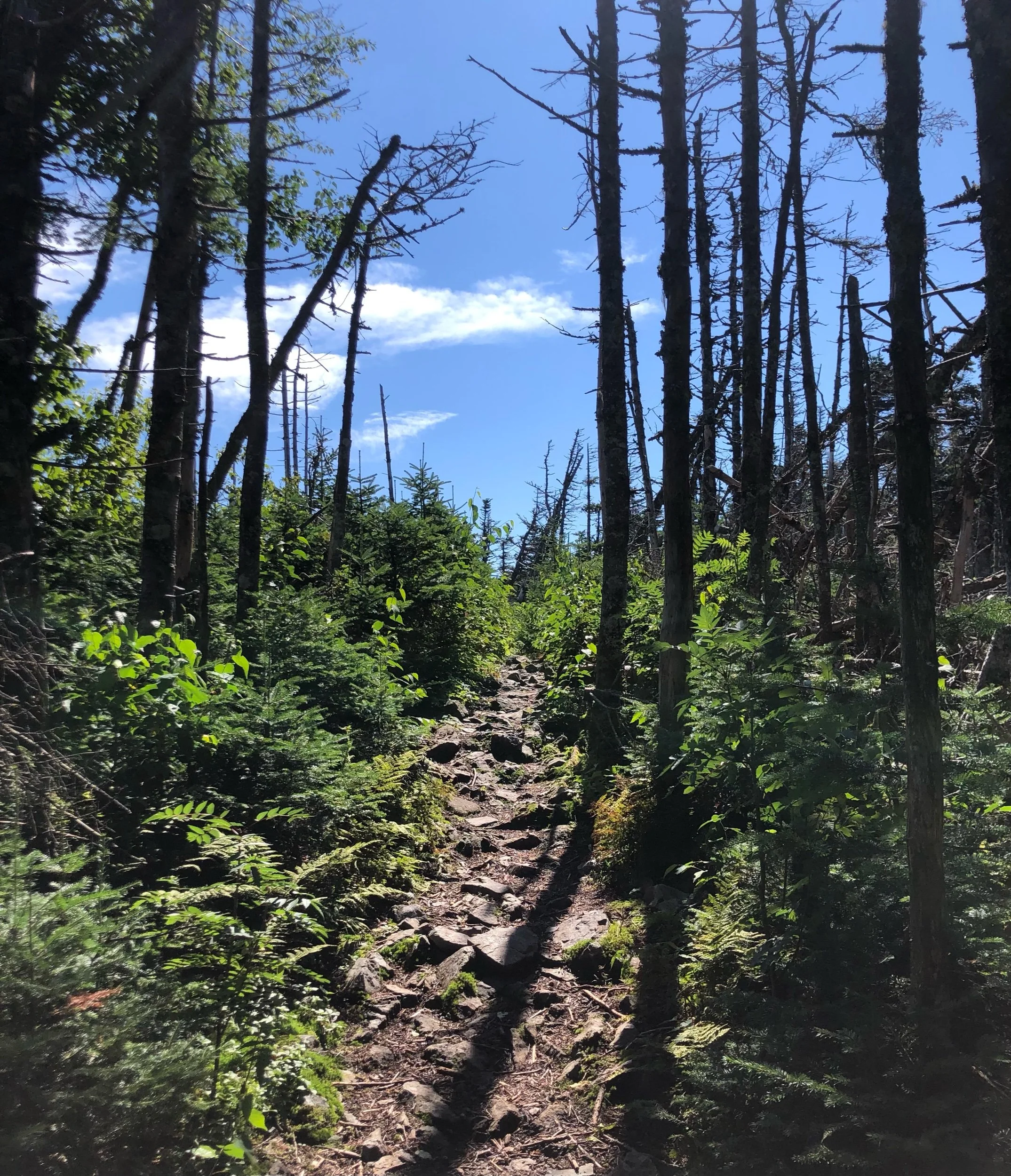
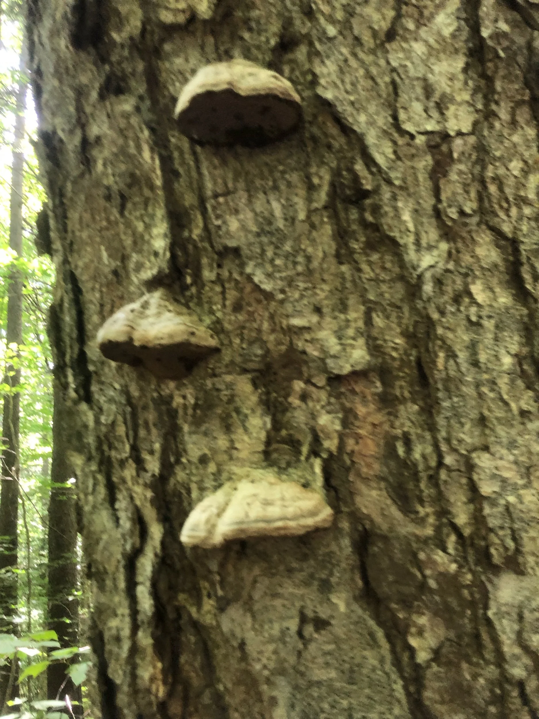
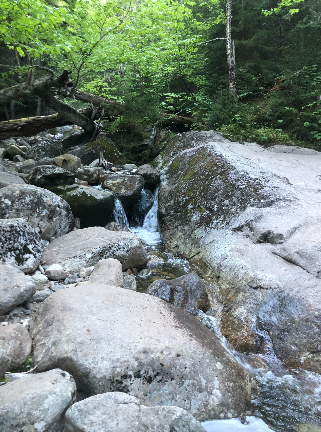
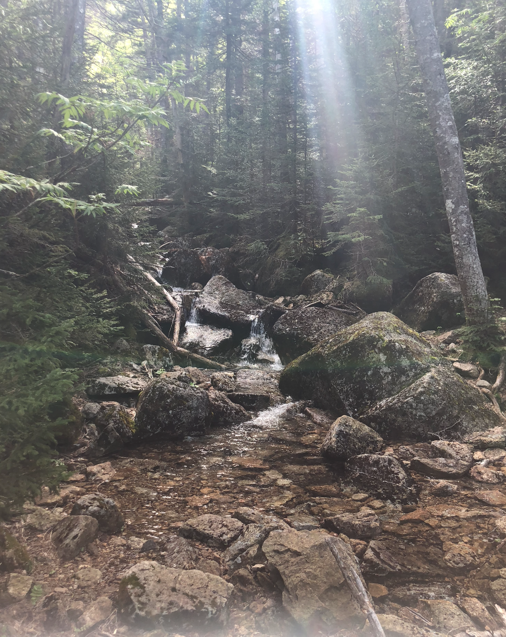
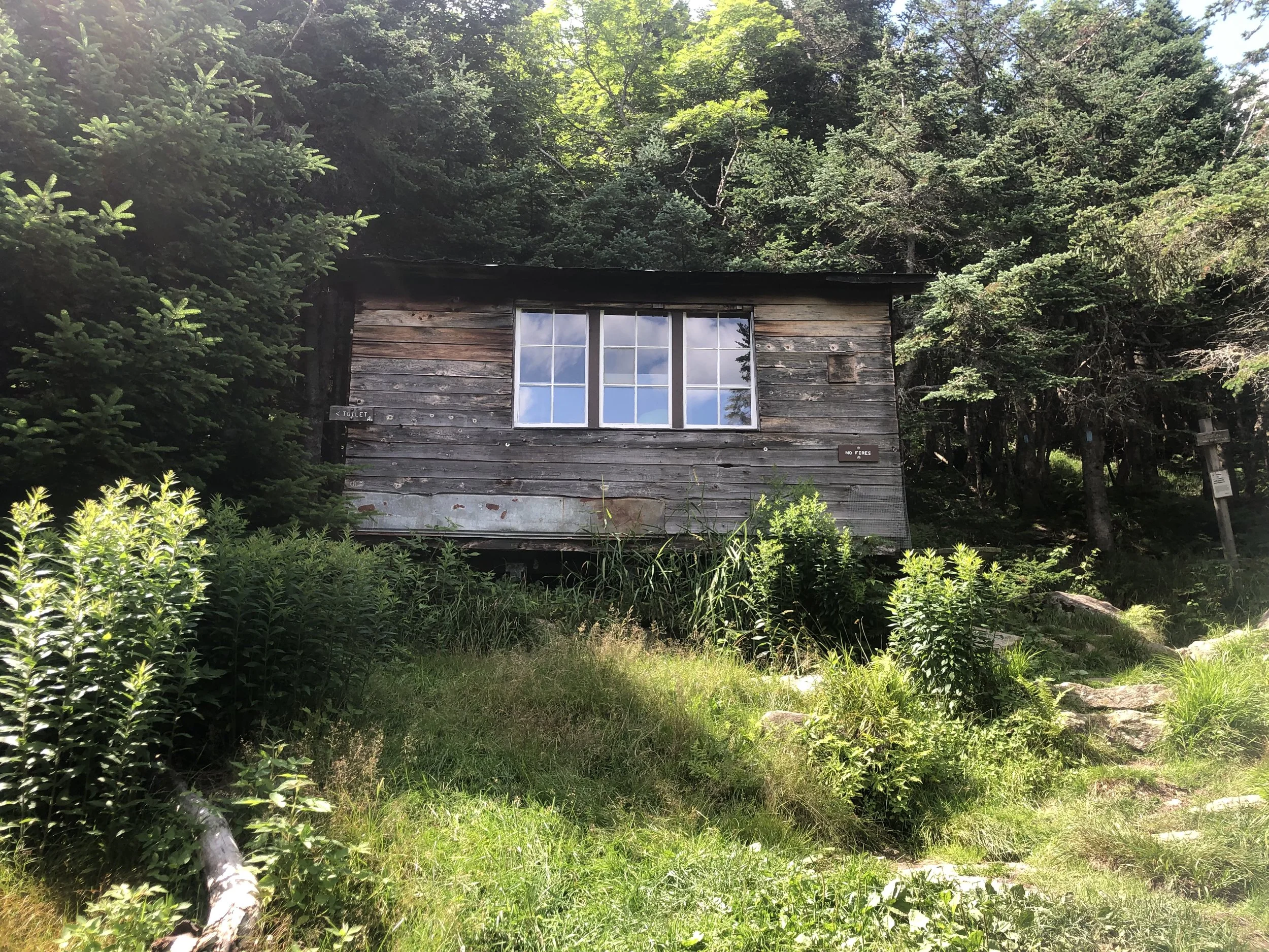
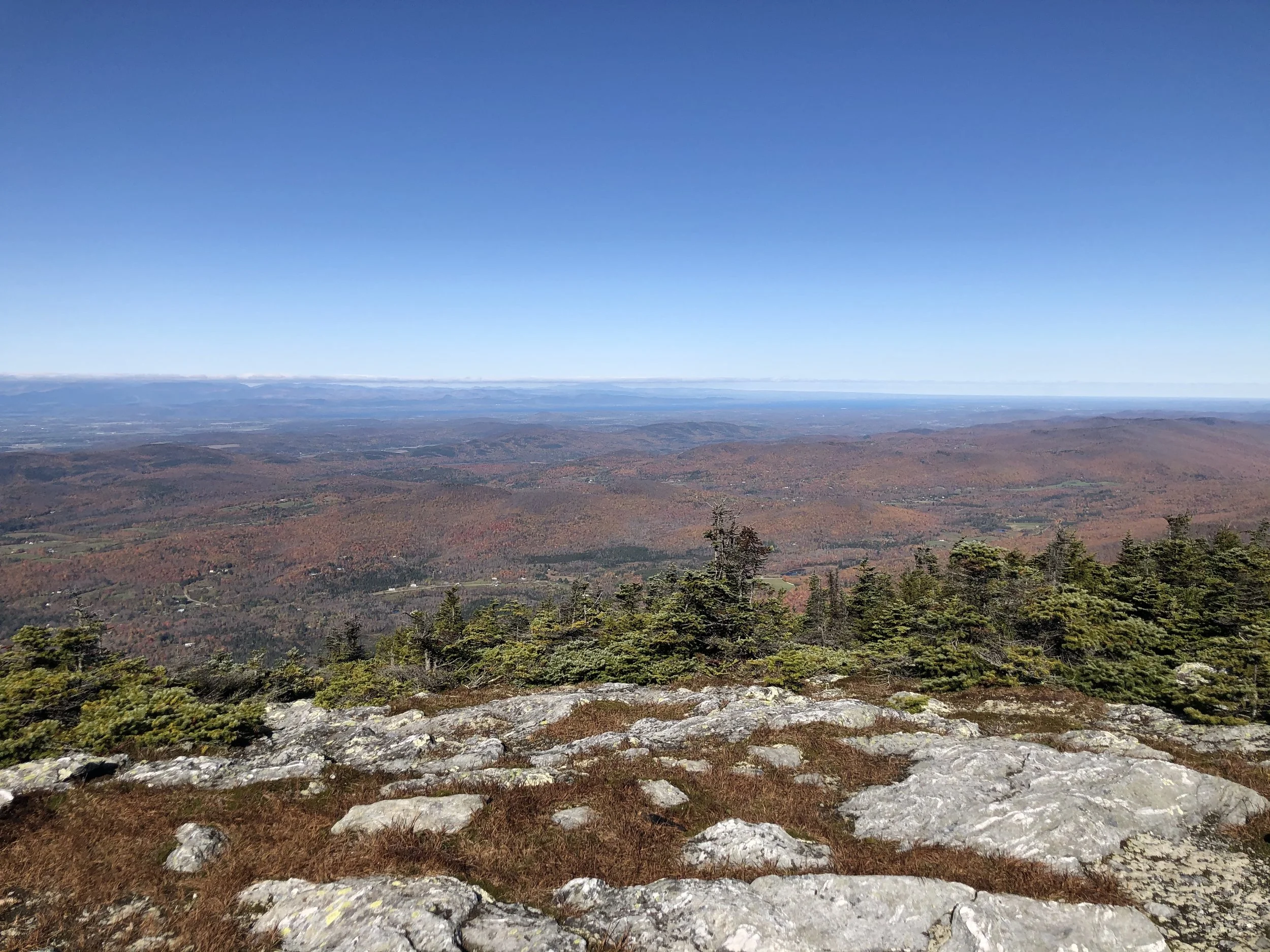
The first three miles were mostly flat, winding through marshy wetlands before hitting the Zealand Hut, one of the many AMC run cabins throughout the Whites. Hikers can stop and grab a bite to eat, a warm drink, or refill their water before continuing on their treks there. After passing Zealand Falls, the majority of elevation gain on the hike takes you to up to Zeacliff, a small rock feature offering gorgeous views to the east of the Presidential Range. A few more zig-zagging herd paths and rock scrambles along the Twinway finally lead to the 0.1 mi spur trail to Zealand Mountain.
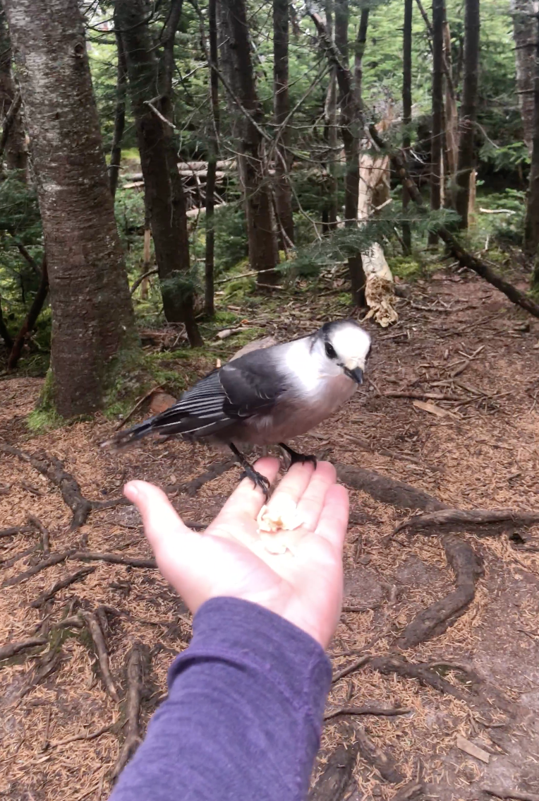
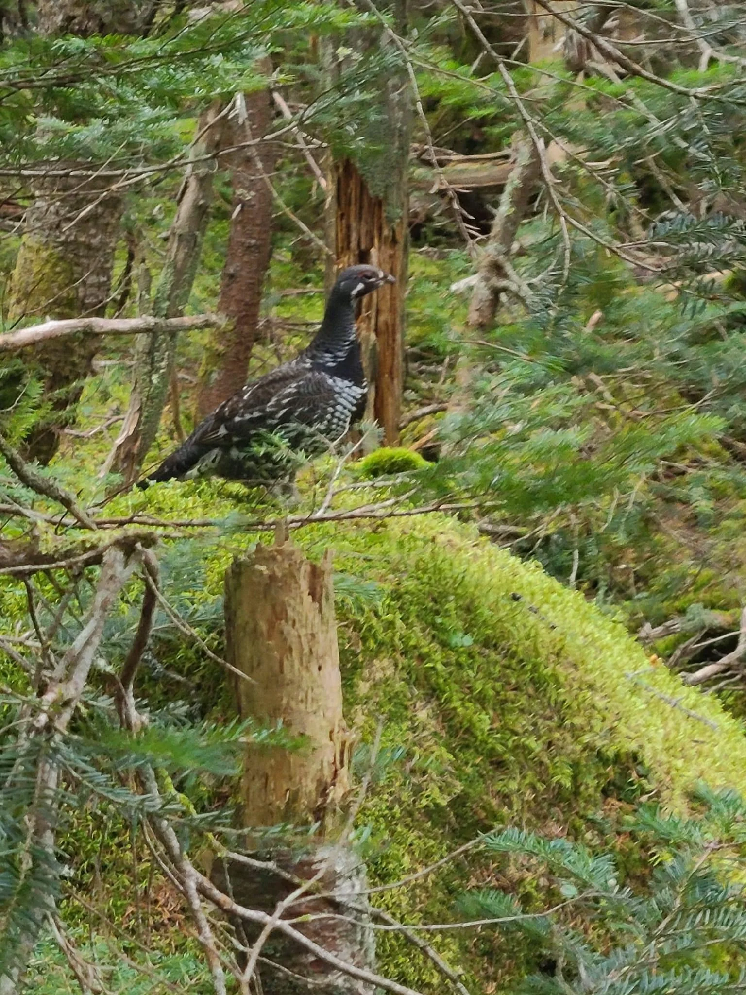
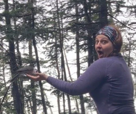
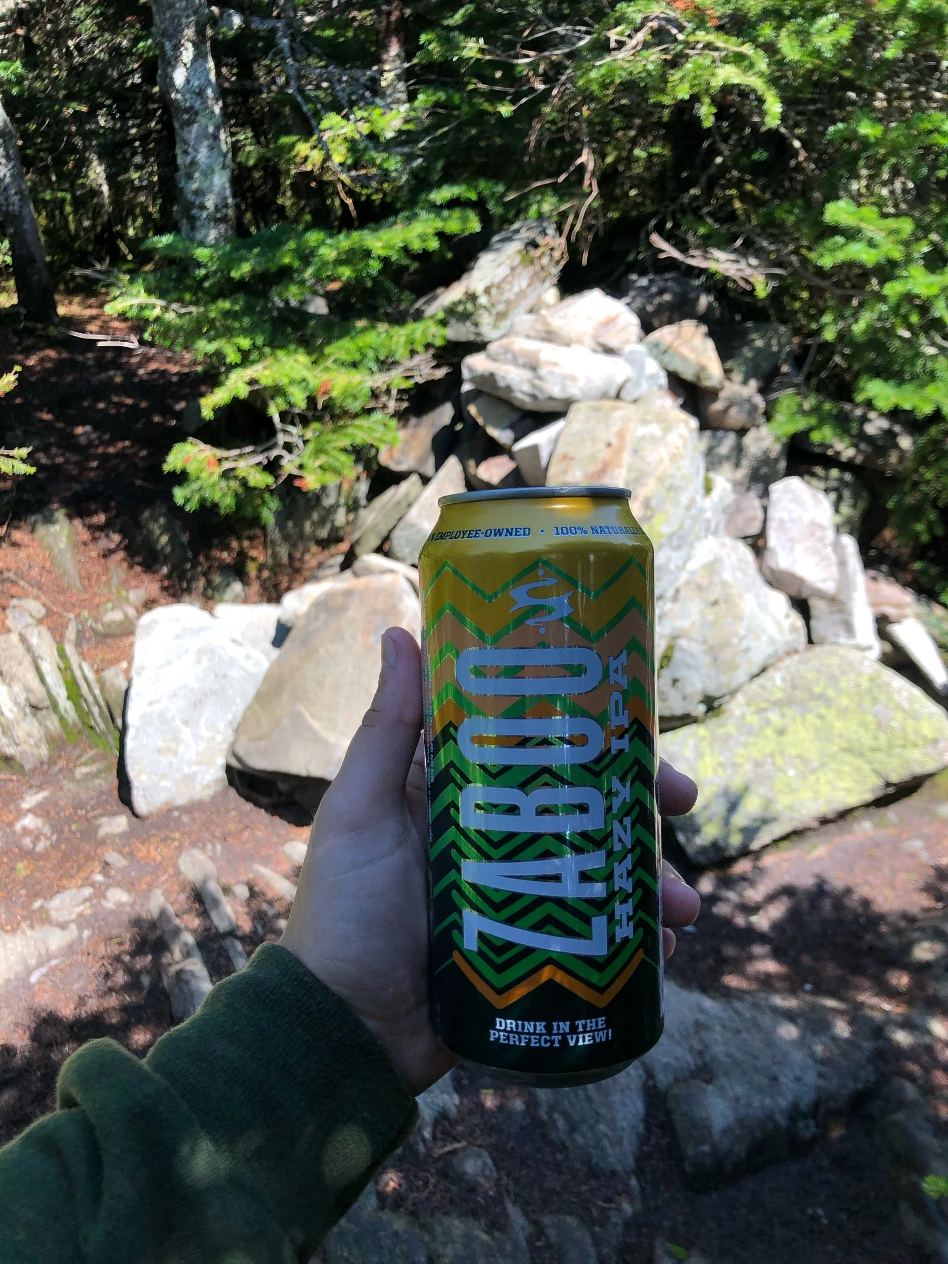
After 5.7 miles to the first peak we took photos of the decorative summit sign, broke out our stoves, and made some almond milk matcha lattes from things we’d packed out. This area is famous for very friendly grey jays who have a propensity for snagging snacks from hikers. A few birds were gathering near, so I shared a few small pieces of tortilla with one who landed right in my hand. Now I get to mark feed the grey jays* off my NH48 ‘bingo card’.
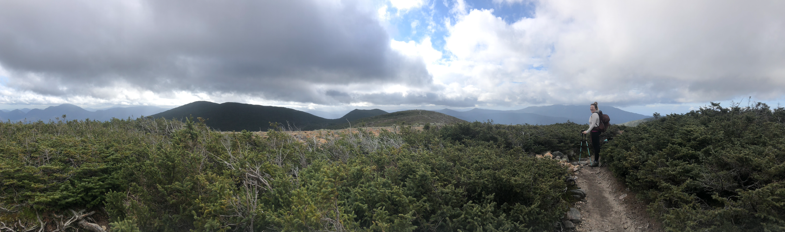
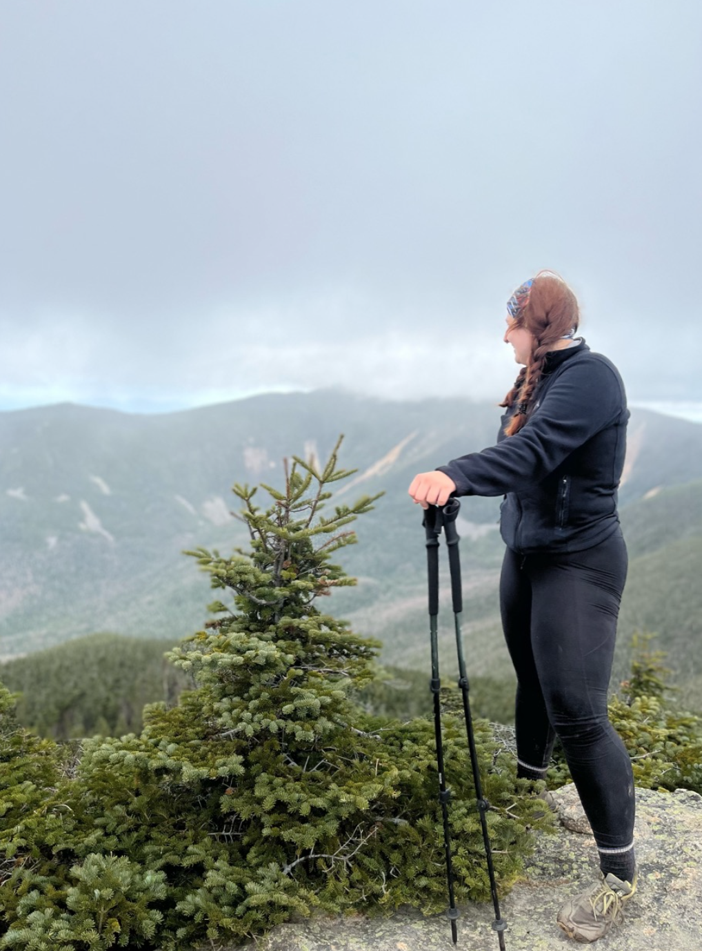
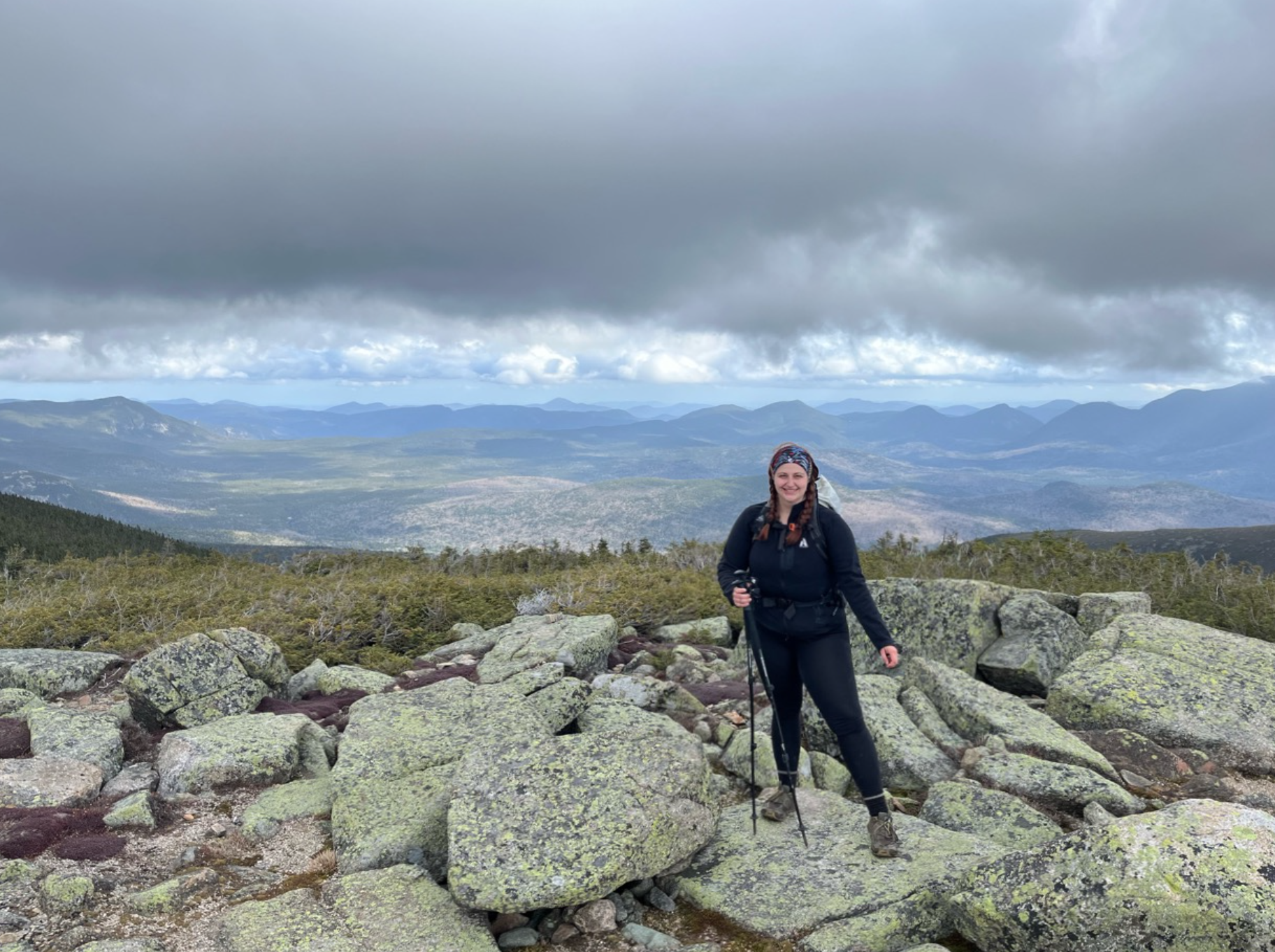
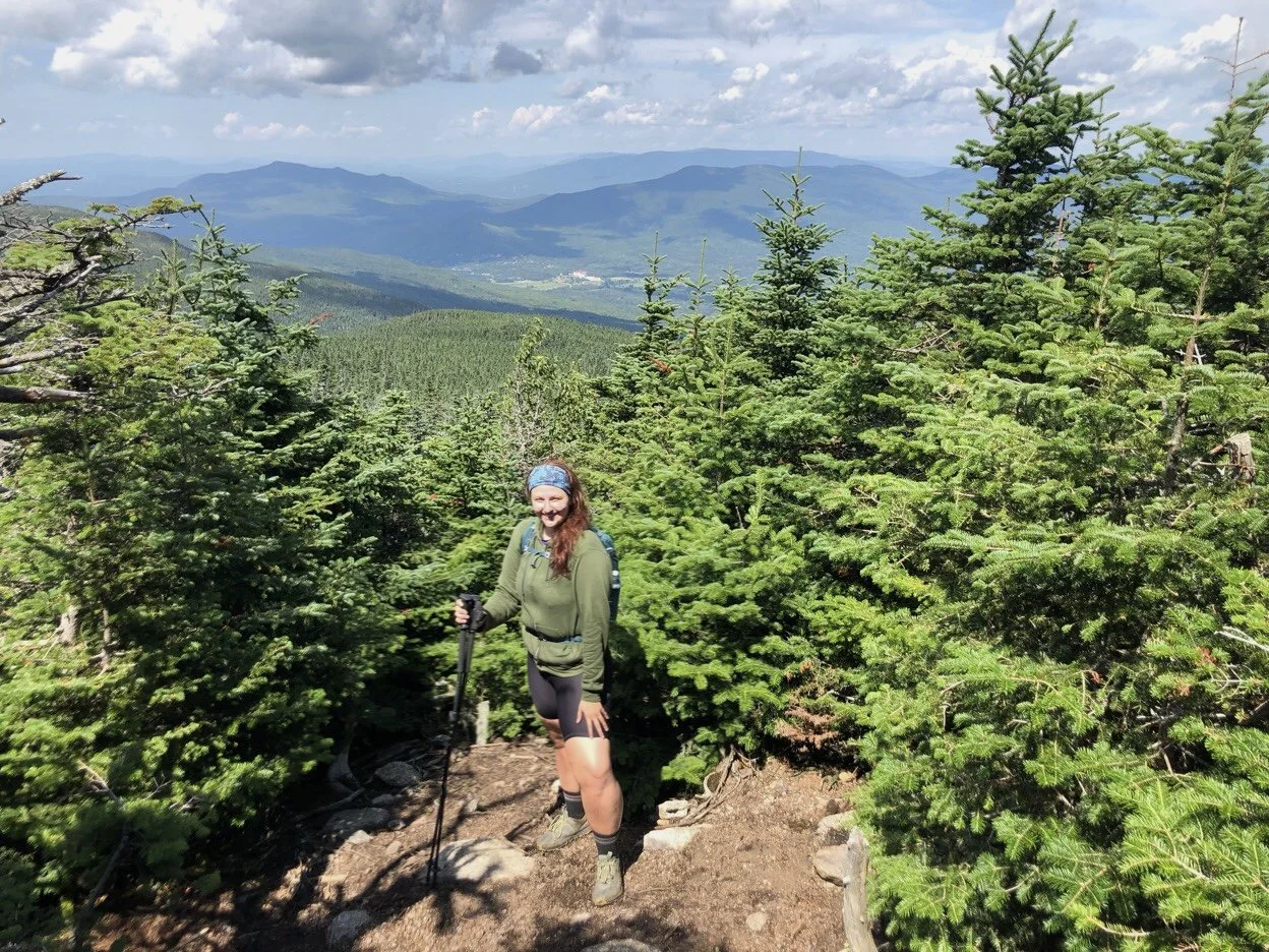
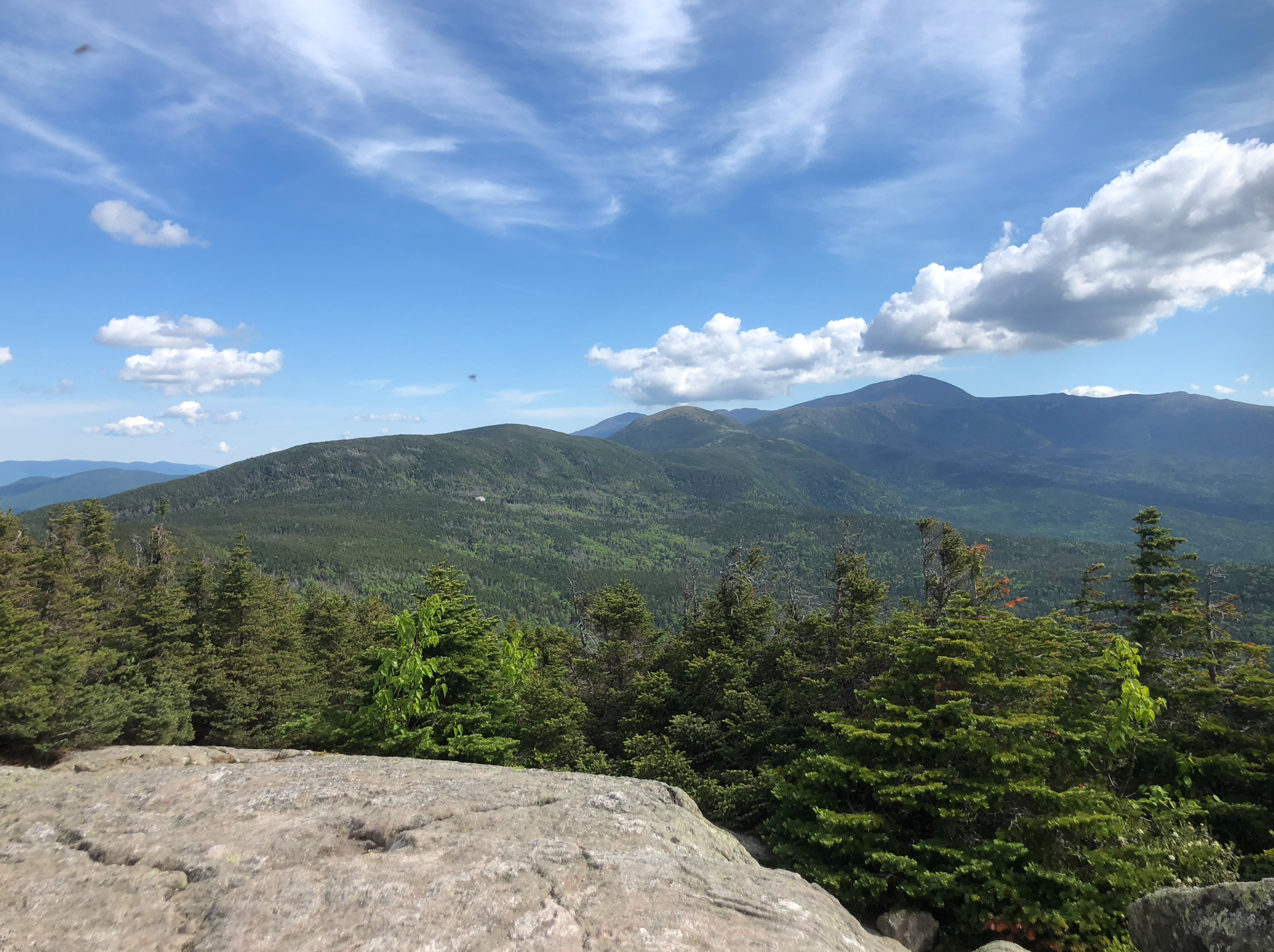
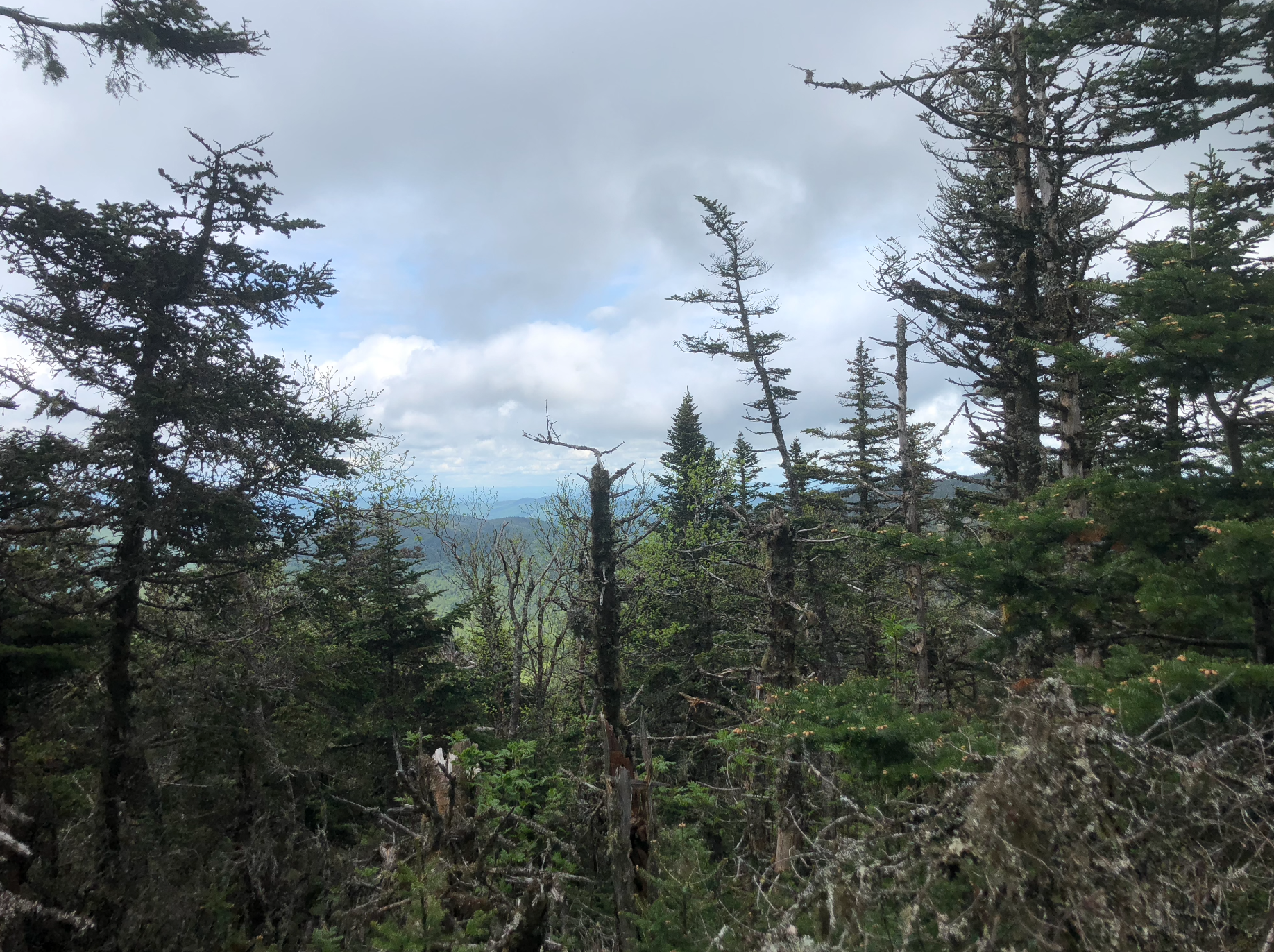
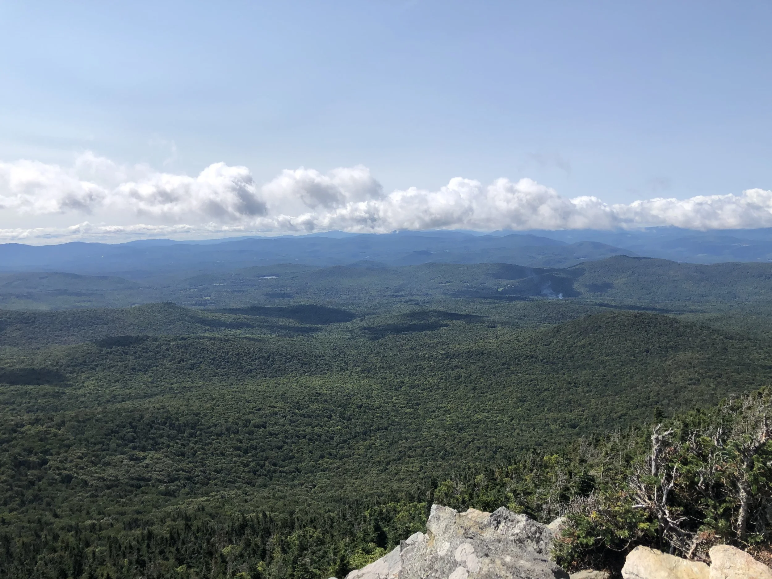
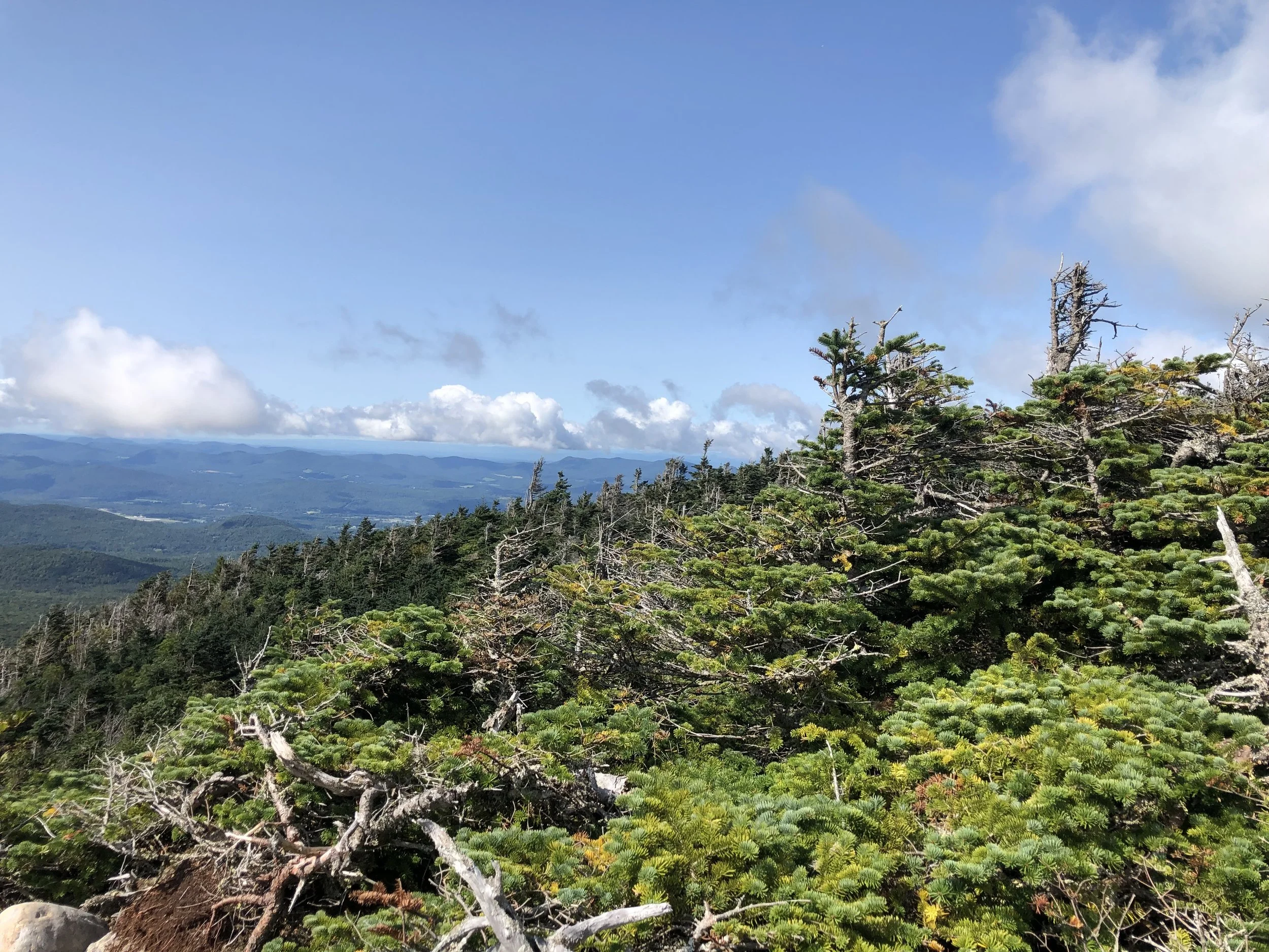
Once the wind chill hit, we decided to get moving again to warm up. It was a rolling set of ascents/descents through the wooded Twinway trail (AT) but before we knew it, we were back up above tree line in what felt like an otherworldly landscape heading up and over Mount Guyot**. The views were breathtaking so the miles came easily in this section. It had finally hit us that we were in one of the most remote places in the White Mountains. The Pemigewasset Wilderness, though well-traveled by avid hikers year round, is still untouched with no sights or sounds of civilization. A few years ago, that would have bothered me, but to be out in the wild like that made me feel so at peace with being disconnected from the world and more connected to myself. I really enjoyed being able to reflect on my growth as a hiker on this trip.
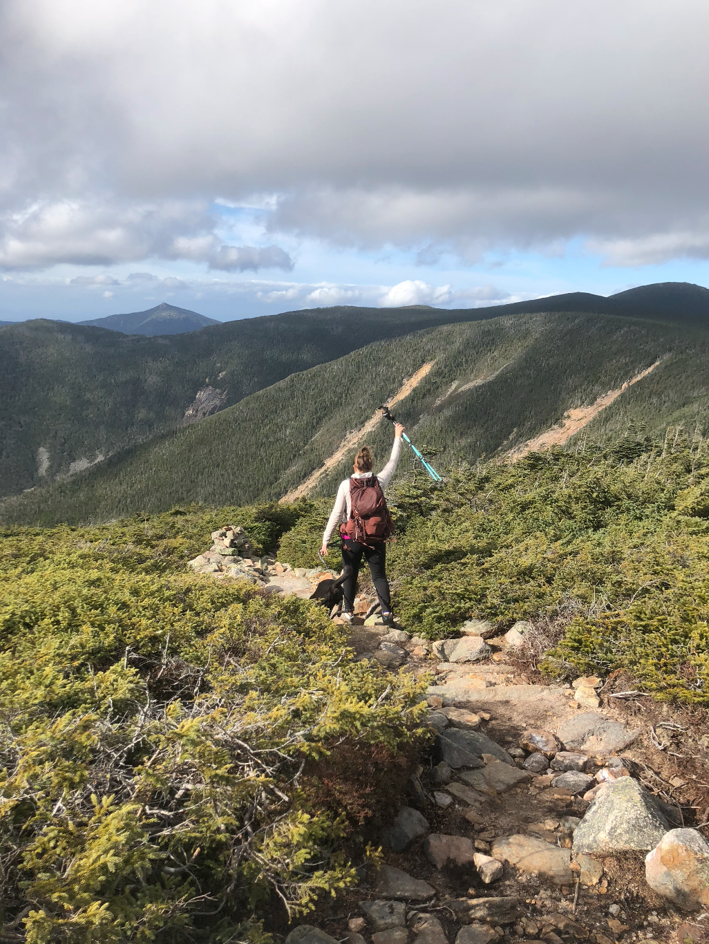
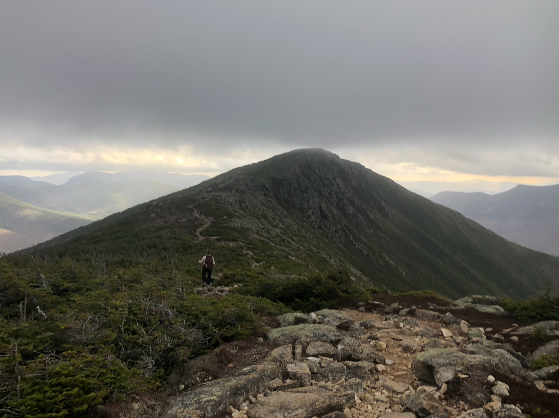
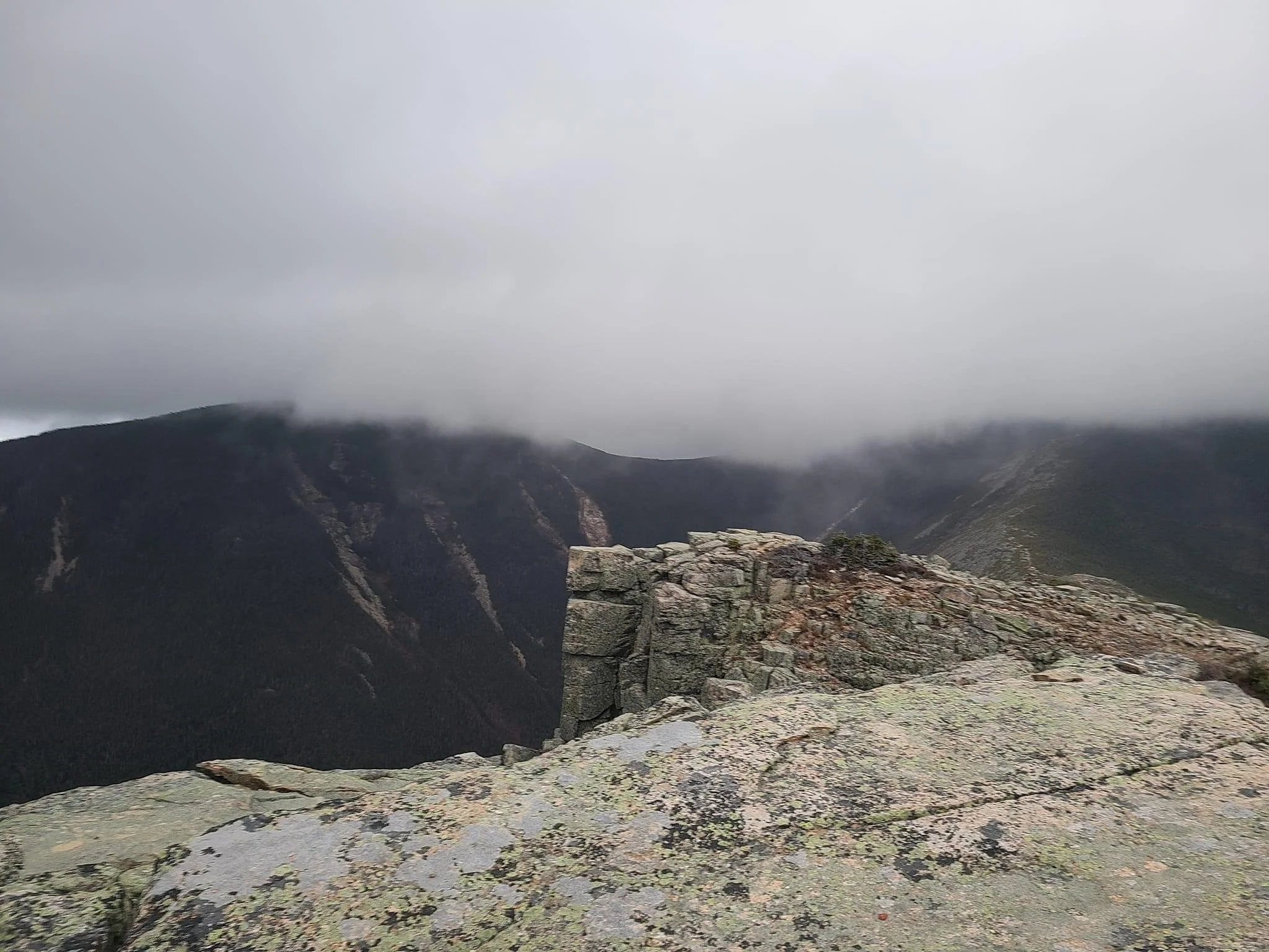
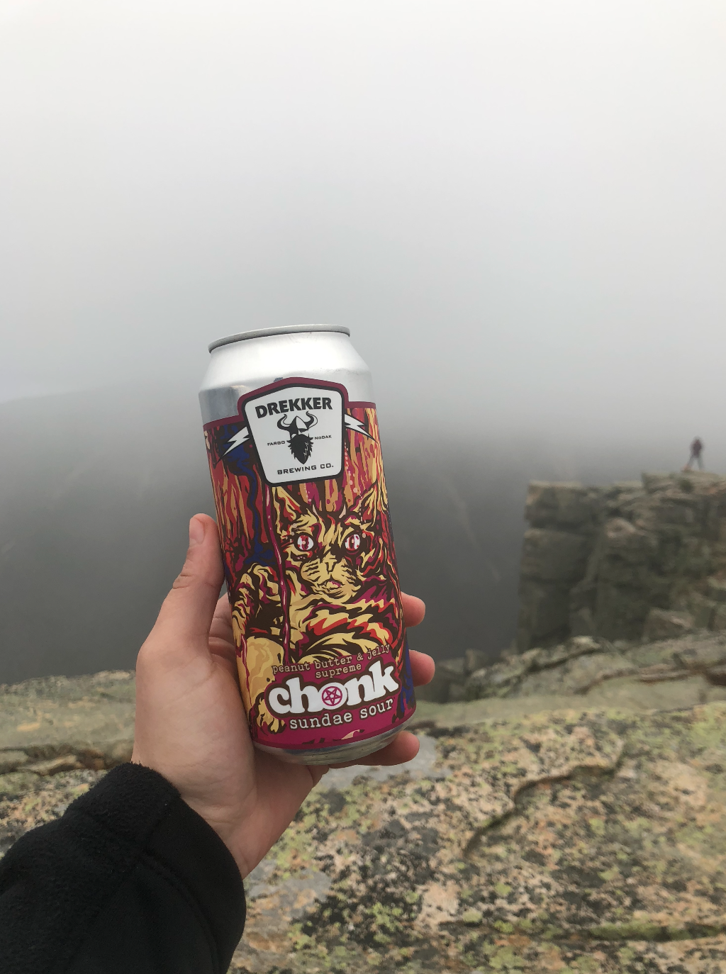
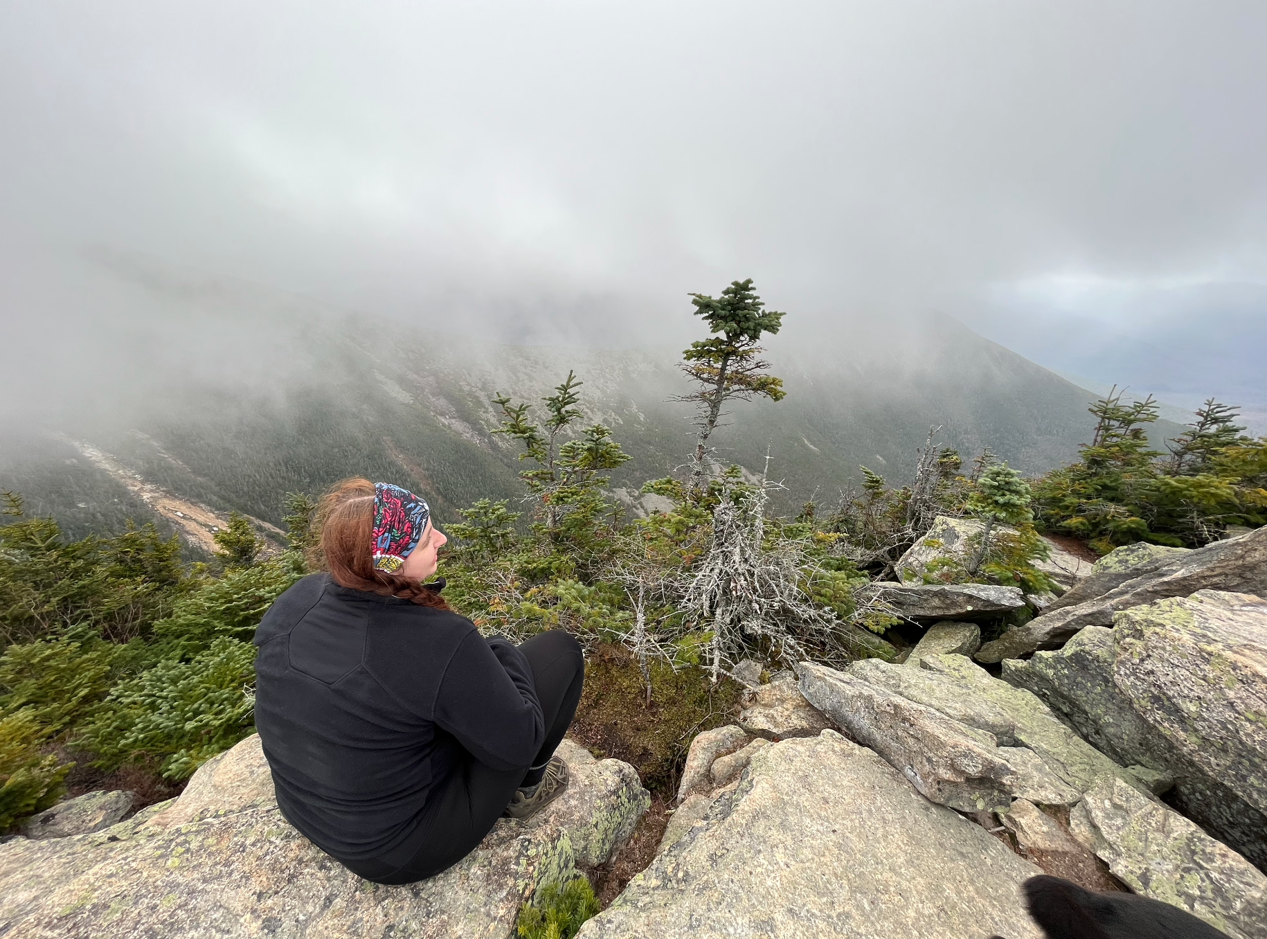
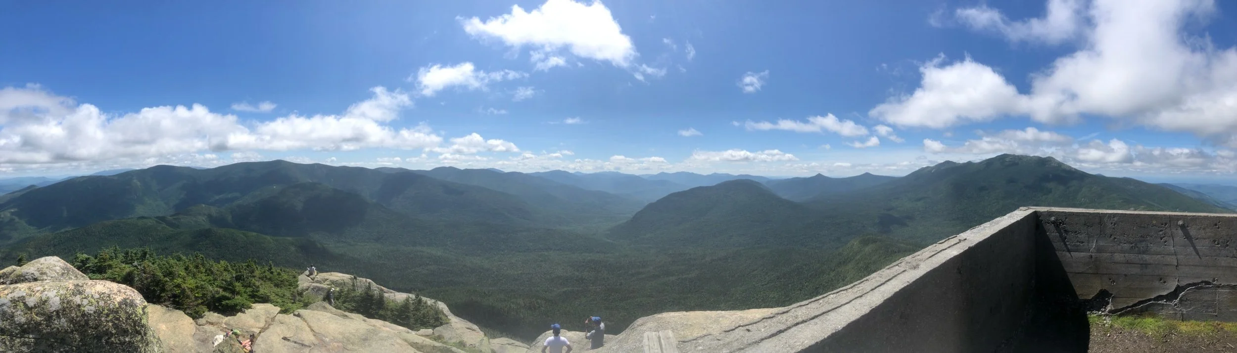
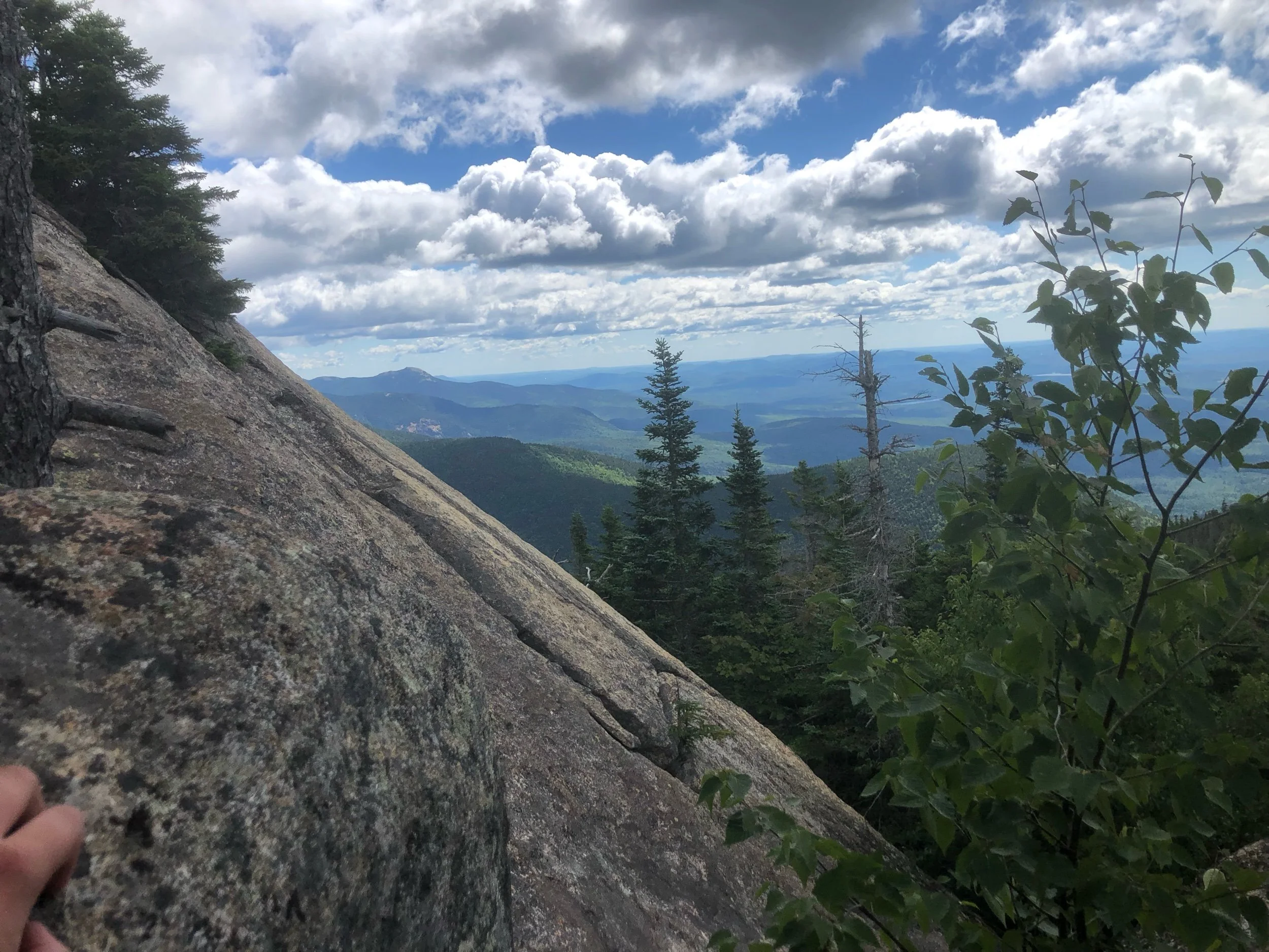
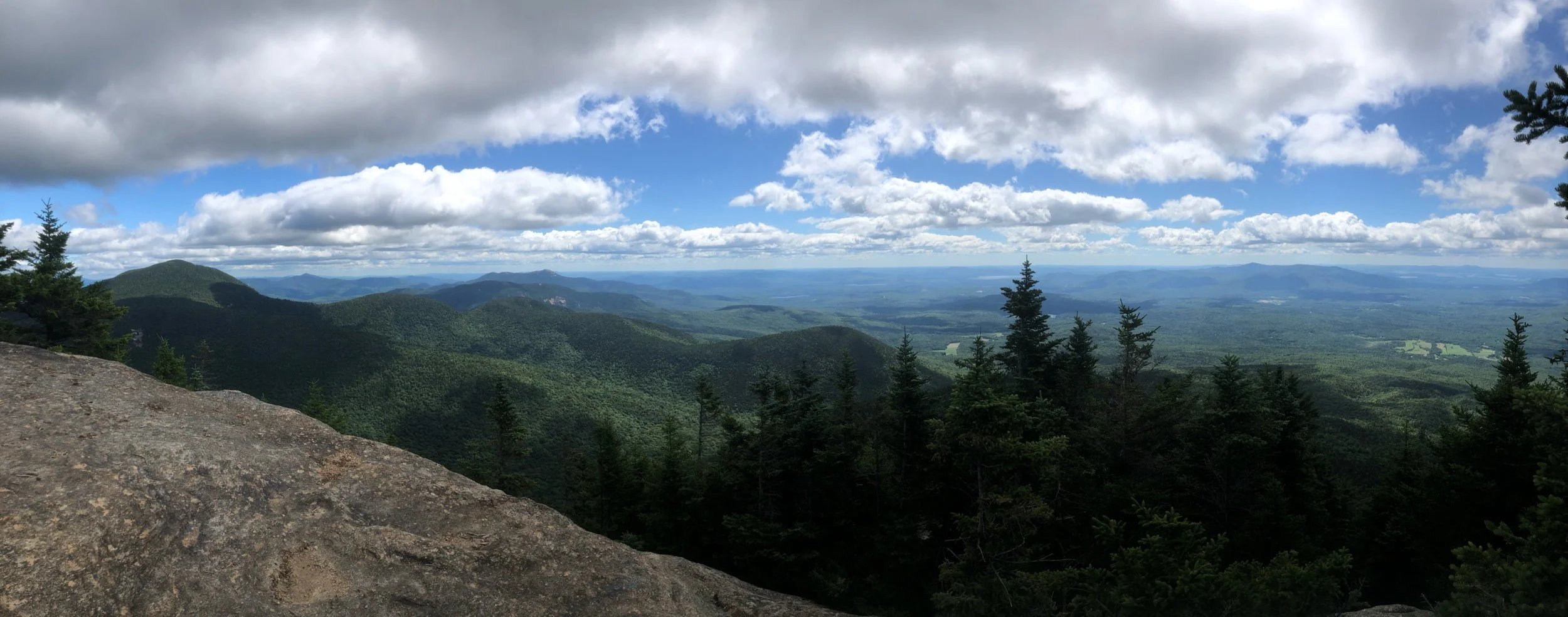
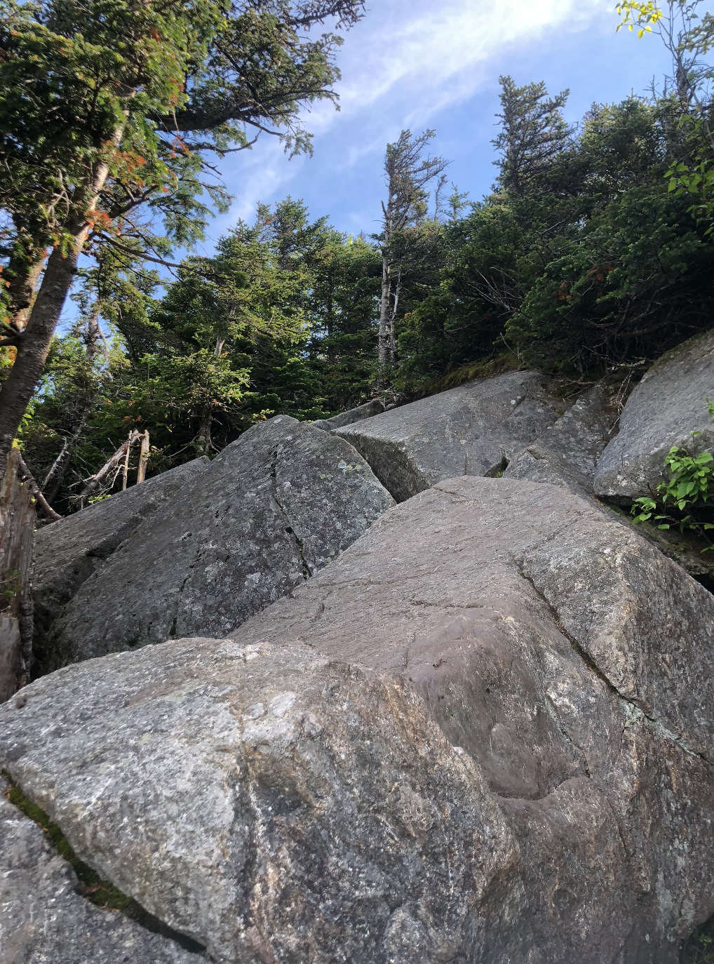
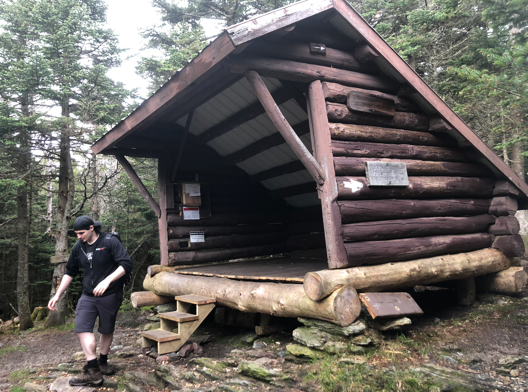
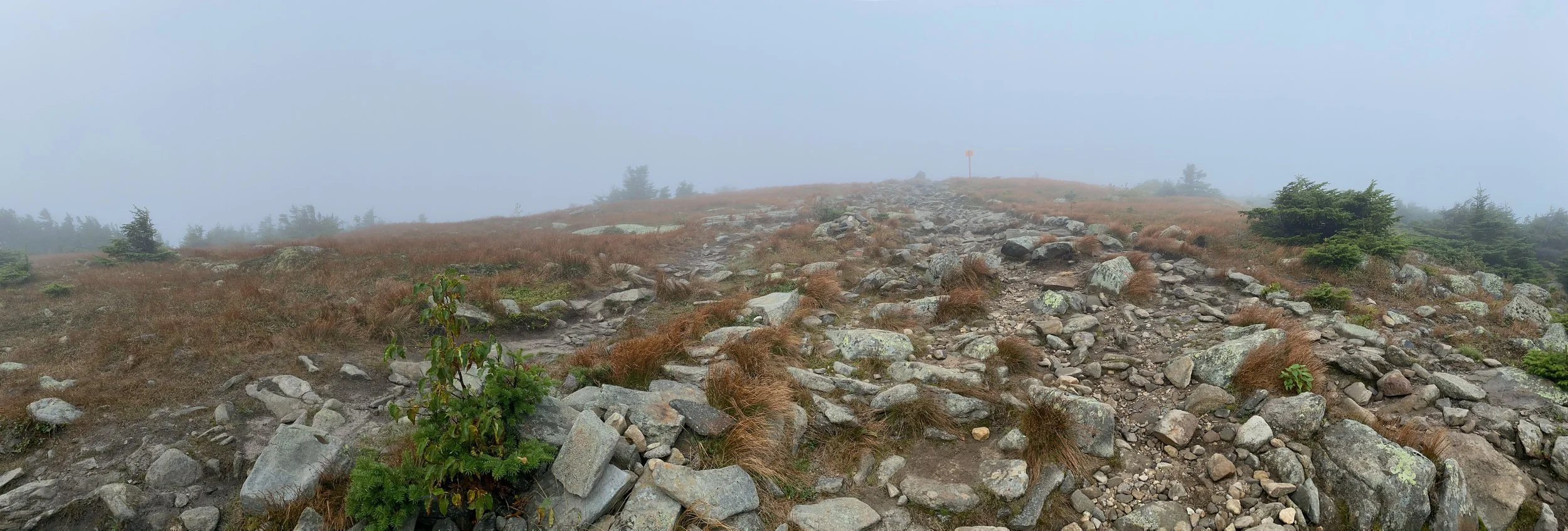
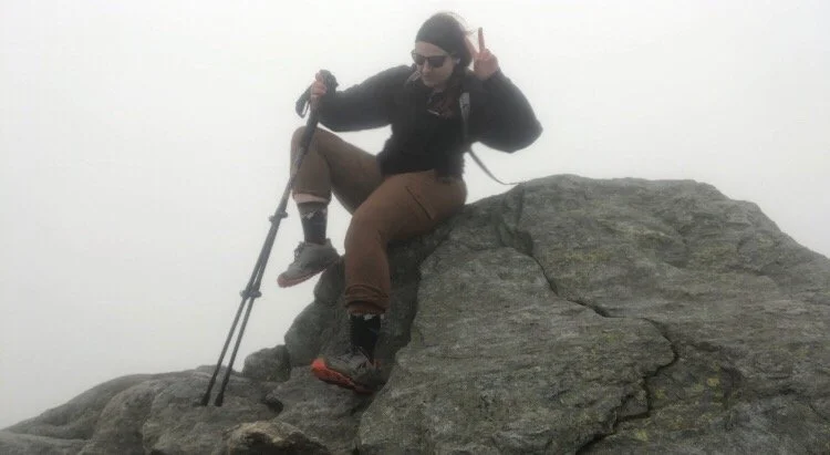
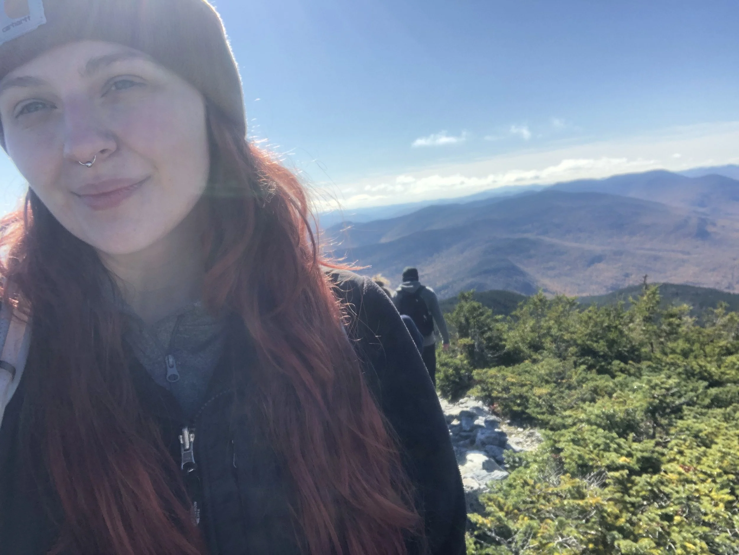
From this point, everything started coming quickly. Soon, we’d passed the Guyot Campsite and were back up in elevation to where the Bondcliff trail we were now on met up with the West Bond spur. This is usually where hikers drop their packs to move more quickly and tag the relatively cramped summit of West Bond - and who am I to break tradition? The last section up to the west peak is some good old fashioned New England bouldering above treeline, which made for an interesting descent as fog and mist began to roll in. We spotted our next target and highest peak of the day, Mount Bond, just 0.6 mi away. Unfortunately we were socked in because of the elevation when we got there, so we took a few quick photos and on to the next.
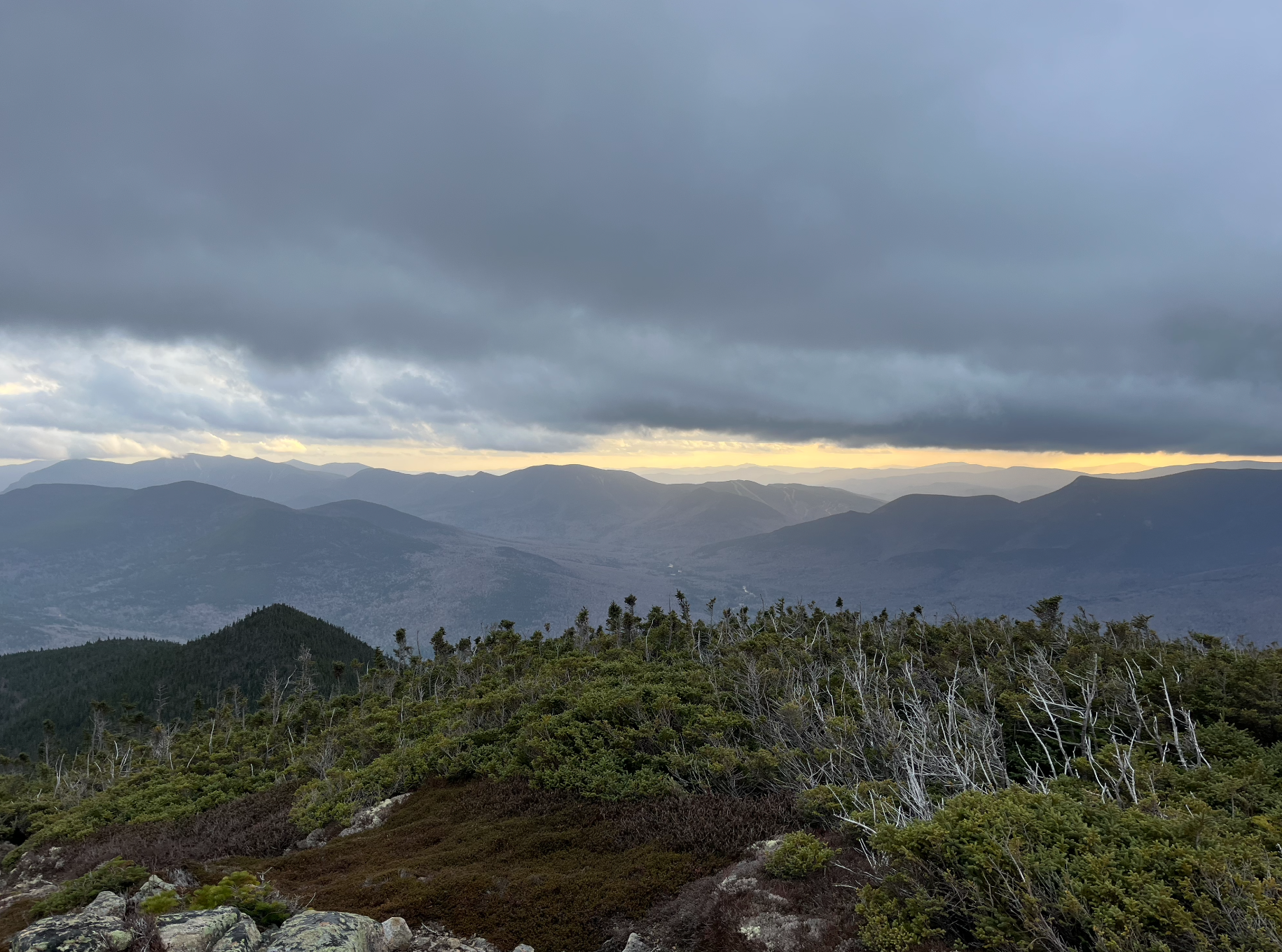
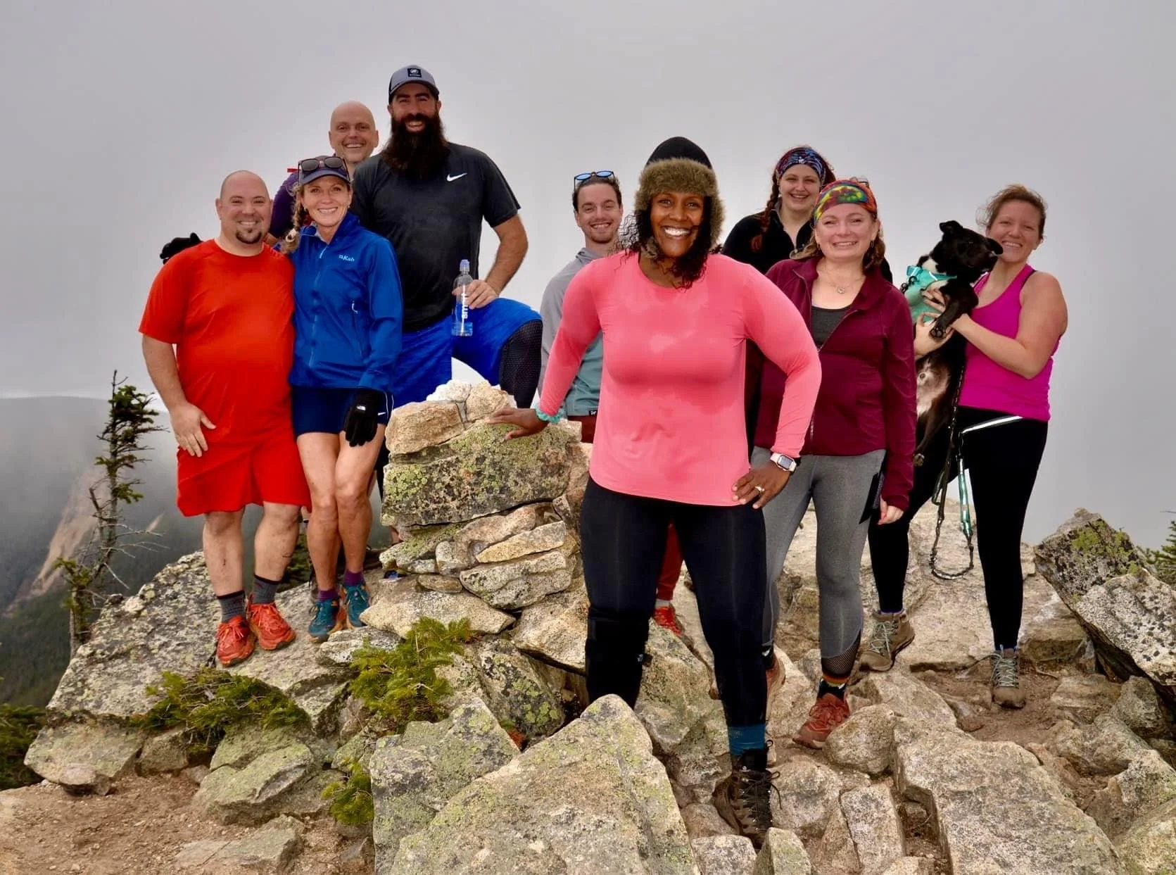
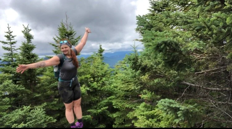
The next 1.1 mi over to Bondcliff were some of the most incredible views and terrain of the whole hike. The entire valley lit up with color so vibrantly as we moved down under the fog. There was a last push up the rock pile and then - we made it to the iconic cliff. The other group we met up with was already at the summit celebrating our new friends’ epic finish. There was beer and cake and champagne and lots of smiles: so much to love about this community. We got our mandatory Bondcliff photos and started our very long walk back to Lincoln Woods, the sun starting to set as we got back below tree line.
They call it the ‘Death March’ for a reason. I’d been walking all day; I’d seen some incredible things and met some amazing people; there was so much excitement, it was such an epic day, and then the reality of 6 miles of flat, stupid, boring, railroad-tie-infested trail in the dark. After already hiking for about 16 miles. I was so tired, my body was beat, and my sciatic nerve pain (I blame my desk job and sitting in a car for 7 hours the day before) was acting up. There was no way to avoid stepping in ‘suck-your-shoes-off’ mud even with a headlamp, so I had what I’d come to find as the worst blisters I’ve ever gotten. I just wanted to stop walking. My muscles were crying for me to stop walking… but I set a challenge for myself and I’d be damned if I didn’t see it through.
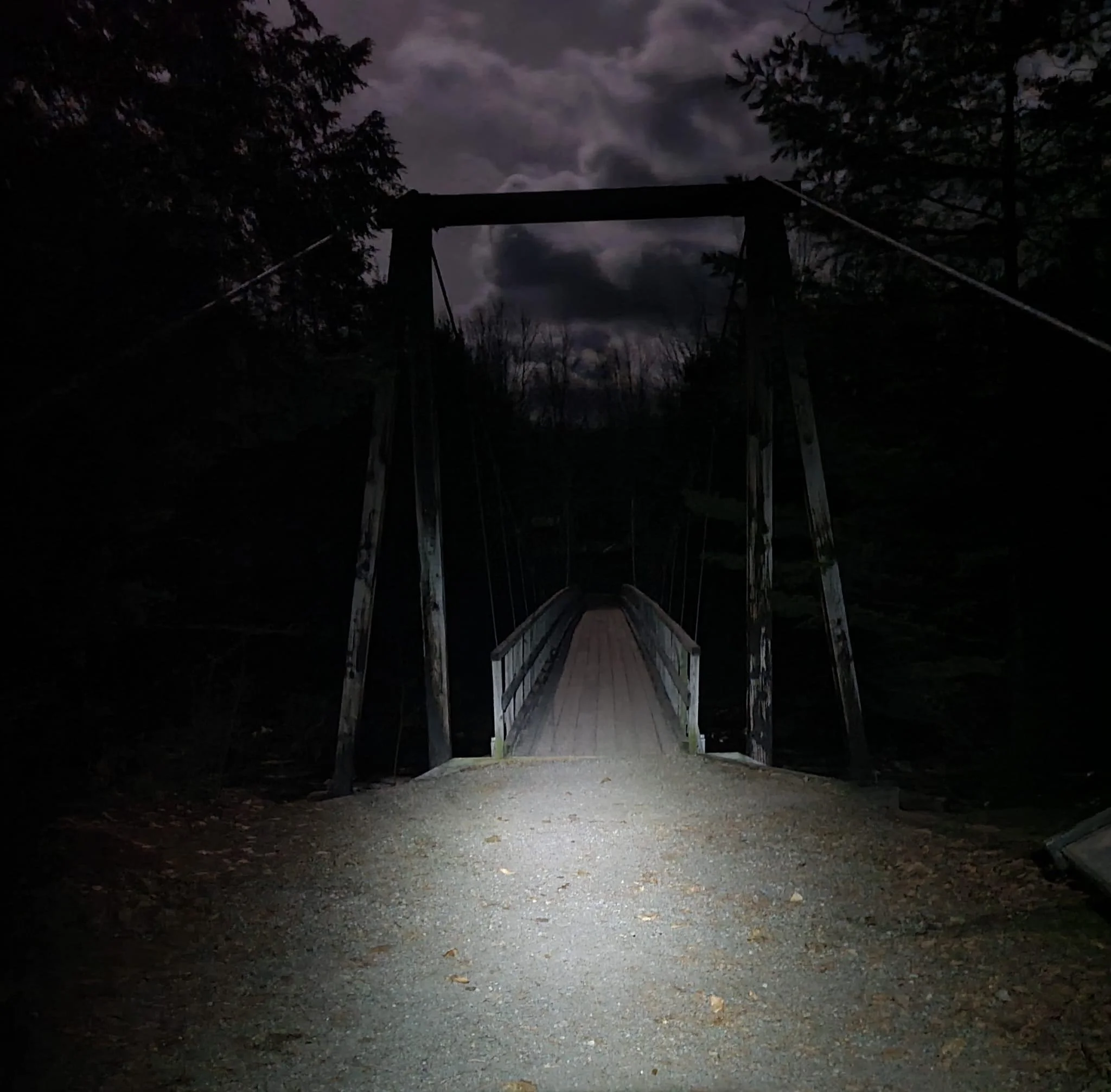
While we had gotten ahead, I physically could not keep my pace up, so I ended up catching back with some of the group we’d hiked with earlier. Joe, Jo-Ann, George, and Carrie - I thank you all so much for your kindness and encouragement. Those last 2.5 miles would have sucked so much for if not for all of you. I had never been so happy to see the near-full moon cresting over that damn suspension bridge.
But… I DID THAT!
Just over two years ago, I struggled my way over those 6 miles and 2,500 ft of elevation gain up Mt. Mansfield in the heat of the summer, exposed to the sun, underestimating these mountains - but I finished it and it sparked a need to get better. I’ve learned so much, met so many amazing people willing to offer their aid or just some kind words to keep morale up. Yesterday, according to my step tracker, I hiked 23.7 miles with 4,630 ft elevation gain - nearly a marathon. I’m proud of how I’ve gotten more fit. Despite not being at my lightest or most toned, I don’t think I could have done what I did yesterday at any other point in my life, even when I was going to the gym 6 days a week. It’s funny how the mountains draw you to push yourself beyond what you thought you were capable of. I’ll be riding the high from this day for a while. A short highlight real, because words really don’t do it justice.
NH 15, 16, 17, and 18/48
New England 20, 21, 22, and 23/67
New England 25, 26, 27, and 28/100 Highest
Northeast 22, 23, 24, and 25/115
*There is a long-running debate over whether or not feeding the Canada grey jays adheres to leave no trace principles. While we’ve all been educated to not feed wild animals, a limited amount of research has shown this feeding to not be creating human-dependent bird populations. It’s a grey area (ha-ha.) Unlike feeding the bears, this is mostly harmless and - in my opinion - there are other more important principles to uphold. To add, it’s also just a really cool experience. I think this creates a connection with nature that people wouldn’t otherwise have, so wouldn’t they be more inclined to care to protect it? Just my two cents!
**Mount Guyot, though standing at 4,580′, is not technically on the official New Hampshire 4000 Footer list due to prominence. However, recent geological surveys suggest prominence has increased to the required 200’ so Guyot may eventually be added to the list. It may potentially replace Mt. Tecumseh which, as of October 2022, stands at just 3,995’.


North Kinsman (4,293') and South Kinsman (4,358')
The stars aligned; for the first time in years, I finally made it back up to New England during peak foliage weekend and getting to experience it in the White Mountains of New Hampshire was just the icing (foreshadowing?) on the cake!
As the days grew shorter, my partner and I drove up to my mom’s under the Friday moonlight. Getting in around 11 pm, we went straight to bed anticipating a 4 am alarm and just over a 2 hour drive in to Franconia, NH. I had a Snickers bar and a 5 Hour Energy in the car - breakfast of champions, am I right? - once again traversing across state lines in the cover of darkness. When the light finally broke as we crossed over the Connecticut River, the world awoke with it in vibrant fall colors. Fire reds, golden yellows, and warm oranges swept over the valley surrounding the Kanc and Highway 116. Saturday’s forecast called for no rain…and lots of leaf-peeping tourists along I-93, so we opted to avoid a dismal parking situation and tackle the Kinsmans from the quieter western side via the slightly longer Mt. Kinsman Trail.
Starting around 7:45 am, the first two miles shared with an old logging road were very gentle. At mile 2.1, you meet up with the spur to Bald Peak which has some nice views - we passed on this as we were on a bit of a time crunch. Continuing on, the typical rock scrambles of the Whites came out to play. I was surprised how cold it got, and how quickly. I tend to start hiking cold, knowing that once I get moving I won’t need the extra layers so I can avoid stopping to take layers off. The air was incredibly damp from the rain the area experienced in the week prior, so between that and the physical activity, my base and mid-layers condensed with sweat quickly. Time to invest in a marino wool base-layer set. Thankfully, my puffy helped immensely, though I was hoping to not need it until we got to the ridge.
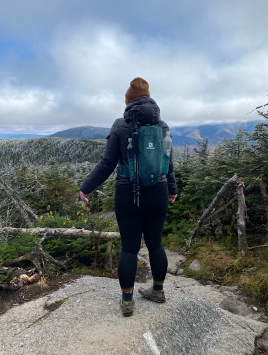
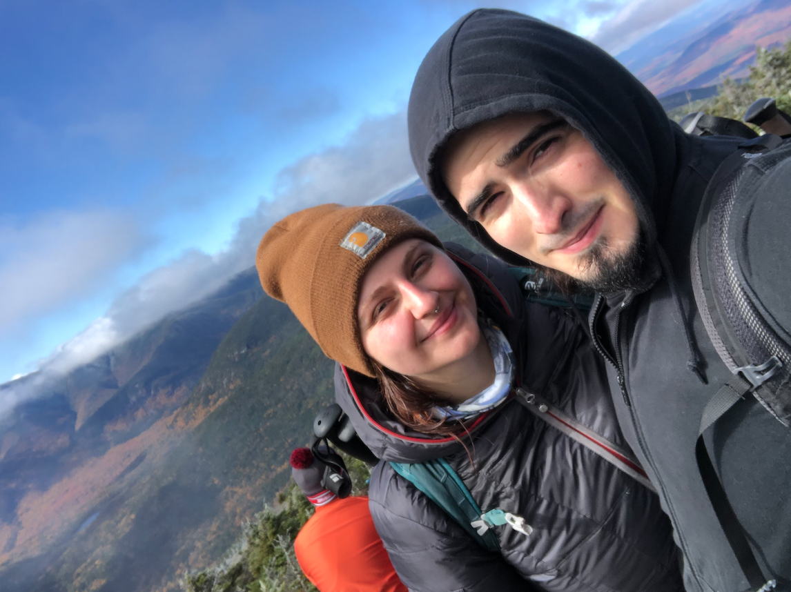
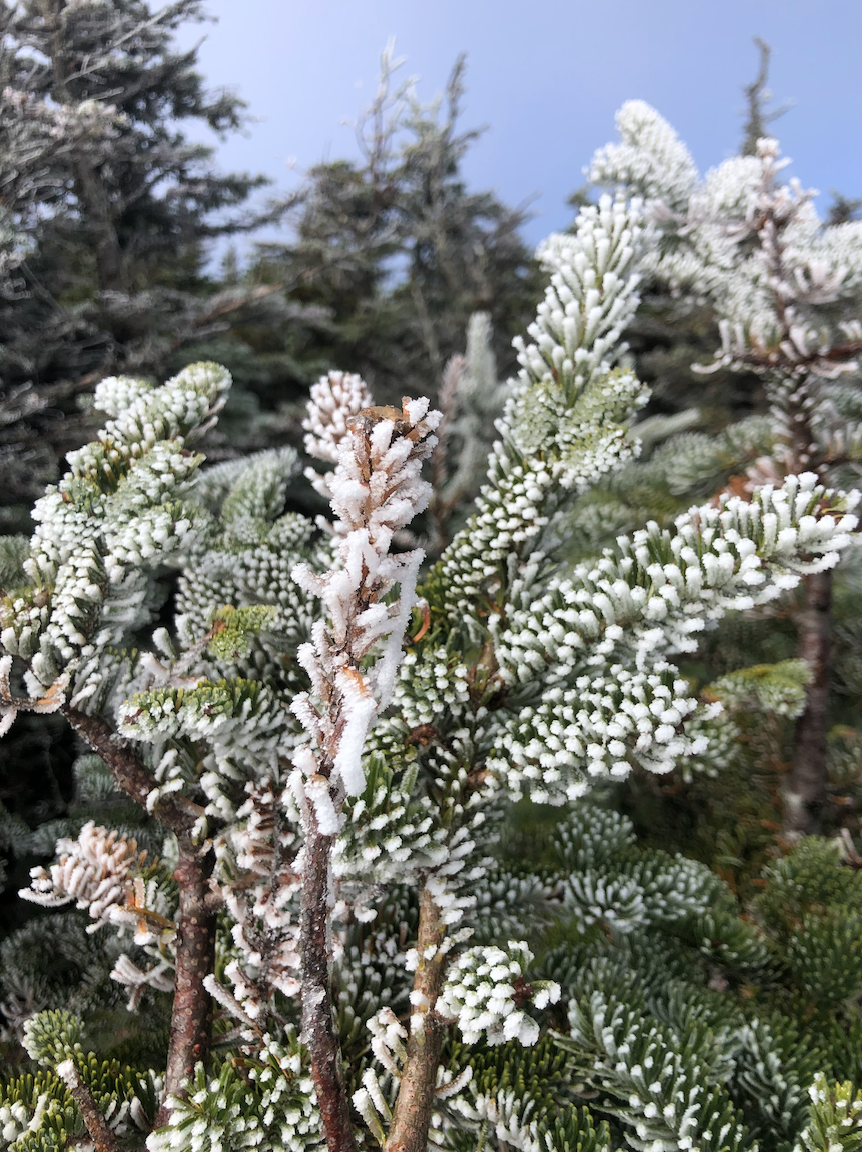
After another 1.6 mi of climbing, the Mt. Kinsman trail joins the Kinsman Ridge Trail (a section of the Appalachian trail) to hit both summits. There’s a nice overlook at this intersection - we stopped for a snack and to snap a few pictures then continued on 0.2 mi of full-body climbing to the North summit. Here, the 180° view point ledge was crowded with hikers coming up the east side from Franconia Notch. There was snow on summits of Flume, Liberty, Lincoln, and Lafayette of the famed Franconia Ridge putting the ‘white’ in White Mountains. Even the trees atop Kinsman Mountain were sporting a throwback hairstyle of frosted tips. My partner decided to turn back complaining of knee pain, so I tossed him the keys to the truck and we parted ways for the time being. Almost immediately after, a young woman with her dog asked if I’d like to finish the hike with her and I was happy to oblige! I love making friends in the mountains - it’s one of my favorite things about this community.
We chatted the whole way to the slightly taller South summit and back where we were met with even more bright white alpine vegetation, adding 1.8 mi to the trip. The clouds had moved by the time we got back to North Kinsman so we were able to enjoy more views - and for me, a summit beer and summit burrito I’d packed out. It looked to be autumn and winter at the same time. Unfortunately, they had come up from the I-93 side so we said goodbye for now after exchanging phone numbers to plan more hikes in the future. The downhill was pretty quick, especially once I’d passed Bald Peak, the logging roads serving as a nice cool down after a few hours of tough climbing. Overall, an absolutely gorgeous day - it’s trips like these that make me wish I didn’t live 7 hours away from this magical place!
NH 13 and 14/48
New England 18 and 19/67
New England 23 and 24/100 Highest
Northeast 20 and 21/115


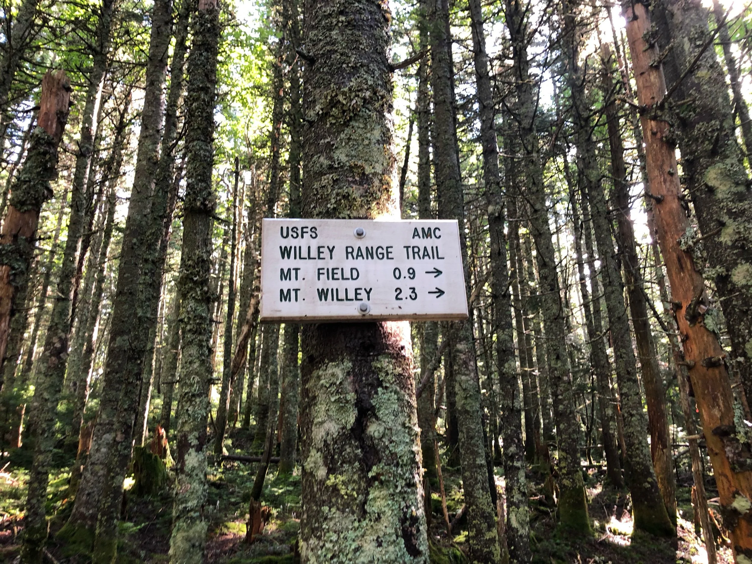
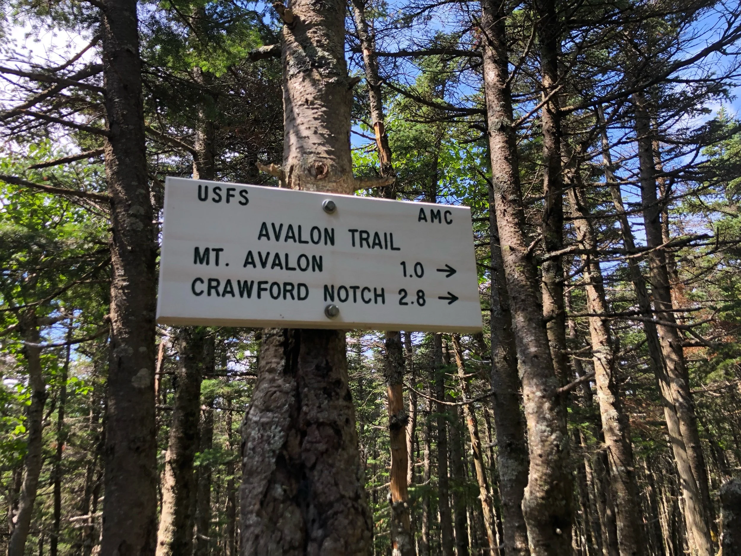
Mount Tom (4,051’), Mount Field (4,340’), and Mount Willey (4,285’)
Taking advantage of an extra two days off work, though jet-lagged as all hell after returning from a trip to Hawaii the morning before, I packed up the essentials and headed north. Stopping at my mom’s in Vermont for an overnight power nap, I left to drive up to the Whites around 4:30 am for a true ‘bang-for-your-buck’ hike hitting three 4000 footers.
This would be my first true solo trip hiking in New Hampshire. I’ve hiked alone plenty, even there, but I usually had my partner waiting at the AirBNB close by in case I needed anything. For some reason, the idea of my immediate connections being nearly 3 hours away made me uneasy. Alas, not everyone is going to want to do what I want to do when I want to do it, and if I constantly waited for other people to live my life, I’d never get to do anything.
I parked at Crawford Notch, crossed over the railroad tracks, and started out on the Avalon trail around 7:30 am. It was a crisp 55° morning so between that and the gentle incline to start, I was able to get moving pretty quickly. Around 1.3 mi in, the Avalon trail continues to Mount Avalon (a mountain on the 52 With a View list) to the left while the A-Z trail veers off to the right toward my first 4000 footer of the day, Mt. Tom. I decided to stay right and hit Tom first - I would live to regret this choice!
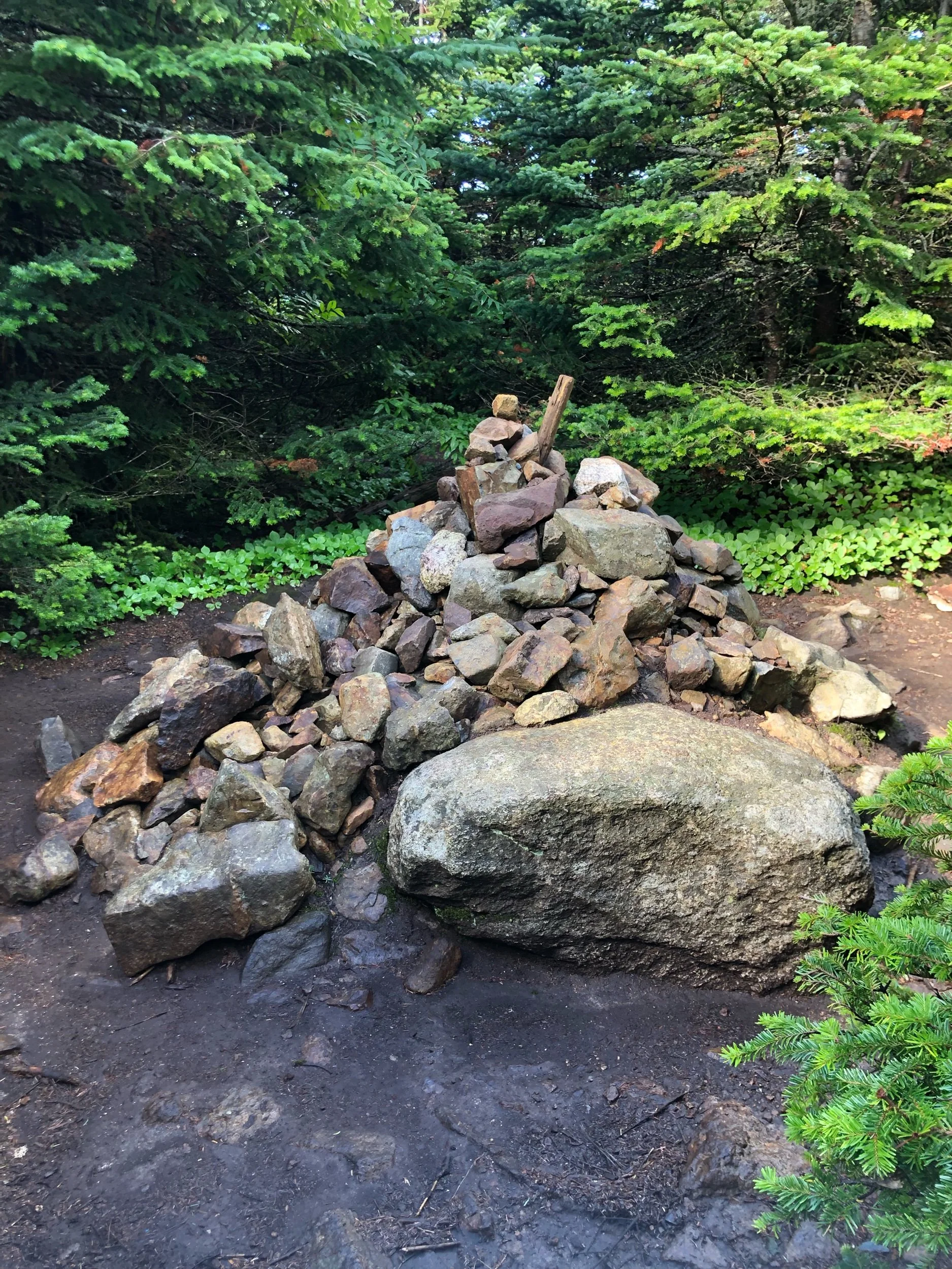
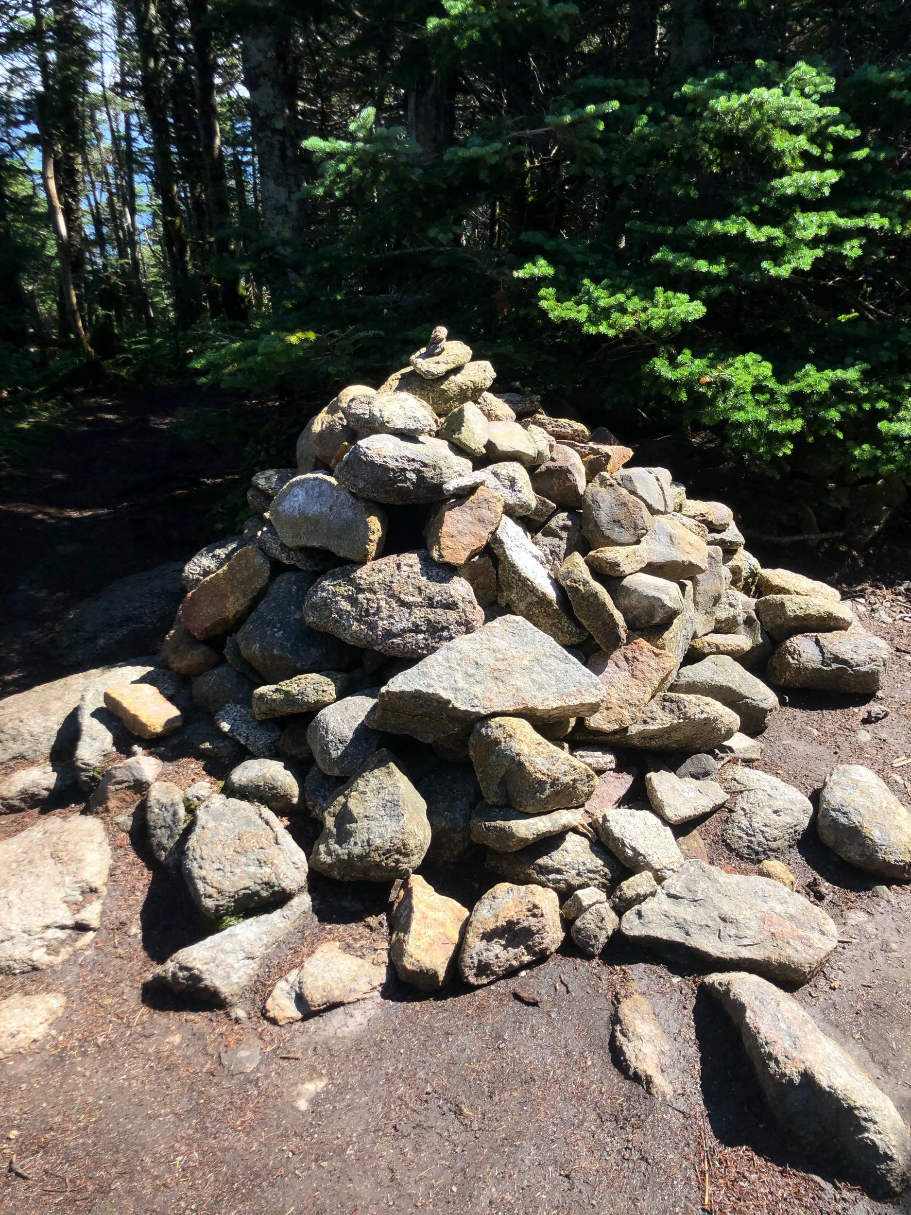
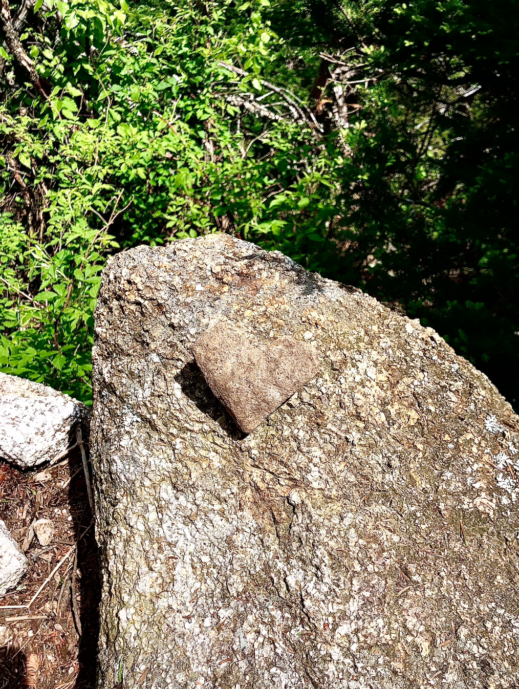
The A-Z trail quickly began to get steeper, climbing just over a mile with several brook crossings along wooded ledges through the forest. You then reach the junction of the Tom Spur trail, another 0.6 mi to the wooded summit of Tom. I hadn’t seen anyone else on trail up until this point. This was a gentle, rolling incline that was relatively easy on the feet, especially for New England standards. I spent more time than I’d like to admit searching for the rock cairn that marked the official summit and quickly realized I’d probably be doing that quite a bit today.
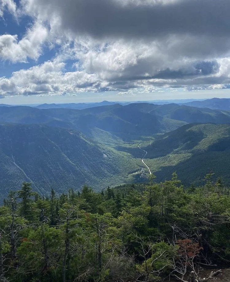
Heading back down from Tom, you continue west on the A-Z trail for a short spurt before going south on the Willey Range trail to hit the other two peaks. From this split, Mt. Field - the tallest peak of the day - is just under a mile away with a bit steeper climbing involved. Atop Field, you can catch a few ‘peek-a-boo’ views above some shorter trees. With not much else to see, I tapped the cairn and started back on Willey Ridge toward Mt. Willey.
Knowing I would have to repeat this 1.4 mi segment to head back, I worried I’d lose some steam coming back up the very steep descent between the two peaks. One moment, I’d think the downhill was over according to the topo map, but I’d soon eat my words as the trail dropped another 100 feet. After what felt like an eternity, I once again found the cairn on the tree covered summit of Willey. I dropped my pack, cracked open a summit beer, and begrudgingly hobbled down to the view point just east of the top; it was totally worth it.
I’m unsure if I would have made it up that incline back to Field with such gusto if not for that beer and the breakfast sandwich I packed out. Once re-summering, I headed down the loop counter-clockwise back on the Avalon trail thinking it would be the quicker way. I should have known better as the common mantra in the northeast is ‘short, but steep’ - I probably could have crawled that 1 mi down to the Avalon spur faster.
My knees were shaky from each cautious step, averaging a 28% decline on wet rocks. I wasn’t necessarily planning on hitting Avalon, but knew those would likely be my best views of the day, so I decided to see how far off trail the summit spur would take me when I got to it. At only 100 yds, I really had no excuse, but that was also #steepaf. Also totally worth it, the summit opening up to a boulder field with outlooks spanning the Presidential Range. After the 0.5 down to the junction of the A-Z trail, the remaining mileage came quickly. I made it back to the truck around 3 pm feeling mighty accomplished. It was a long day with a long drive back, but I’ll never take any time I get to spend in my favorite place for granted.
NH 10, 11, and 12/48
New England 15, 16, and 17/67
New England 20, 21, and 22/100 Highest
Northeast 17, 18, and 19/115
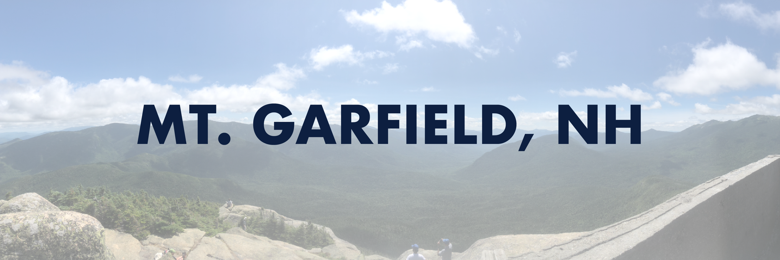
Mount Garfield (4,500’)
After some reconfiguring, and on the recommendation of a family we’d met yesterday, we decided to hit the long but mild Mount Garfield trail after a quick run into Dunks. It was nice to be back up near the Presidentials and we were low-key hoping to bump into my friend’s coworker’s son who just so happened to be in the area at the same time we were while on his AT thru-hike.
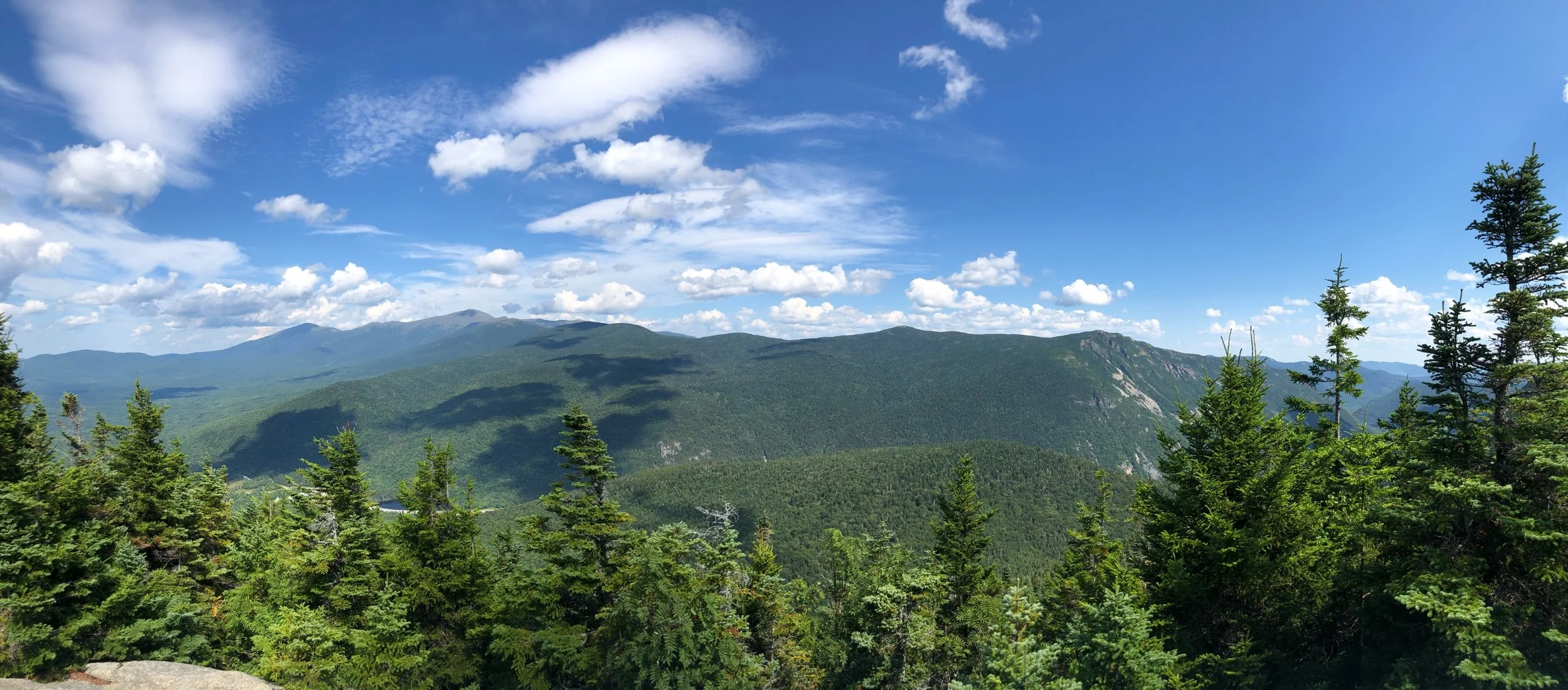
We set off around 8 am, the trail mostly gradual with some steeper sections but even had some switchbacks thrown in (a rarity in New England.) Quite a few people were out there day hiking for similar reasons, hoping to meet up with a friend thru-hiking before heading into the Presidential Range. After many ‘are we there yet-s’, we’d completed the first 4.8 mi and reached the junction of the Garfield Ridge trail that continued on to Galehead Hut.
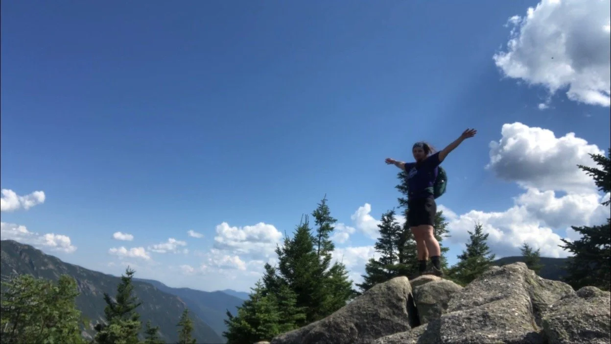
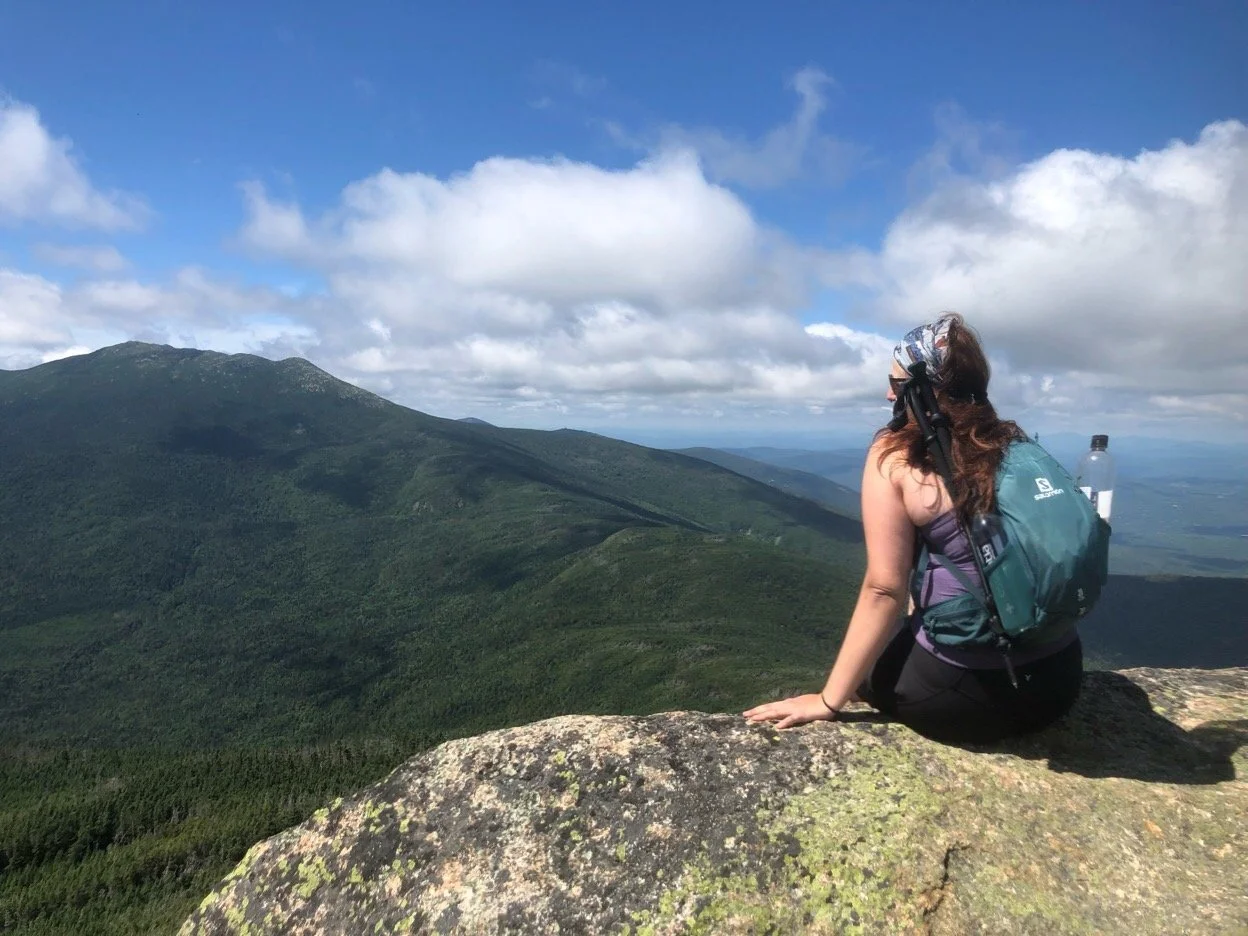
We stayed to the right for the last 0.2 mi, the only real steep and bouldery section of the entire trip, up to the summit of Garfield. The trail, like many others in the Whites, spits you out way up above tree line offering breathtaking views seemingly out of nowhere. There are remnants of a fire tower we clambered our way up toward, sprawling out on a rock ledge facing south. From there, the famous Franconia Ridge was in plain sight along with Owl’s Head standing alone in the center of the Pemigewasset Wilderness and the Prezis to the East in the distance, almost completely socked in.
We spent a good hour and a half up there, basking in the sun, snacking on our lunches, and drinking celebratory summit beers. At one point, a group of thru-hikers rolled through and we took the chance to talk to them and ask about the hiker we knew. It turned out we’d just missed him by about a mile. I asked them about their own journeys, expressing that I’d started planning for my own thru-hike a few years down the road. An older gentleman in the group reminded me of the importance of that commitment to myself - “write that date down”, he said, and those words echoed in my head for the rest of the day. I wished them all luck and off we went down the scramble.
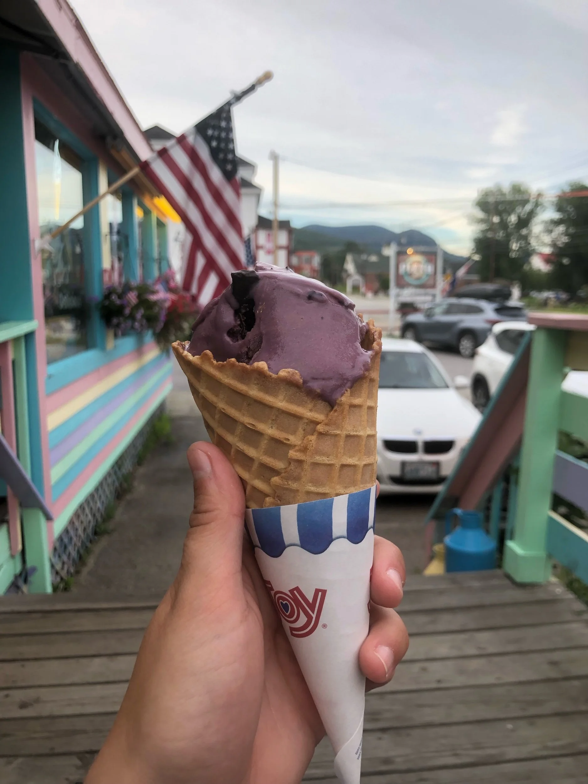
We made - for our standards - record time coming back down, despite the trail lingering on for a full 5 miles back to the road. We grabbed beer, poutine, and ice cream in town and when we got back to the AirBNB, I did exactly as the man on the mountain said. I wrote that date down. And I’m sticking to it.
NH 9/48
New England 14/67
New England 19/100 Highest
Northeast 16/115
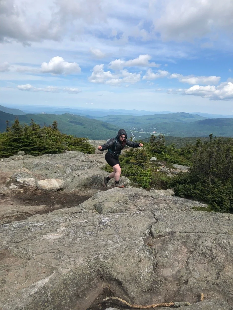
Mount Whiteface (4,020’) and Mount Passaconaway (4,043’)
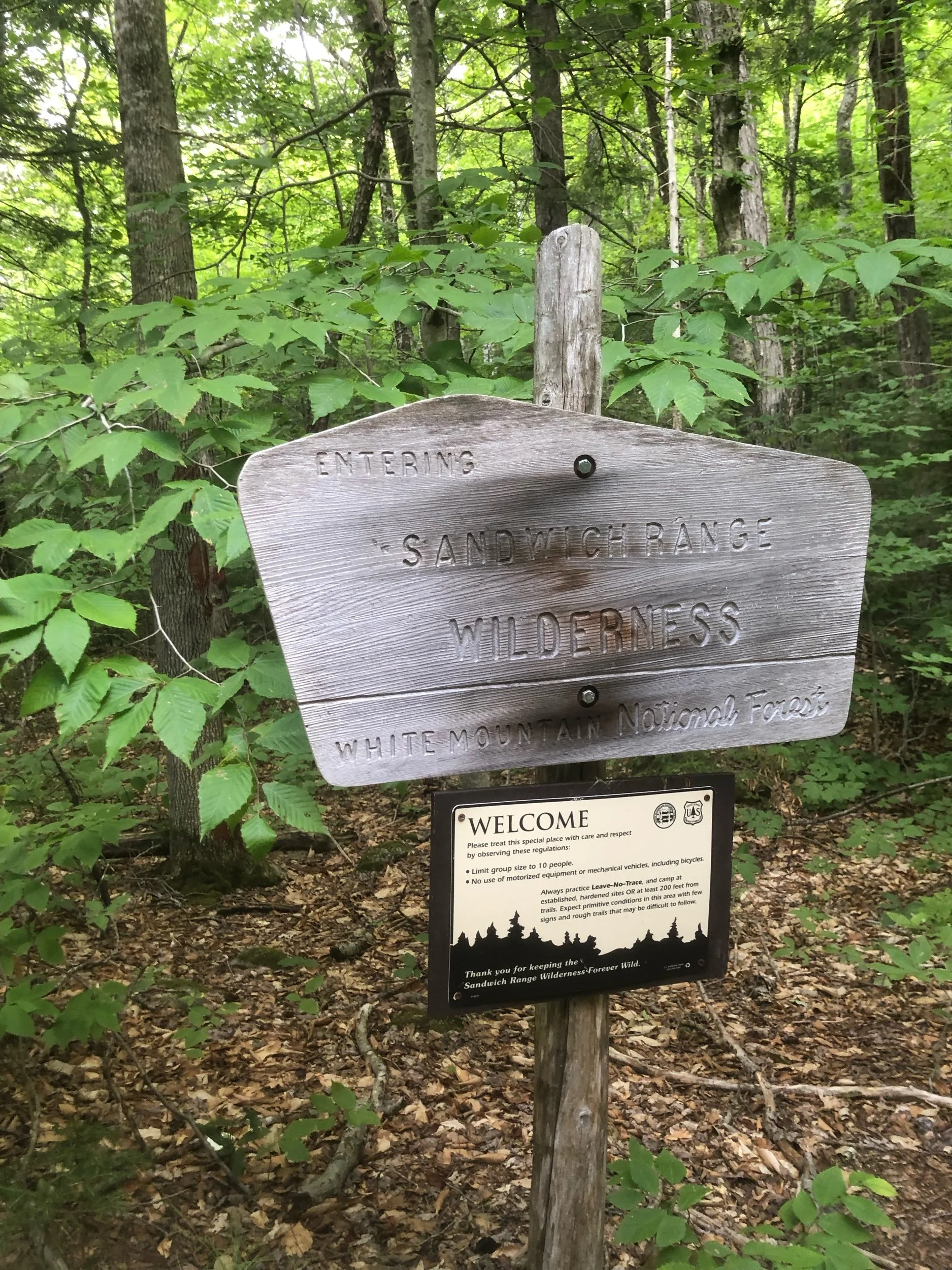
Now that I’ve cycled through what many would consider the more moderate of the White Mountain 4000 footers, I decided to challenge myself more this trip. Not only would this be my longest and most elevation gained hike in the Whites, but I would also be attempting my first trail off the Terrifying 25 list.
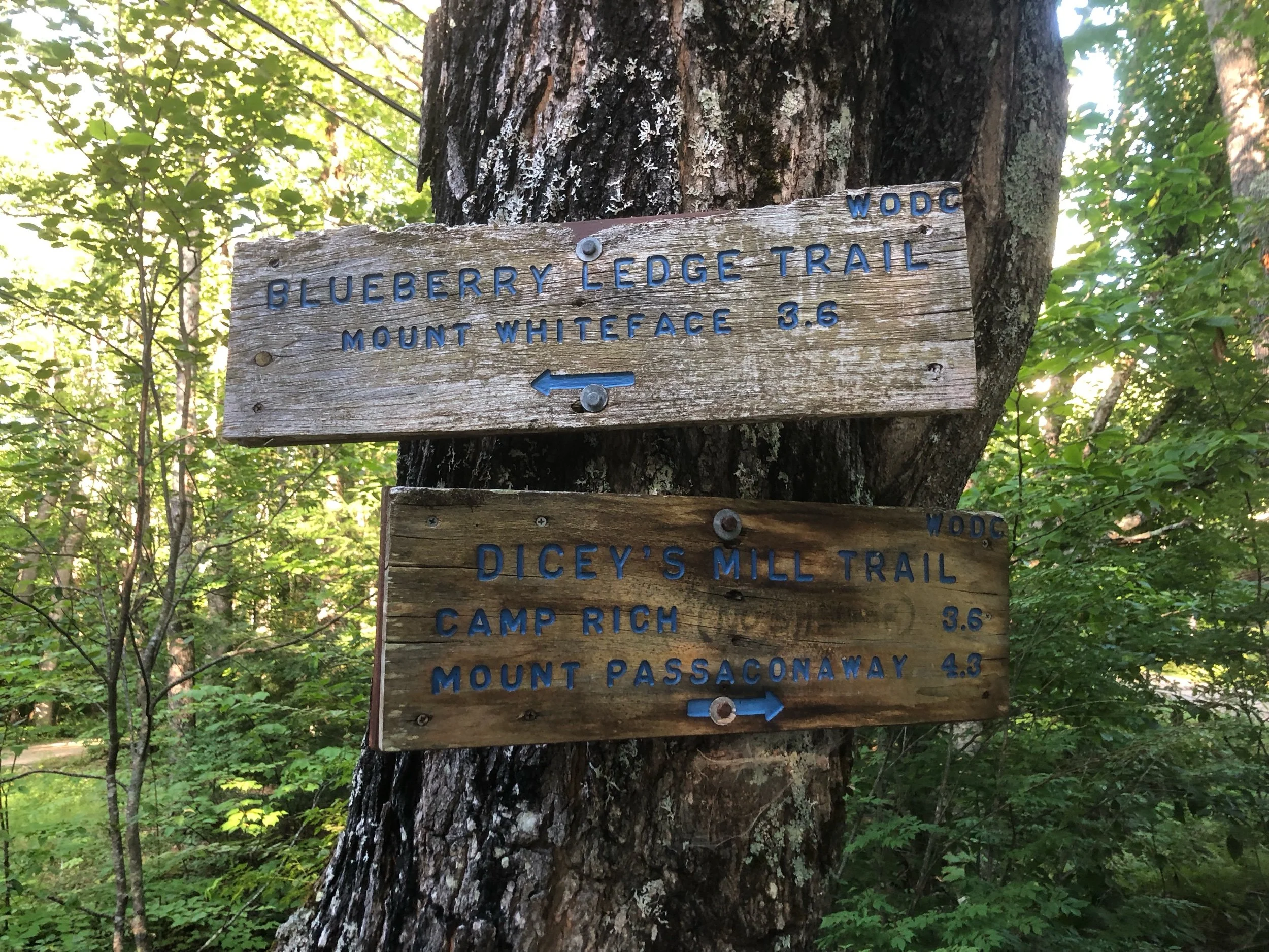
The Ferncroft trailhead was about an hour from my AirBNB for the weekend - further than I typically like to stay - so this meant a very early wake up call. I brought 2 friends along and we started hiking around 7:30 am, the parking area already almost full when we got there. We ascended the Blueberry Ledge trail up Whiteface. While gradual to begin with, the path increasingly steepened with boulders and rock slabs - a precursor to the ledges to come.
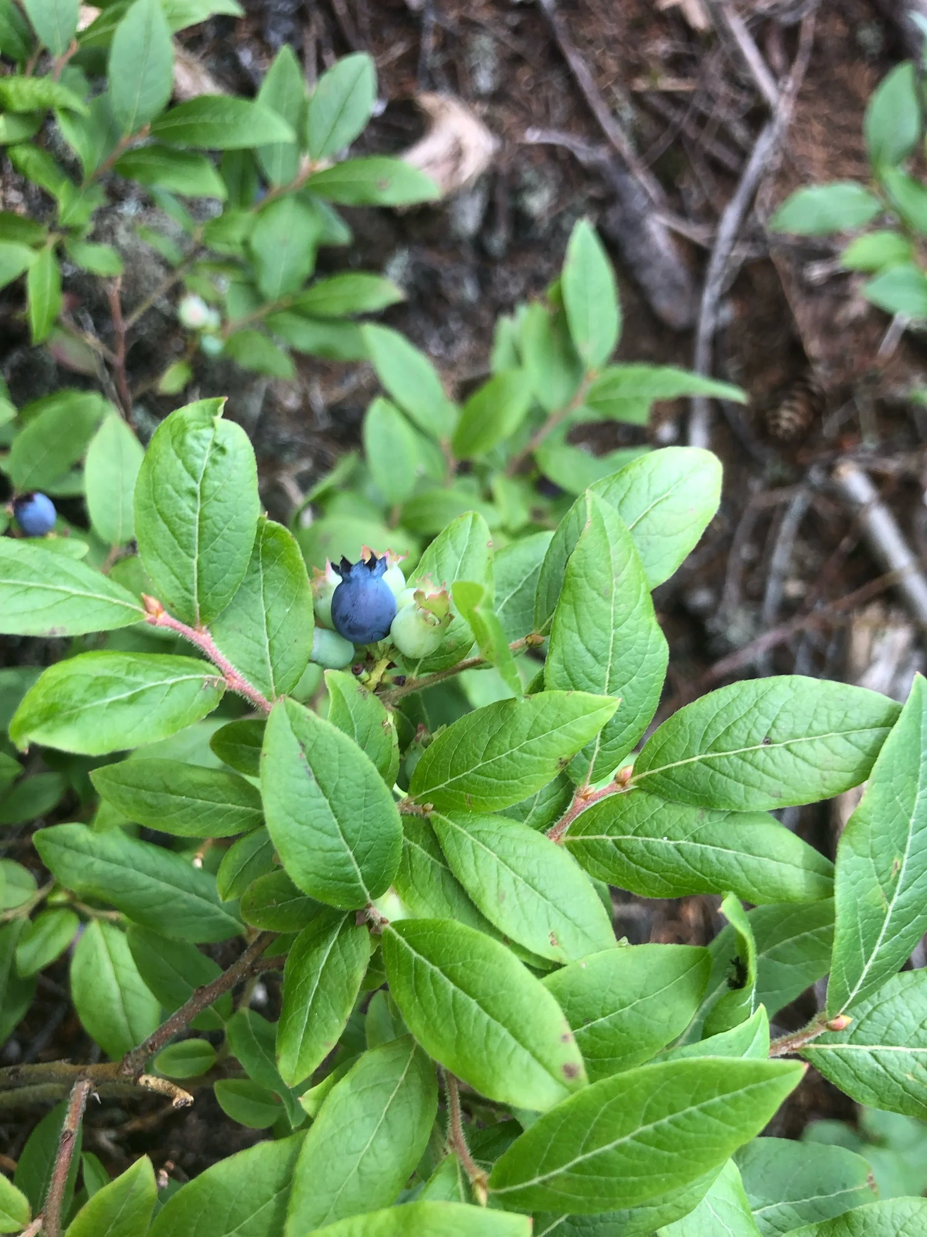
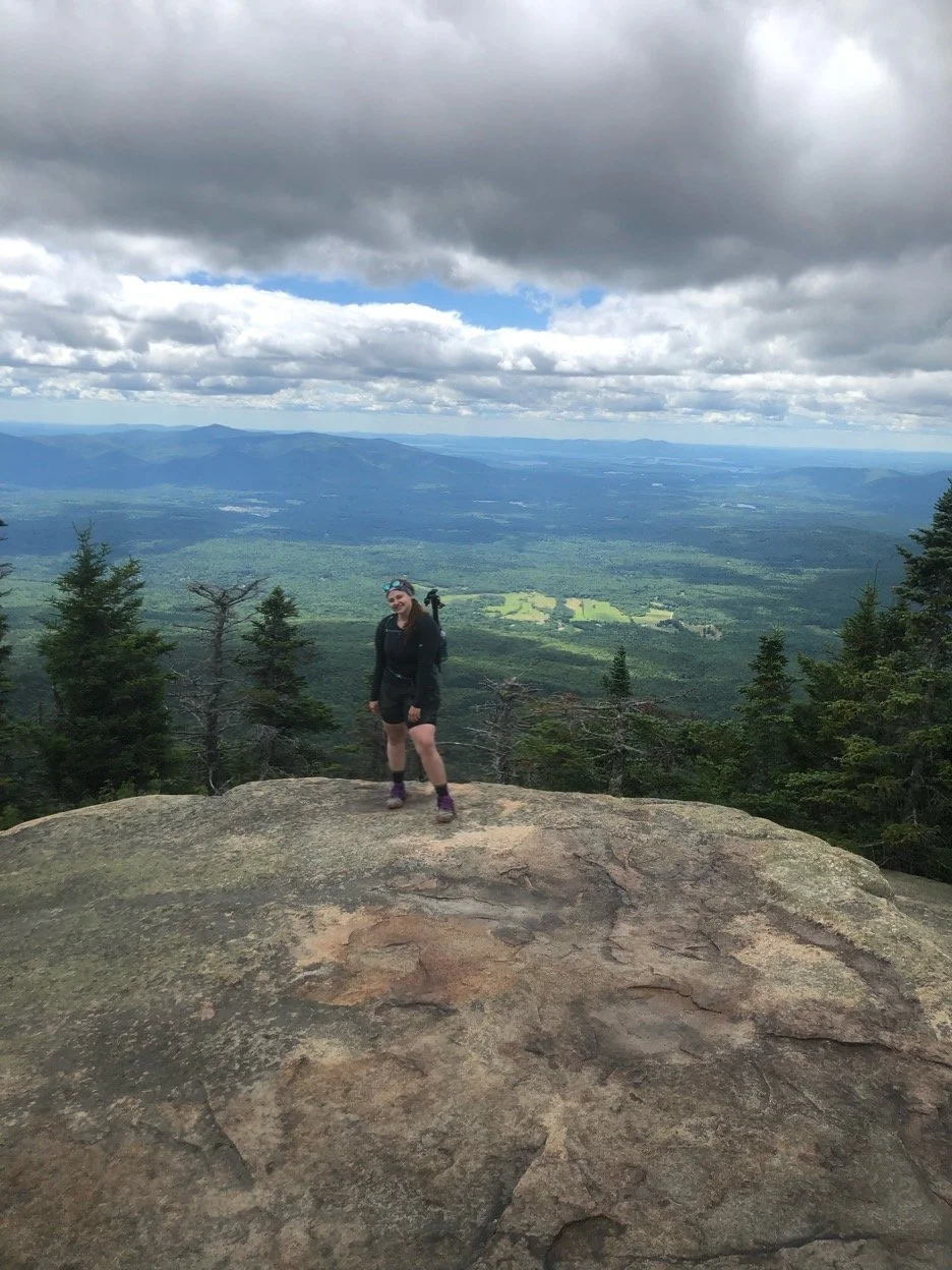
Around 2.8 mi in, the first few mild ledges appear on the trail, but they eventually open up and become even more intimidating. The holes in the rock faces from where rebar ladders were once attached taunted us as we scaled our way up to the summit which hosted some beautiful views north up toward Waterville Valley. This trail truly lived up to its name with a sweet treat of wild blueberry bushes near the summit. We grabbed a handful of ripe berries and continued on the long haul to Passaconaway.
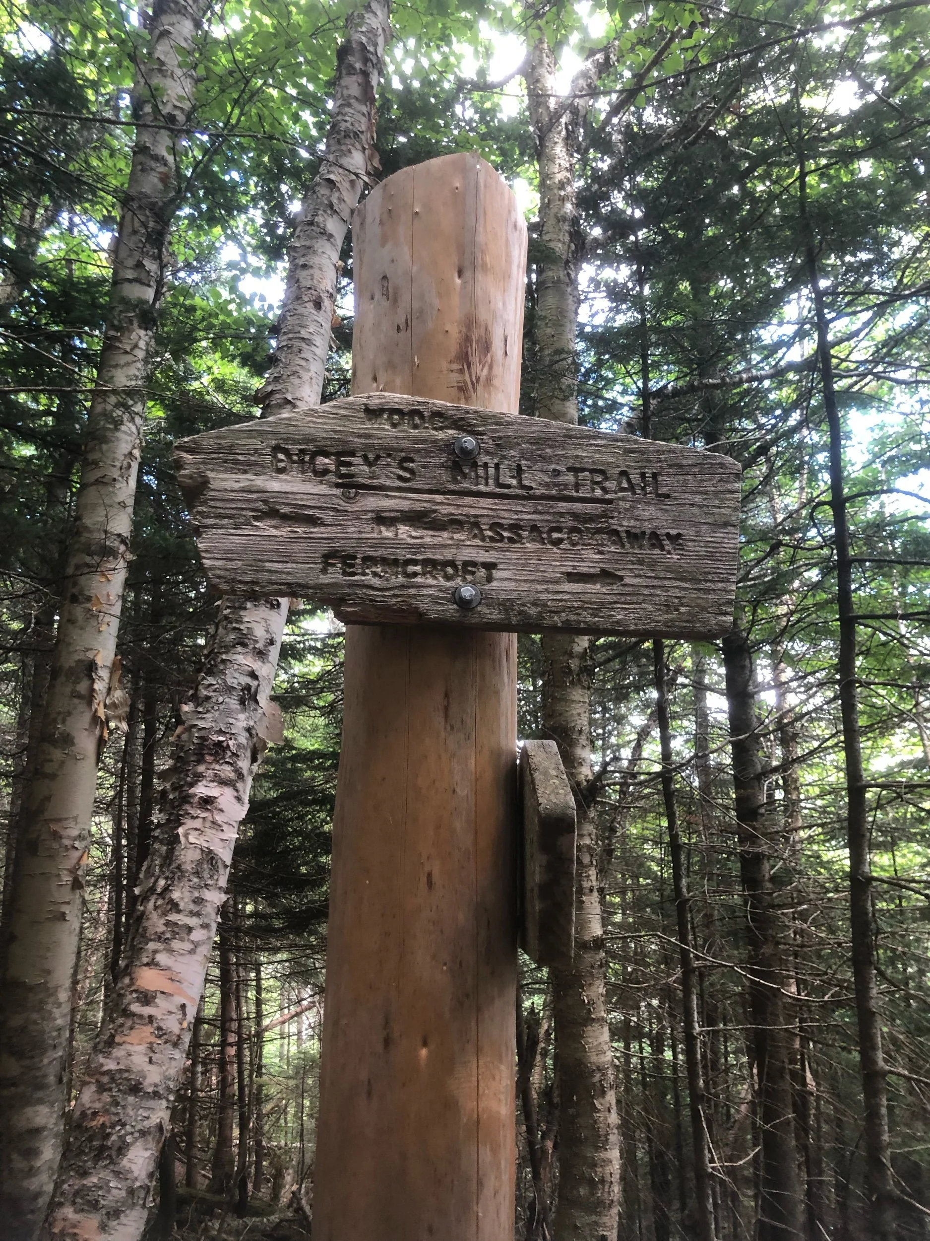
When I say long, I mean it. A combination of the lack of discernible views and the heat wave we’d been experiencing throughout the northeast made that 3 miles on the Rollins trail seem to last a lifetime. Once joining up with Dicey’s Mill trail, the terrain eased up and water sources became plentiful, meaning a much more pleasant ascent up Passaconaway with only some mild rock scrambling. No views on this summit meant a quick tag-and-go as one of my friends had become separated from the group and was awaiting ‘rescue’ (and by that, I mean we’d heard back from her already - she’d found her way to a campsite where two lovely doctors from Boston invited her back to their tent for cold drinks, food, and a nap. We continued on the last short stretch with her blessing!)
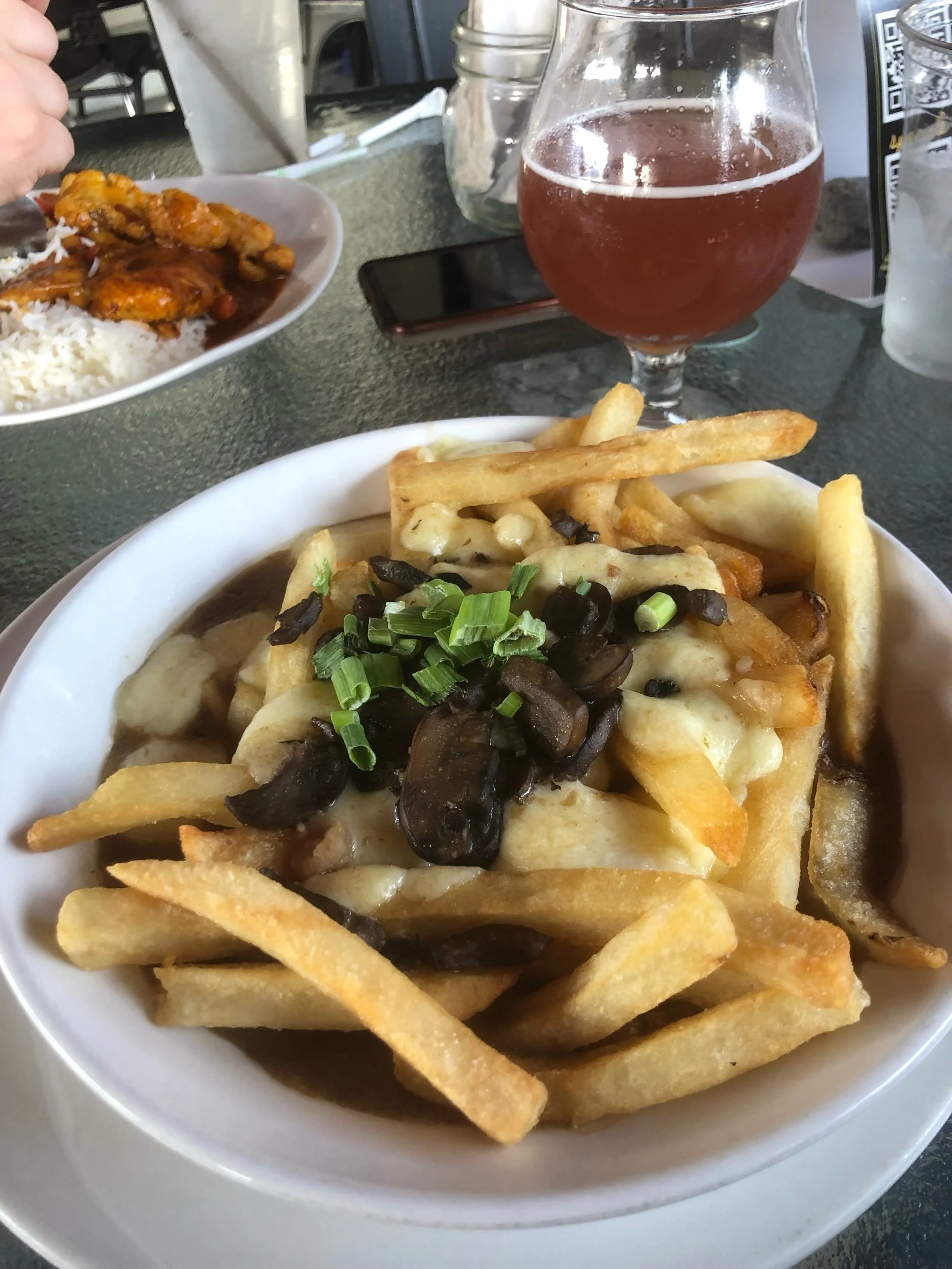
Speaking of blessings, what a joy the trip down Dicey’s Mill trail came to be. It was long, around 4.3 mi, but a nice break on the feet and knees considering all the rock climbing we’d done previously in the day. We made it back to the truck around 4 pm and shared a beer in the parking lot, exchanging happenings of the day before heading back into Lincoln for some well-deserved Mexican food. It certainly was an adventure, but what are those dog days of summer without one?
NH 7 and 8/48
New England 12 and 13/67
New England 17 and 18/100 Highest
Northeast 14 and 15/115
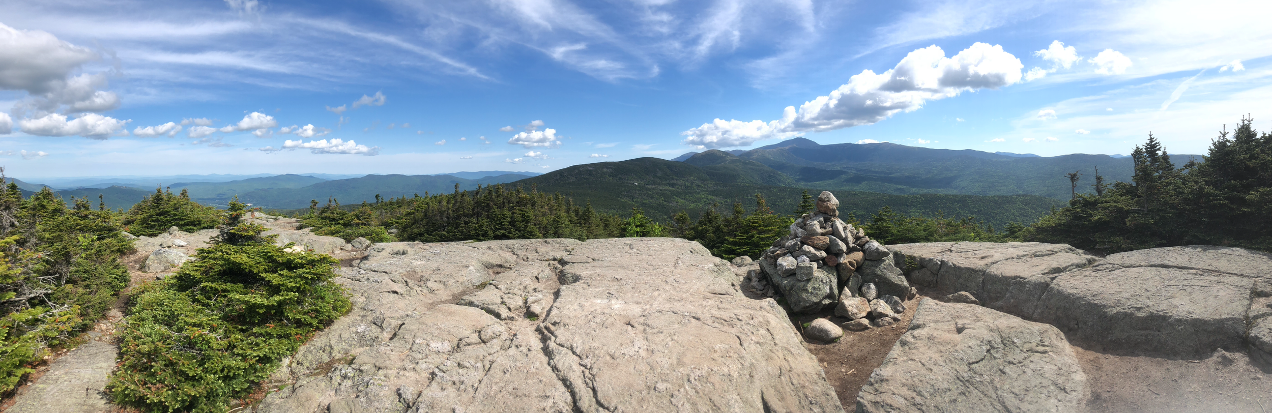
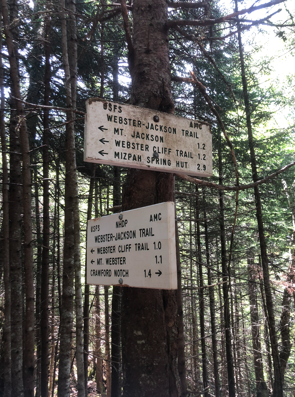
Mount Jackson (4,052')
Feeling a little beat up from the hike yesterday, I decided to take it a little easier today. Jackson was my first hike in the famed Presidential Range so needless to say I was excited. I was in a bit of a rush as I had to check out of my AirBNB at 2 pm which meant an early start around 6:45 am on trail.
It was pretty chilly out right from the get-go; I started hiking with my puffy on and I don’t think I took it off for the remainder of the hike. The Jackson-Webster trail made no mistake in letting you know just what you were in for - you’re climbing a mountain, so you’re going straight up. After about half a mile, I encountered some (what I would call) pointless ups-and-downs. I think my body was more frustrated at that than my mind was, my legs seemingly not wanting to support the frequent changes from incline to decline and back again. The trail was rocky, littered with larger boulders, so I was continuously clambering over them the whole way up.
Short on time, I decided not to hit Webster this time. The last half mile or so came with the traditional ‘slap a strip of white paint on a rock and call it a trail’ rock scrambling, putting my remnant slab climbing skills to use. One boulder after the other, the trees grew smaller and suddenly I popped out of the forest above them all. It was a humbling moment; one second, I was in the thick of the spruce forest, the next I felt small as I peered out over the verdant Crawford Notch. I’d be lying if I said I didn’t shed a tear, just grateful to be back up there. I summited at around 8:45 am.
I sat on the summit for a while, taking in the breathtaking Presidential Range, visually glazing over Pierce, Eisenhower, Monroe, and Washington (Agiochook) with Jefferson, Adams, and Madison trailing behind in the distance. Munching on a breakfast burrito I packed out with me, I thought about how I’d feel a few years from now looking down at all the places I’d been instead of the places I’d yet to go; I’m not sure which side is more exciting.
Heading down in the still morning light, it felt like venturing through an enchanted forest, the light filtering through the trees. There weren’t too many other hikers on the way up, but I did run into several on my way down. I was pretty quick on my feet, making it back down to the truck around 11:30 am. I made the 40 min drive back to North Woodstock, took one last shower at my AirBNB for the weekend, and packed up to head to my mom’s before going home.
NH 6/48
New England 11/67
New England 16/100 Highest
Northeast 13/115

Mount Hancock (4,420′) and South Hancock (4,319′)
Something I don’t speak on too often, though something that’s on my mind frequently, is my maternal grandparents’ bouts with Alzheimer’s and dementia. My grandmother passed away in September of 2014 after a near decade long decline due to Alzheimer’s complications. Seven years later, my grandfather who also suffered from sundowning dementia also passed a day after his 93rd birthday. The most heartbreaking part of it is to watch your loved ones - slowly and entirely out of their control - become someone unrecognizable to you; to lose what makes them, well, themselves. I grew up with them holding a lot of influence in my life and I miss them every day. When I found out about the fundraising event 48 Peaks hosted annually by the Alzheimer’s Association, I knew I wanted to take part in it. My grandparents loved New England, traveling, and the outdoors. They were avid hikers, skiers, horseback riders, and cared deeply for animals. Right up until the end, my grandfather made sure someone was leaving out corn for the deer and seed for the birds on his property. Between myself, family, and friends, we raised almost $300 for the Alzheimer’s Association to continue research in finding a cure for Alzheimer’s disease. I was so grateful for the support and felt amazing going into my hike.
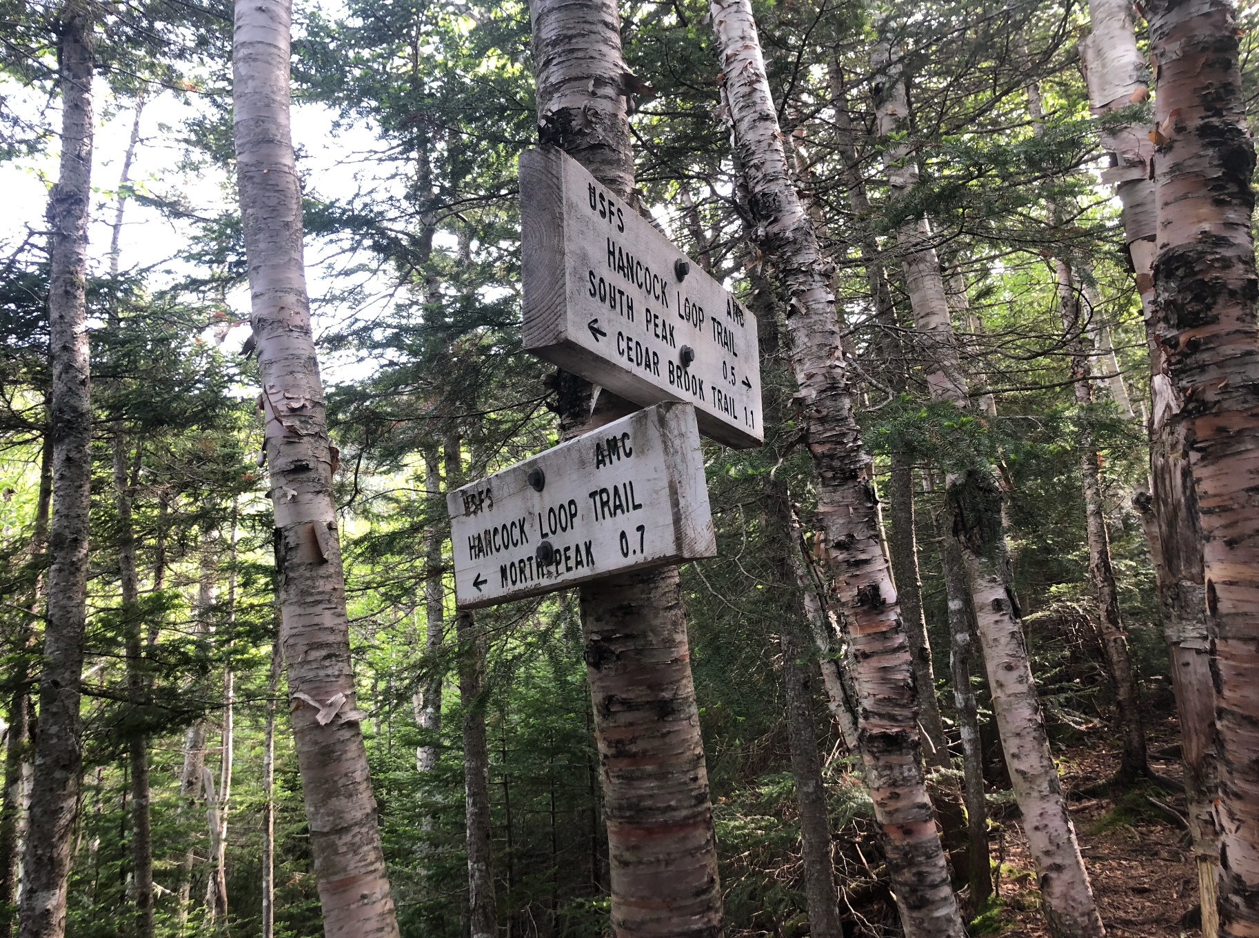
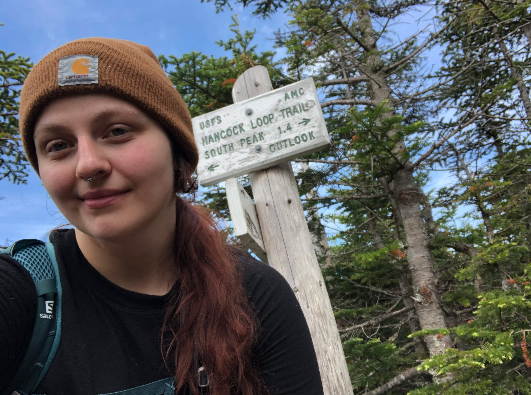
I decided to tackle North and South Hancock via the Hancock Loop trail, arriving at the trailhead around 7 am at a chilly 55°. The first 3.6 miles were quite deceiving for what the rest of the trail would hold as it was a very gentle incline with some moderate brook crossings. At the fork of the Cedar Brook and Hancock Loop trails, I took the popular clockwise loop up to North Hancock first. This section of trail was a tough, slow-going 0.7 mi rock slide up to the main peak with lots of loose rocks. It seemed as if all the elevation was gained here and I hit the summit right around 10 am.
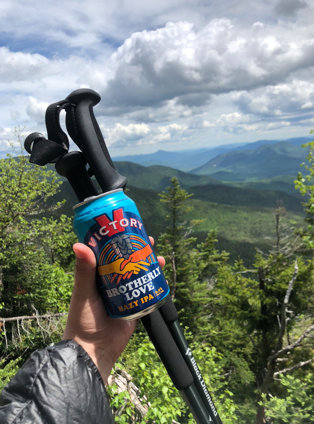
The 1.4 mile trail over to South Hancock was very easy and a nice break from the steep scramble up. Nothing exposed along the ridge, but the trees thinned and offered some sunlight and glimpses of the surrounding Pemigewasset Wilderness. Both summits featured a small overlook with nice views. I enjoyed a Brotherly Love IPA from Victory Brewing Co. at South Hancock before heading down. The descent was rough. Loose rocks made for lots of unsure footing on a nearly-disorienting steep decline which led to some wicked bruises from sliding into upturned roots on the side of the trail. Again, the last 3 or so miles finally came and those seemed to fly by. I made it back to the truck around 1:30 pm. A well-deserved flight and plate of vegetarian poutine from One Love Brewery in North Woodstock was in order.
NH 4 and 5/48
New England 9 and 10/67
New England 14 and 15/100 Highest
Northeast 11 and 12/115

Breadloaf Mountain (3,835′) and Mount Wilson (3,745′)
The first hike back of the year is always tough. Winter seems to be, for most people, a time of hibernation. I’d fallen victim to it for years, turning into a hermit with the shortening days and wanting to stay inside until the sun started creeping out for longer after daylight saving’s time. This winter, between my farm and horse training jobs, I felt more fit and prepared than I ever had coming into the spring season.
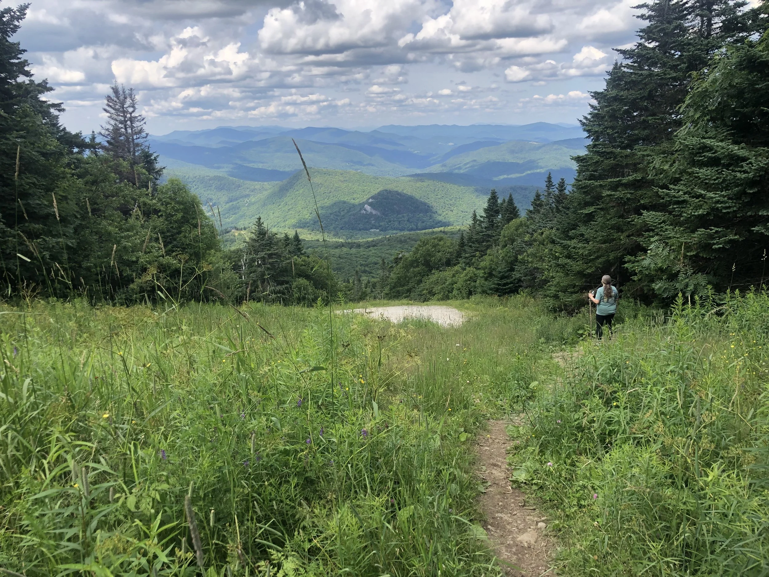
We chose a more moderate hike for our first outing of the year to get back into the swing of things. With Vermont’s mud season hopefully wrapping up around Memorial Day Weekend, we hit a section of the Long Trail just outside of Waterbury around 8 am on Saturday heading north. The first two miles of the day were on the Skylight Pond trail up to those official white blazes. The climbs were fairly gradual and we hit a good pace right off the bat, the trail rolling along through serene hardwood forest. Weather forecasts called for rain around noon, so between the looming showers and this section being pretty remote, we were the only ones on trail that day.
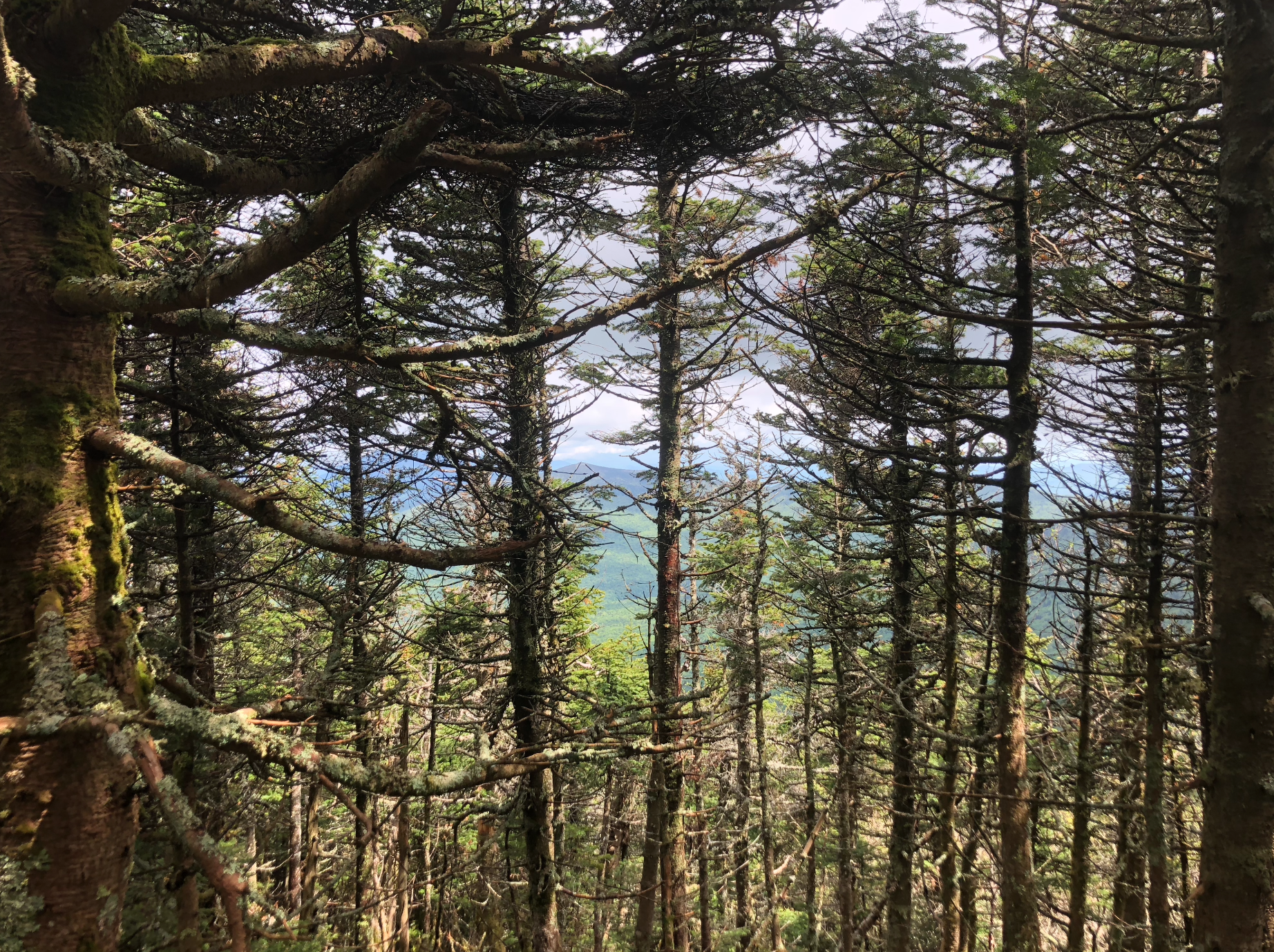
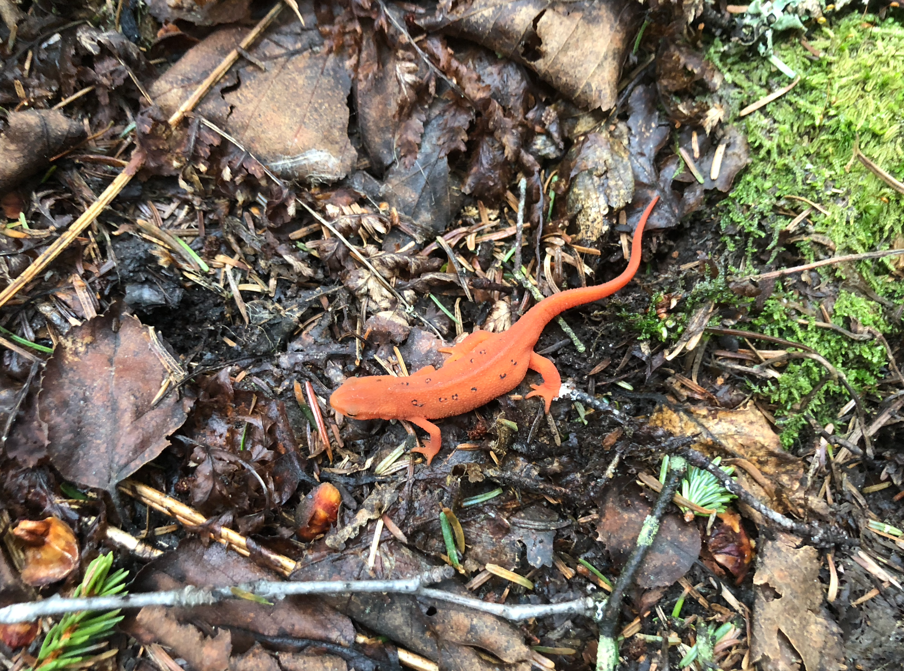
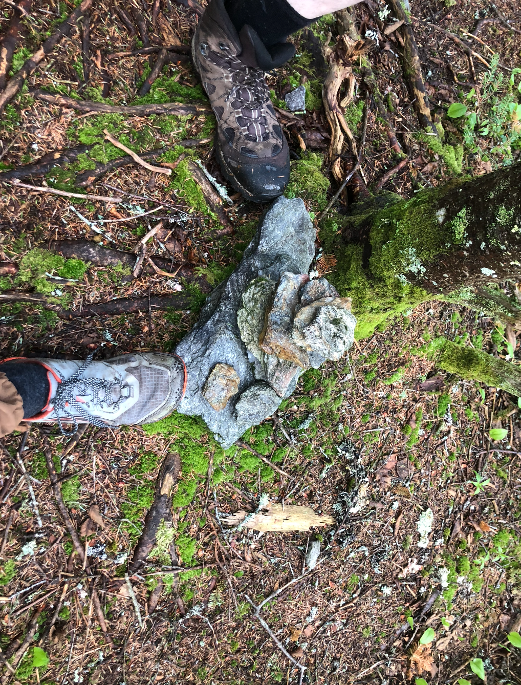
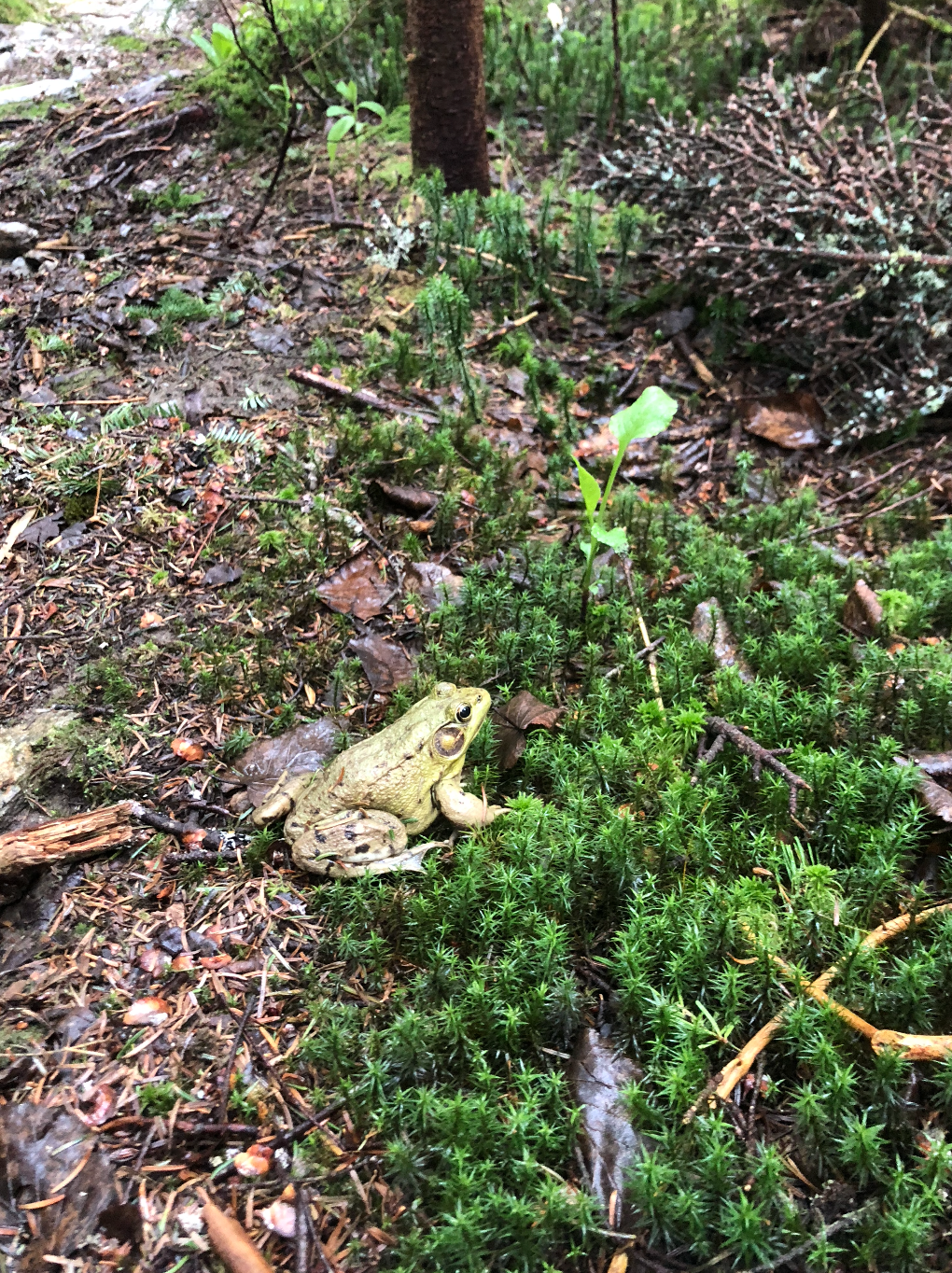
After about 3 miles, the woods turned to spruce and a short while later, we made it to the covered summit of Breadloaf Mountain. There were a few views peering through the trees, but nothing substantial - this wasn’t expected, sometimes the hike isn’t about the view at the top but simply enjoying some time taking in the natural world. We continued on another 1.1 miles to Wilson while dodging piles of moose droppings, avoiding stepping on frogs hopping out from under our feet, and counting vibrant orange northeastern newts as they appeared on this misty day - I believe we found around 24 of them along our 11 mile total journey. It was a day of exploration and feeling like a kid again, taking moments to look at the little things.
Heading back around 10:30 am, the rain came sprinkling down. We stopped at the Emily Proctor shelter for an early lunch and to throw on our rain gear, moving forward through the striking green tunnel and making it back to the truck by 12:30. I learned I really do enjoy hiking in the rain and maybe I’m in better shape than I give myself credit for, not to be undone by the pints of crème brûlée ice cream-turned-melted milkshakes on the hour and a half long drive back to my mom’s place.
NH 3/48
New England 8/67
New England 12 and 13/100 Highest
Northeast 10/115


Equinox Mountain (3,855′)
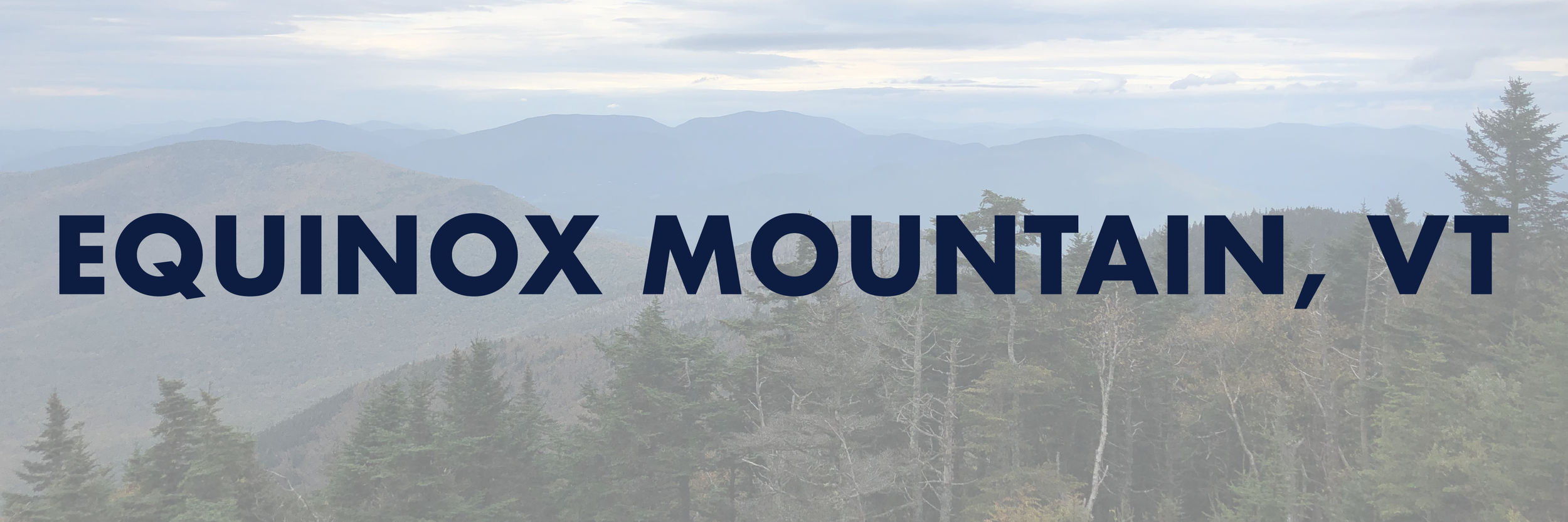
For the record, September sucks.
This summer, I’ve been bouncing back and forth between my to expensive and time consuming hobbies; horses and running away to the mountains to go hiking. A day after my last big hike, I lost my heart horse who I’d owned and loved for nearly a decade to a horrible colic incident. Everything that I could have done, I did, but it still wasn’t enough. I’m angry. I’m heartbroken. I’m sick to my stomach over it and nothing could really make it any better. I can’t sleep, I can’t eat, people think I’m crazy because “he’s just a horse” - it’s more than telling when I hear that last line. There’s nothing comparable to the relationship between horse and rider. It’s losing something you couldn’t communicate with in words, yet still entrusted your life to. Perhaps then they’d get it.
I figured a trip out to the woods to sort my mind would do me some good.
I begrudgingly got out of bed around 10 am (I’m not one to sleep late, but the last week had been too difficult to bear staying awake for longer than I absolutely needed to be), got dressed, threw on shoes, and headed down to Manchester Center with my partner. We got to the parking lot around 11 am and started hiking. I wasn’t necessarily looking forward to checking anything off my list, but at least I’d feel like I accomplished something, anything. The Summit trail started off on a wide, switchbacked logging road and quickly turned steep and rocky after a small stream crossing. My partner had been complaining of some knee pain so, ready to bail as this trip was just not doing it for me, I asked if he’d like to turn around and head back. He said no, so we continued on as the trail narrowed and we began seeing a change in scenery, from fading maples to vivid pines and ferns.
The last 0.25 mi to the top was oddly civilized; old radio towers, wires, eventually happening upon the notable Carthusian Monastery accessible via auto road from Skyline Drive below. It’s an incredibly odd feeling to emerge from the woods covered in sweat and mud only to be faced with a horde of people dressed in their Sunday’s best. And of course, every “you HIKED up here?” - maybe we were the crazy ones. So many times I go to the mountains for some silence, when my head is rushing and I can’t turn it off. Today was just not that day and sometimes, you don’t get those answers you were looking for.
My partner’s knee pain had only worsened from the steep decline. It was a hellish 4 hours back down to the car with me doing my best to support him mentally and physically while we clambered back down by light of headlamps and the lunar light peering overhead in the trees. Did we do everything right? Probably not, but sometimes you can only do the best you can in that moment. It made me think of grief - living without really existing, survival mode, not always doing everything the right way, but in your own way to keep your head above water. We sat under the moon in the bed of the pickup truck, each with a massive Bud Light Seltzer in our hands and Chinese takeout in our laps. We were banged up, but still proved to ourselves if we can still find a way to laugh even in those darkest moments; well, I guess we’re doin’ alright.
NH 3/48
New England 8/67
New England 11/100 Highest
Northeast 10/115


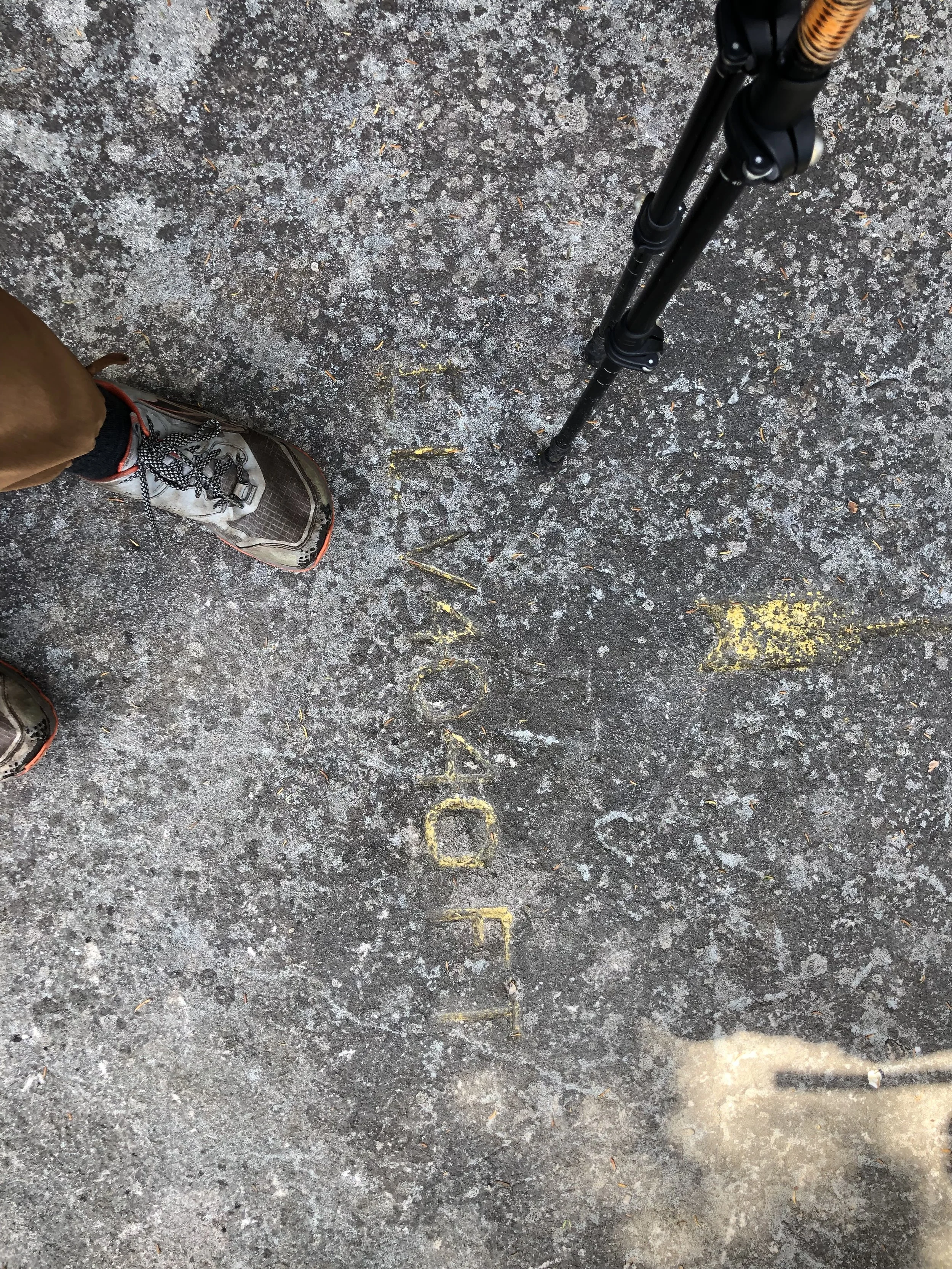
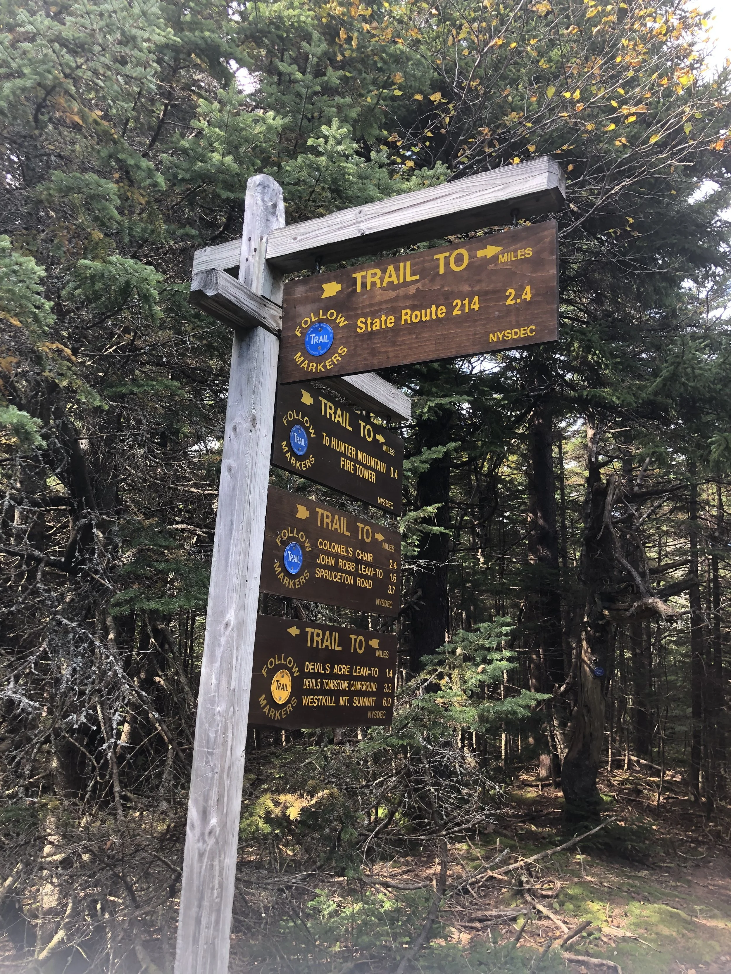
Hunter Mountain (4,040')
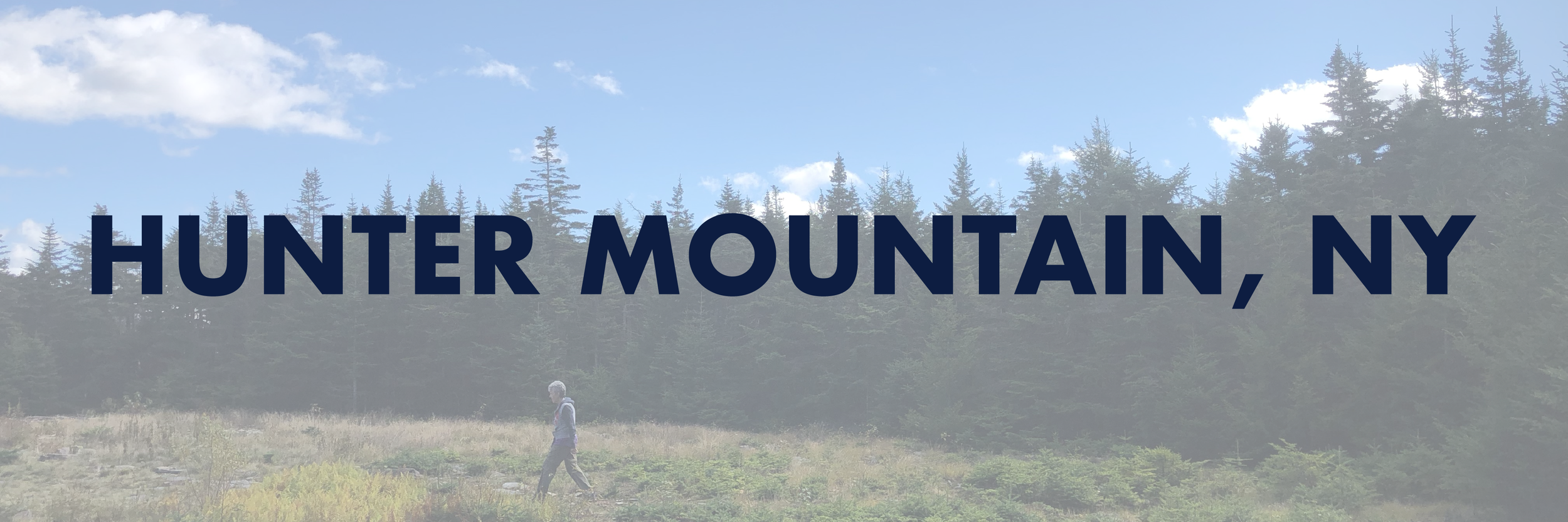
Because the Catskills are a reasonable day hike’s distance away from my home in New Jersey, I had a rare opportunity to hit a 4k with a few of my local friends. We got a late start heading up and didn’t make it to the Becker Hollow trailhead until 11 am. It was humid as heck and even this late in the season, we were seeing bugs. The rocks started immediately with the short-but-steep elevation gain creeping in after the first 3/4 mile; seriously steep moments of actual climbing on all fours up slate crumbling beneath our feet.
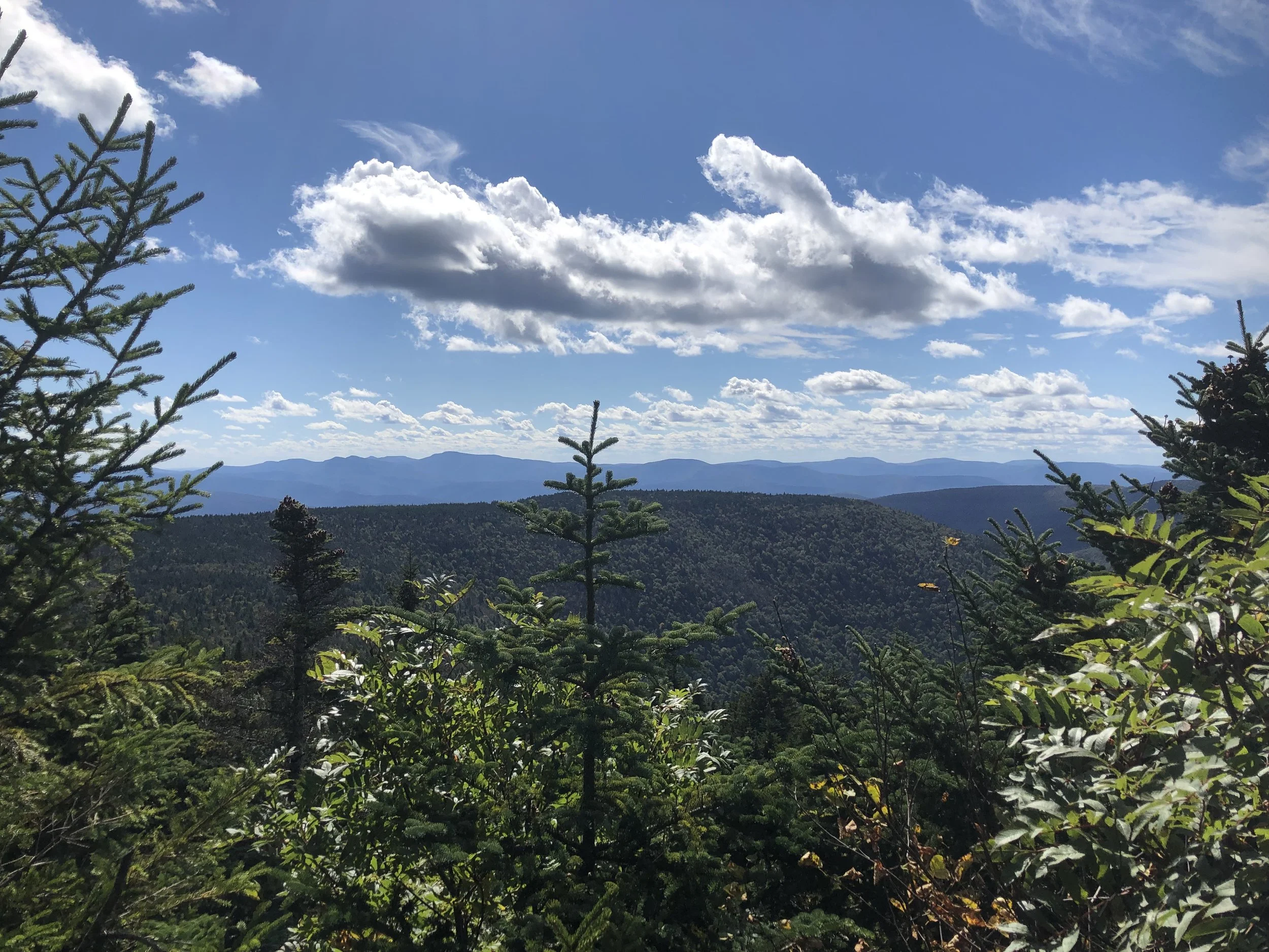
We took the guide’s advice and took the loop counter-clockwise to the summit - a huge, open, grassy area with a famous northeast fire tower. For the Catskills, the views were stunning atop the lookout; I preferred Hunter much more than Slide for this very reason. From up there, it was quite the blustery day, but the leaves were starting to change indicating fall was nearing. On the way down, a group clad in purple was stationed in the far corner of the summit - they were running a hiking event fundraising for the Alzheimer’s Association, just another testament to how kind and giving the trail community can be. I happily dropped a donation and got back on trail.
Rough go on the knees through the steeper sections; we fell more times than we’d care to admit, but made it back to the car before 5 and went for beer and burgers at our favorite spot near my friend's place in north Jersey. I’ve no aspirations to join the Catskill 3500 Club, but perhaps some day I’ll be back to square up for another round.
NH 3/48
New England 8/67
New England 10/100 Highest
Northeast 10/115


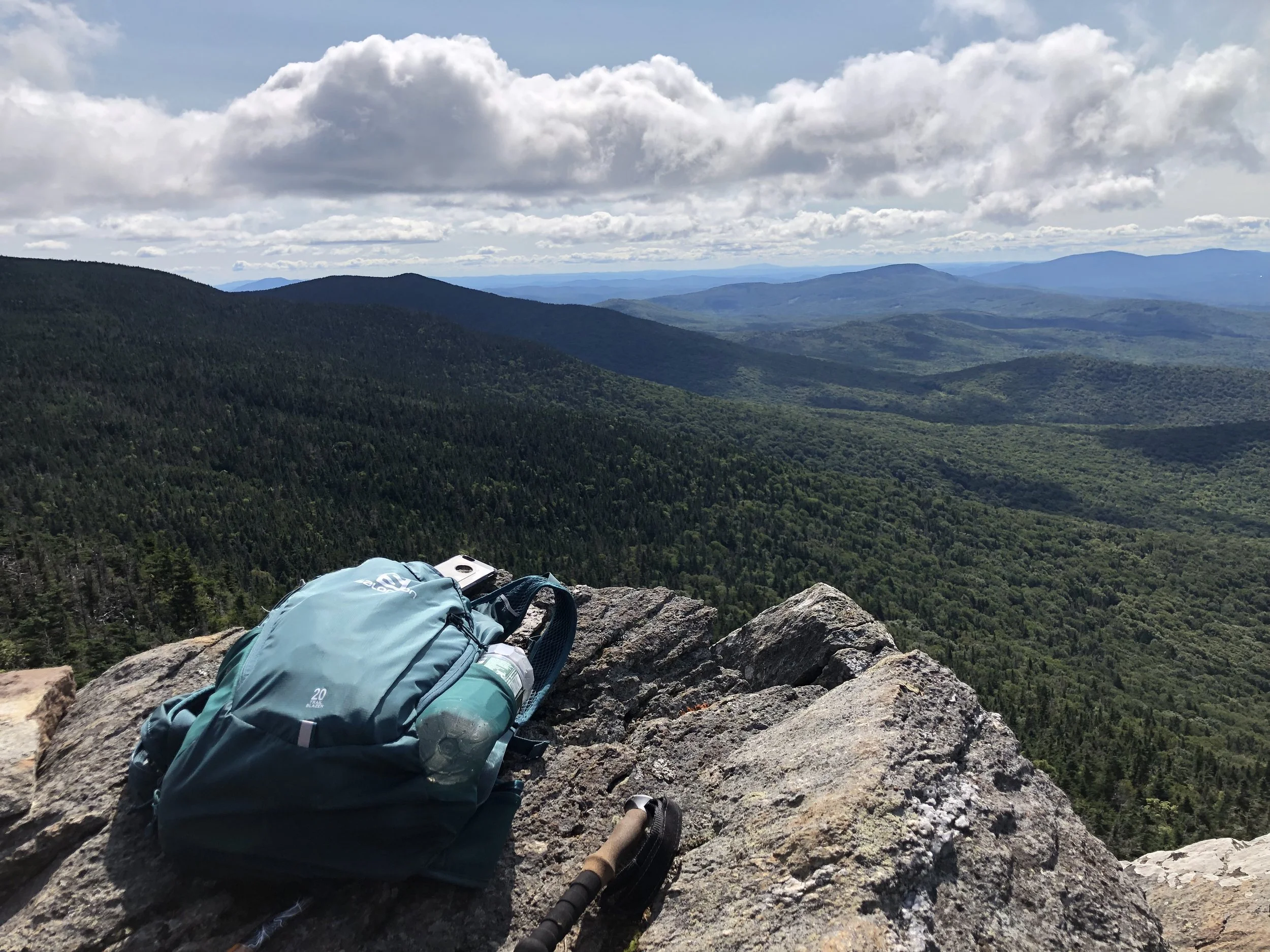
Mendon Peak (3,840′)
Directional navigation has always made sense to me, and I’ve truly always had a knack for it, especially on road trips. It’s not all that complicated. Begin with positioning the sun - in the Northern Hemisphere, the sun’s highest point in a given day is directly south, you just have to visualize the projected arc. Once you have that, the other cardinal directions are easily realized. I’ve read a lot of maps; roadways, topographical, etc. Maybe I’ve just gotten good at navigational awareness, but I will never claim to be perfect. This trail certainly gave me a run for my money.
The Mendon Peak trail, though not much of a trail as I’d come to find out, shares a parking area with the Bucklin trail I used to hike Killington a year prior. A longer mileage hike for a single, smaller peak at around 10 miles, the first mile is a relatively flat logging road until you reach a fork. From there, things get a bit tricky with multiple turns coming up quickly, around every 0.25-0.65 mi. Nothing is marked and I found myself searching for the brook crossings I read about in the guide book before leaving for this hike. At some point, I’d gotten off track, resulting in a 2 mile bushwack to get back on trail. Exhausted, mostly from nerves as this is a very remote trail, I finally found the brook I should have woven over several times and continued on.
From there, the trail is a series of steep switchbacks up to the peak - I would say these would be welcome, as switchbacks are fairly uncommon in New England, but the added distance was frustrating and I was running out of battery life from trying to find my way back on trail. The last mile to the top is, once again, completely unmarked and in a more open forest so it was really easy to lose your way. The actual summit is wooded, but there is a nice overlook slightly northwest from the sign where I recognized the Killington fire tower and Pico Peak. Should I have brought a backup battery charger? Sure. Should I have brought a paper map? Maybe, though it might not have even been that helpful since there really was no trail. Learn from my mistakes and always have a backup to your choice of navigation just in case.
After a quick snack on the overlook, I bolted back down the mountain - the correct way this time - and made it back to the truck before my phone died. Between the bushwacking and wandering around to find the trail, I hiked almost a half marathon today. Needless to say, I was happy to make it back home.
NH 3/48
New England 8/67
New England 10/100 Highest
Northeast 9/115


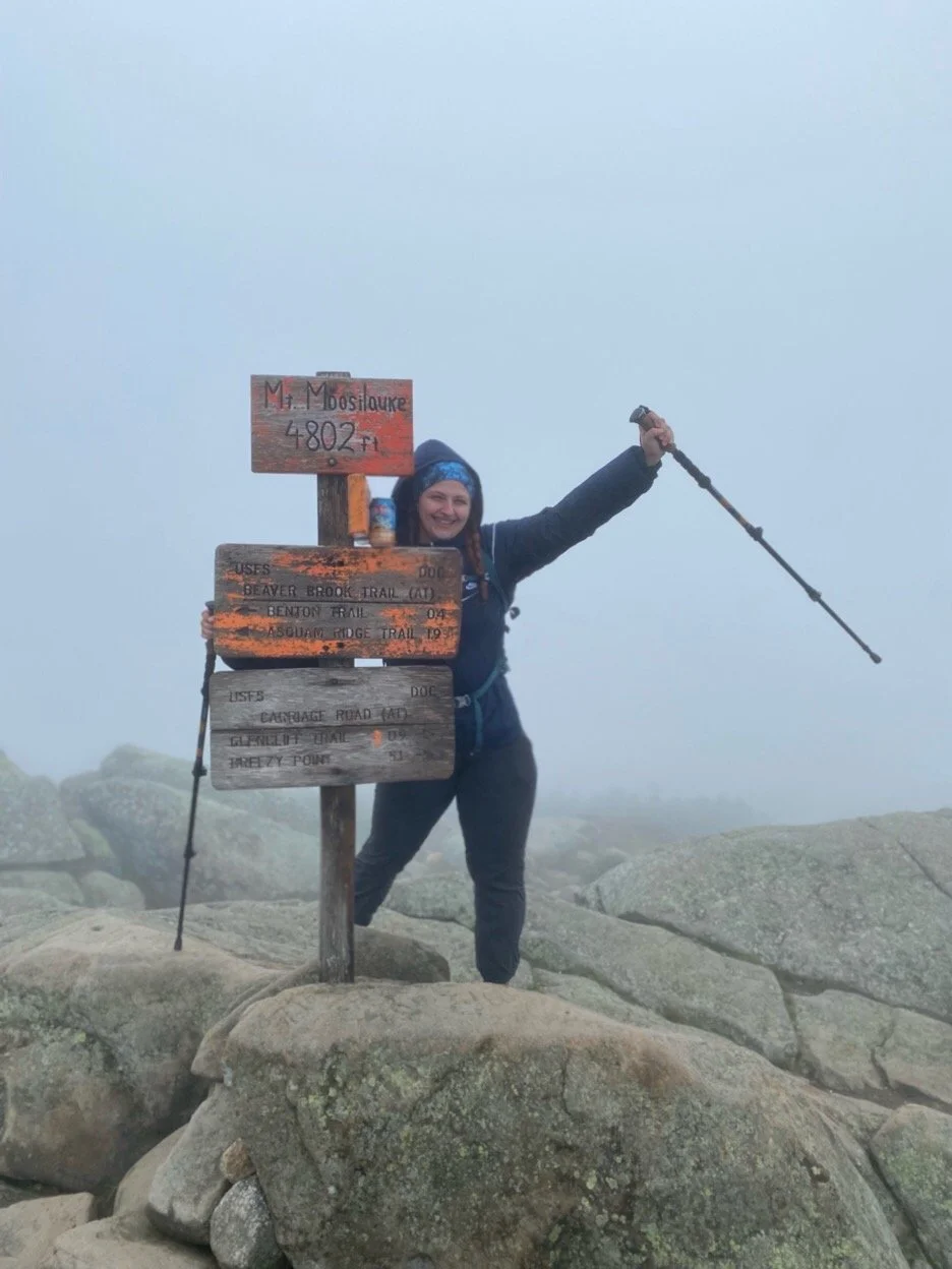
Mount Moosilauke (4,802')
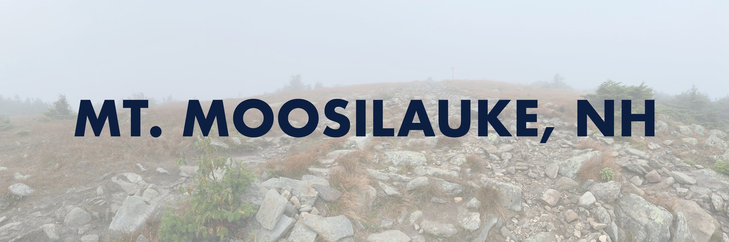
Our first trip of back to back hiking to make the most of the drive didn’t come without any concerns. I was strategic in my planning and chose a second hike that would hopefully not cause our legs to fall off from sheer exhaustion after the 9-ish miles yesterday and I believe I picked the right one. My partner was never a huge hiker, but has always been supportive of my goal (although insignificant to him) so the fact that this became his favorite mountain we’ve hiked felt even more justified.
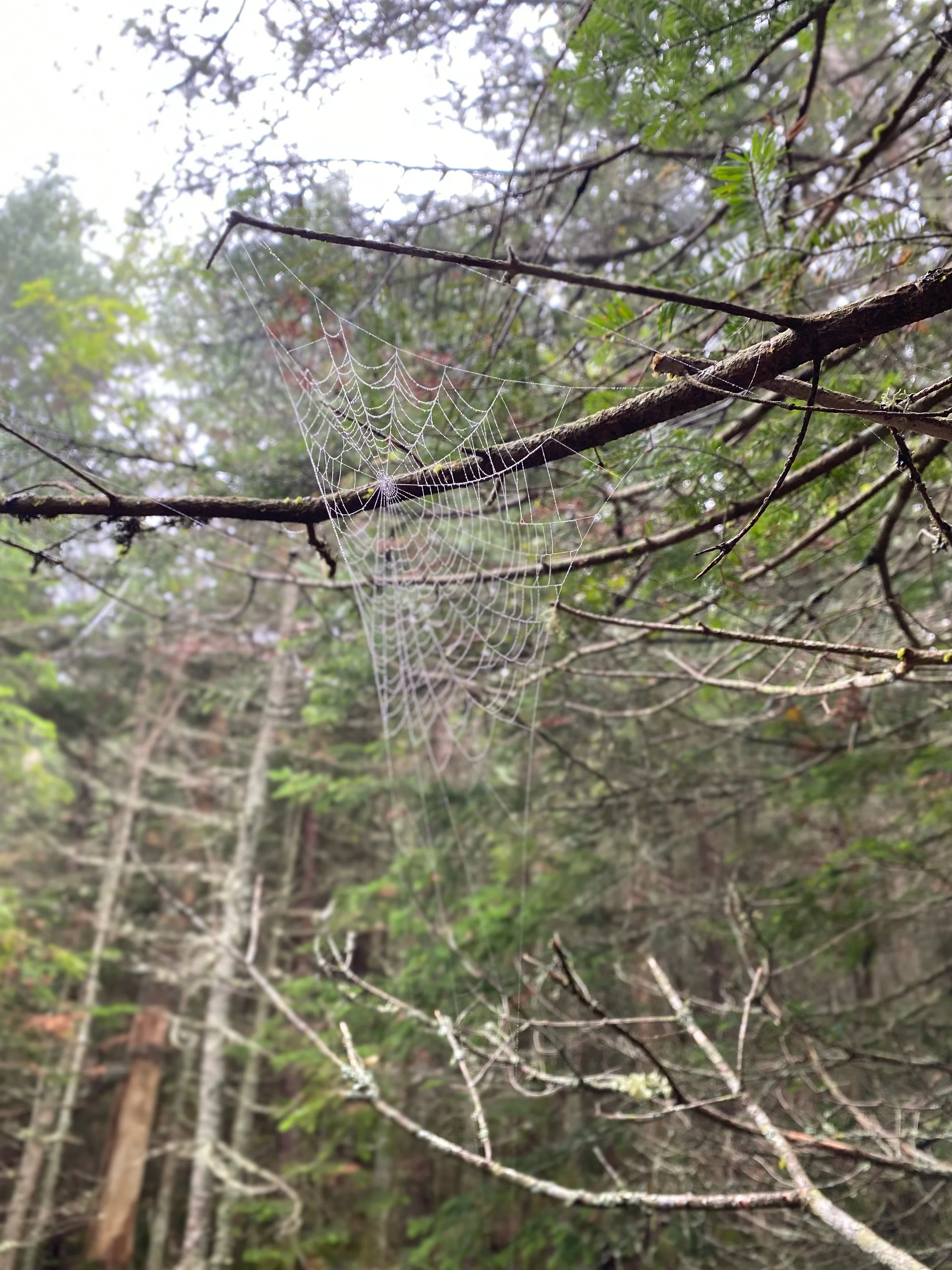
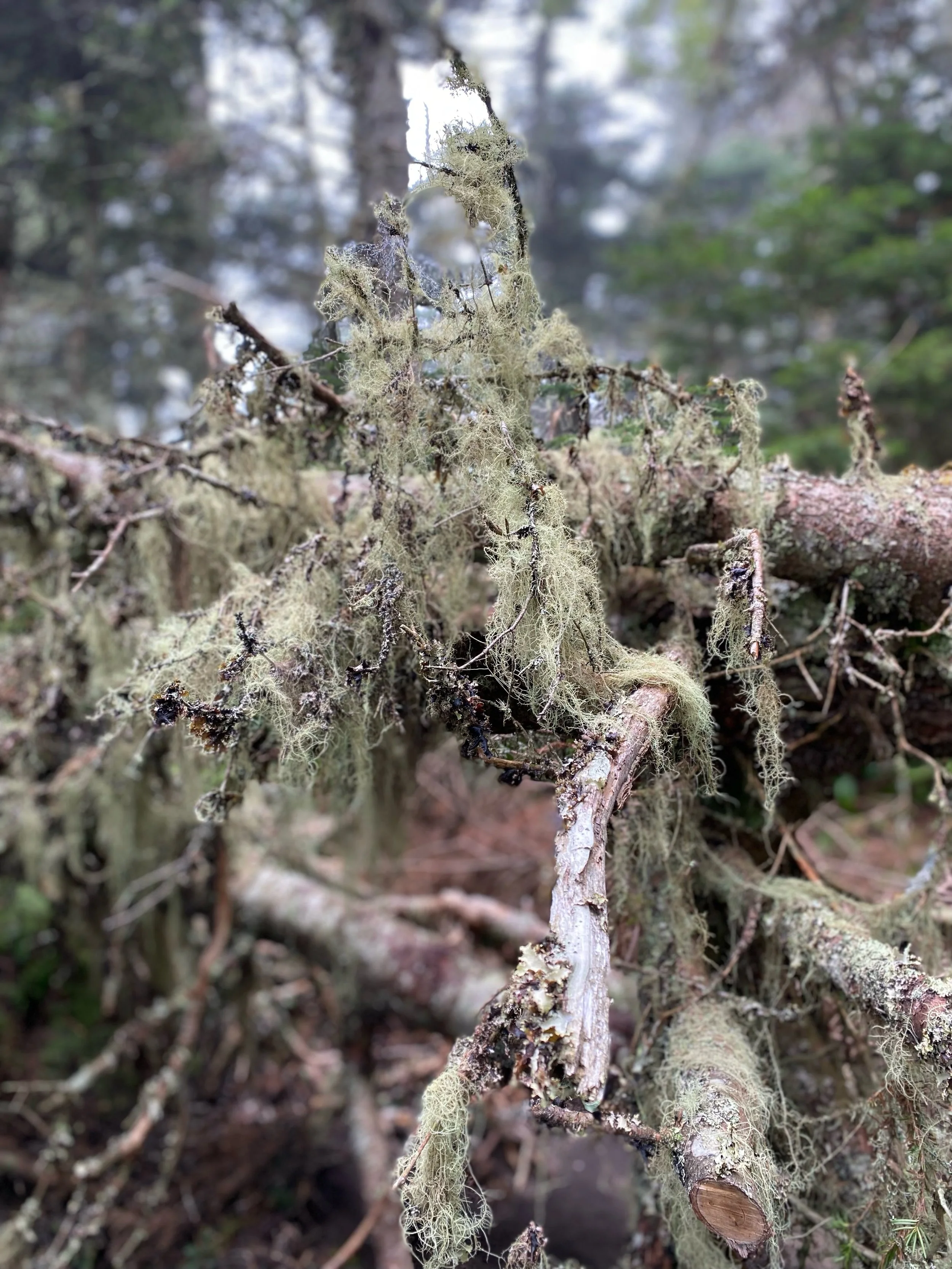
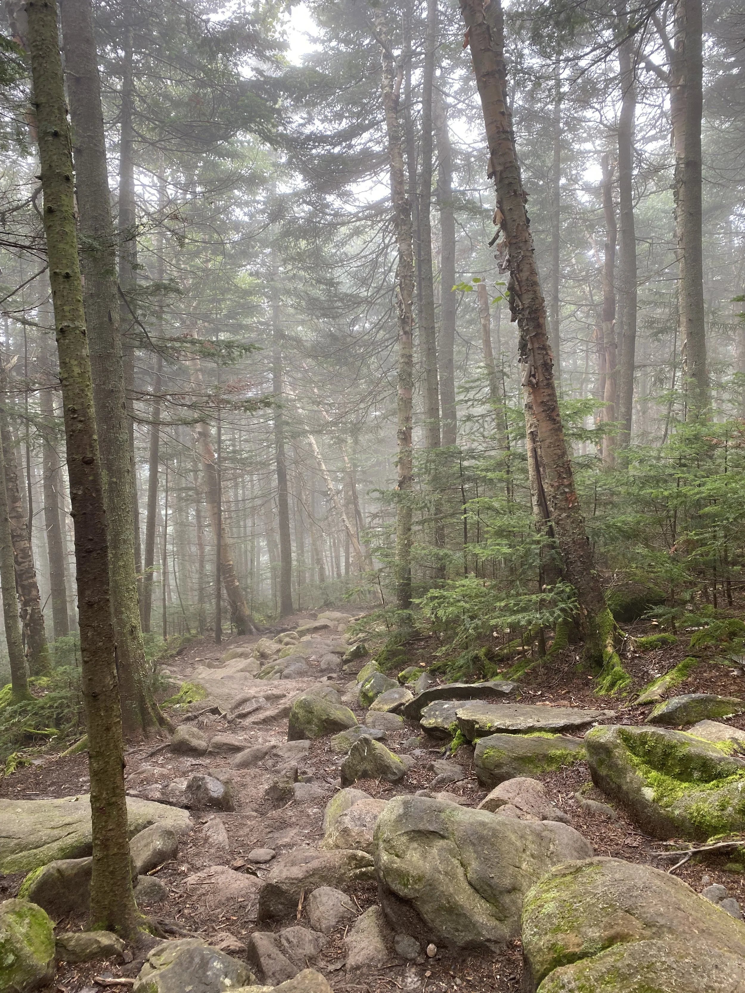
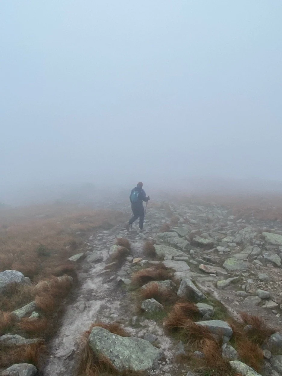
The day didn’t look particularly inviting for a scenic summit, I seem to attract the clouds, but the iconic sign atop ‘The Moose’ and perhaps even more iconic propensity for poor weather seemed fitting for our first trip up. We ascended via the Gorge Brook trail, the roaring water serving as a sort of calming soundscape. For what we’d accomplished yesterday, we were moving fairly quickly, though the trail was quite forgiving with only a few high-grade steep portions towards the top. For the most part, we fell silent and took in all the sights and sounds of the forest. As far as the White Mountain four thousand footers go, though well-traveled, Moosilauke stands alone in its own remote section of the Whites. My partner has a better phone camera than I do, so I played around in portrait mode capturing the quiet things that no one ever really knows are there. Moss, lichen, and spiderwebs coated the trees like lace; they gripped onto water droplets from the misty morning air.
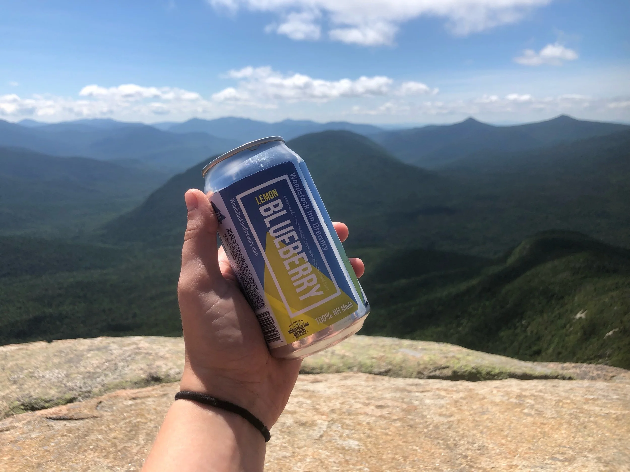
Entering the alpine zone I was met with the most refreshing, delectable smell I lack the words to describe. Zippy evergreen pine; sweet, sticky syrup; the earthy decay of the forest floor - I wish I could have collected it in a jar and made it into a candle I could burn for the rest of my days. It had been quite some time since I’d been on a truly bald summit, trodding over rock piles through the haze. At the summit sign, I popped open an appropriately named Cloud Walker IPA and exchanged some pleasantries with a few AT thru-hikers gearing up for the Whites.
The descent was equally peaceful, despite the breeze growing stronger, whispering through the alpine grasses. Ferns and branches billowed in the wind, needles cascaded to the forest floor. It was pure sensory satisfaction today in every detail and it’s pretty incredible to think that Mama Nature made it all herself. I understand the appeal of the White Mountains; the polarity of the woods wrapping its coniferous arms around you versus the barren but beautiful ‘Life on Mars’-esque nature of the open summit. Nonetheless, I felt so at home. As we crossed the bridge back to the Ravine Lodge, I wondered if perhaps in another life I had been there before. Perhaps, I was just there to visit an old friend.
NH 3/48
New England 8/67
New England 9/100 Highest
Northeast 9/115


Mount Osceola (4,340′) and East Osceola (4,156′)
Despite taking a few trips over the border into New Hampshire growing up, I never actually hiked there. This weekend, I finally made it up to the elusive White Mountains. Fear-mongering runs rampant in these parts, touting the world’s worst weather and most rugged/technical terrain on the East Coast; don’t underestimate the Whites. Not to say these warning words are unjustified, but maybe pick a different slogan for the postcards. Even still, thousands of locals and flat-landers alike wander into the WMNF each year for peak-bagging, backpacking, skiing, and general tom-foolery. After waiting out the grace period from being sick and receiving the first shot, I finally got my COVID vaccine’s second dose two days ago. I was told to take it easy, but I’d planned this trip weeks ago and I’ve never been one to take the rules as anything other than mere suggestions.
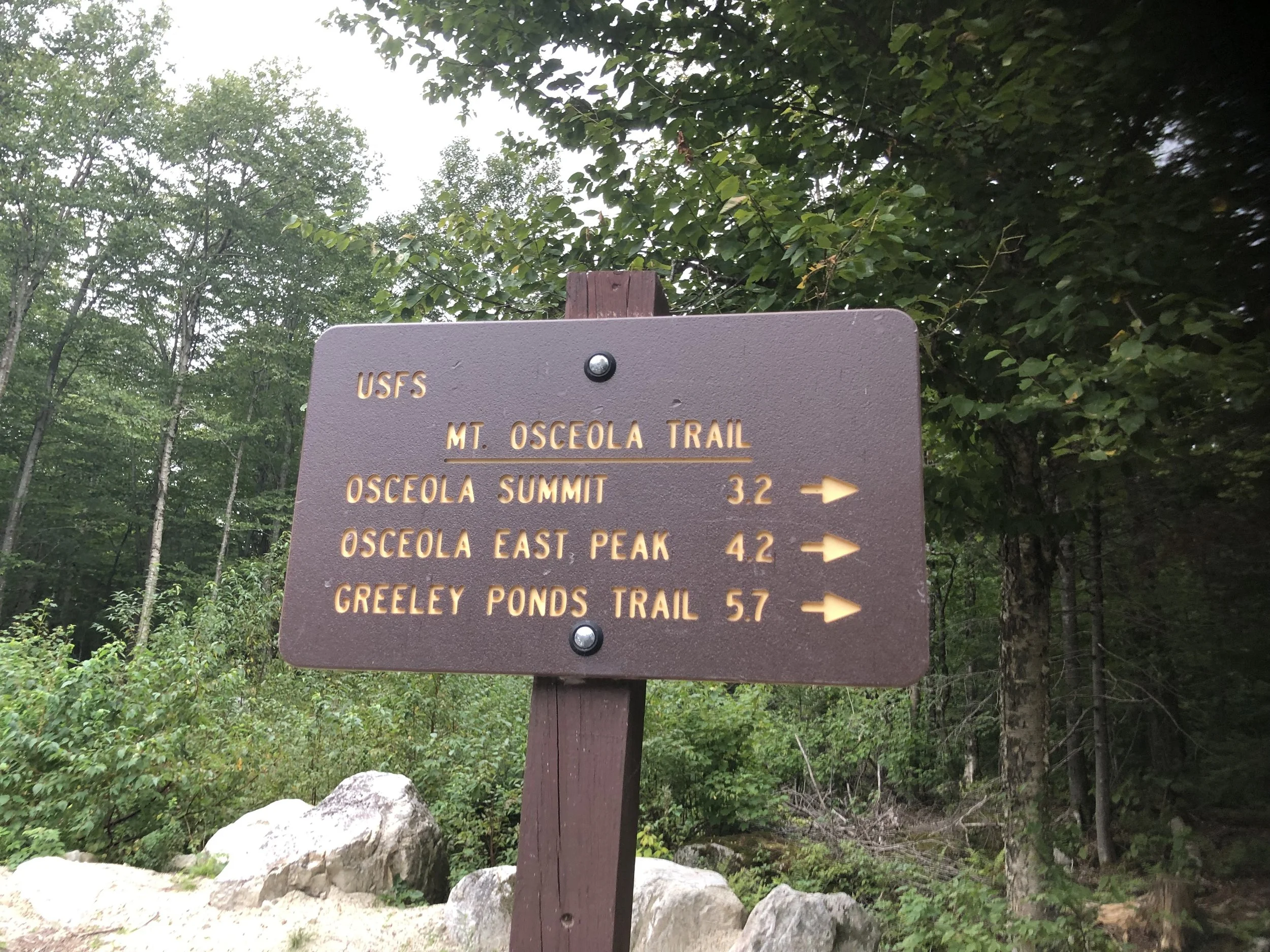
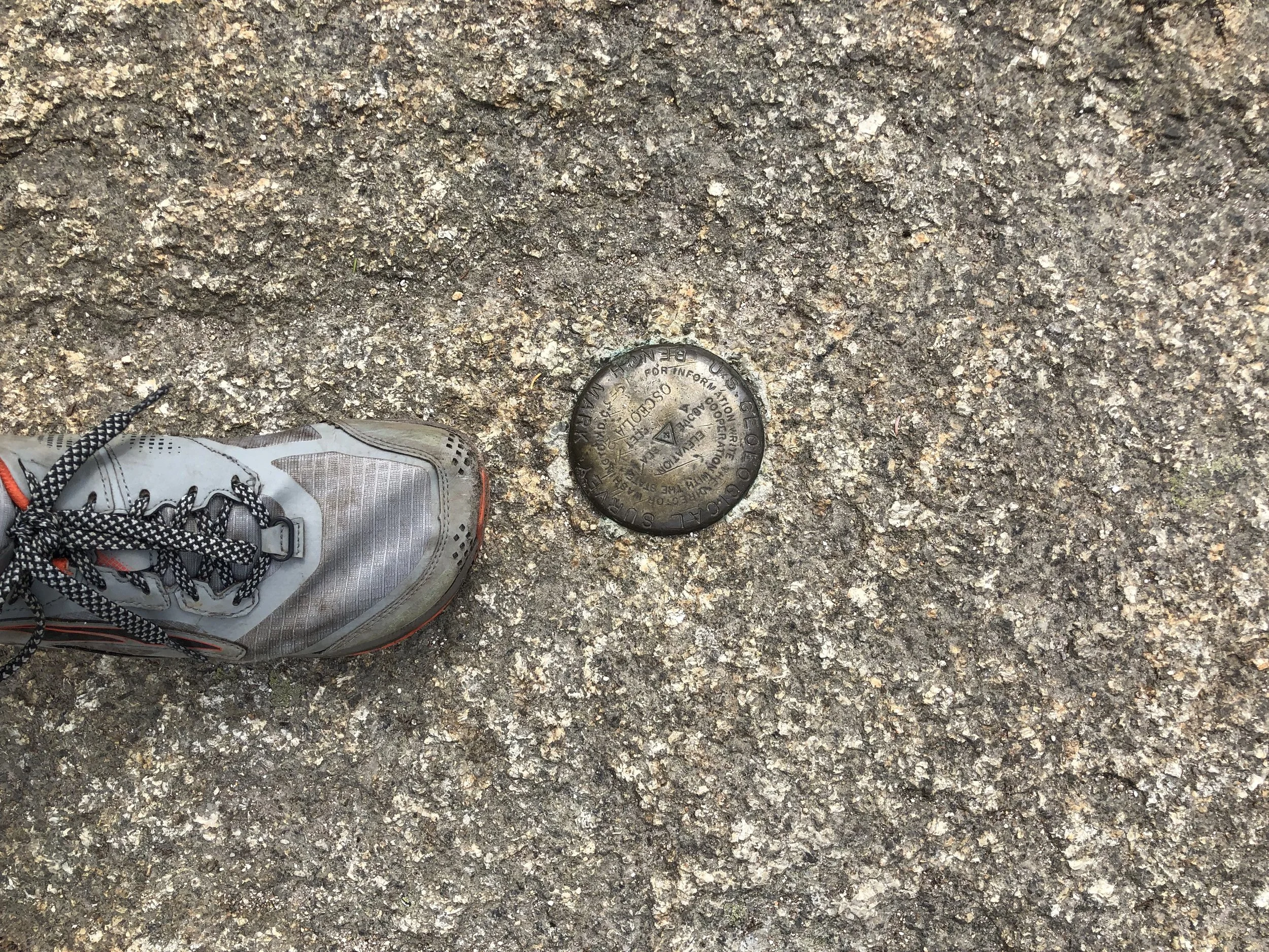
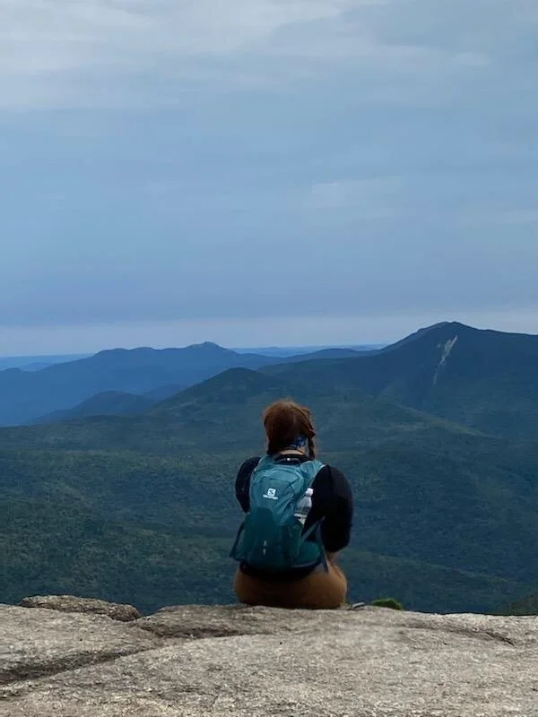
My partner made the 7 hour trip up with me last night and this morning around 9 we stepped foot on the Mount Osceola Trail from Tripoli Rd. Overall, the way up was challenging, but nothing I felt the VT5 hadn’t prepared me well for. Even nearing the top, the trail seemed to flatten out some before popping us out onto the huge summit overlook of the main peak. It was a bit crowded, but still had the most gorgeous views down into Waterville Valley Ski Area. Unfortunately, last night’s dinner from the Pemi Pub was also making it’s way up for my partner, so he opted to turn around and head back to the truck for a nap while I continued on to East Peak to check it off my list.
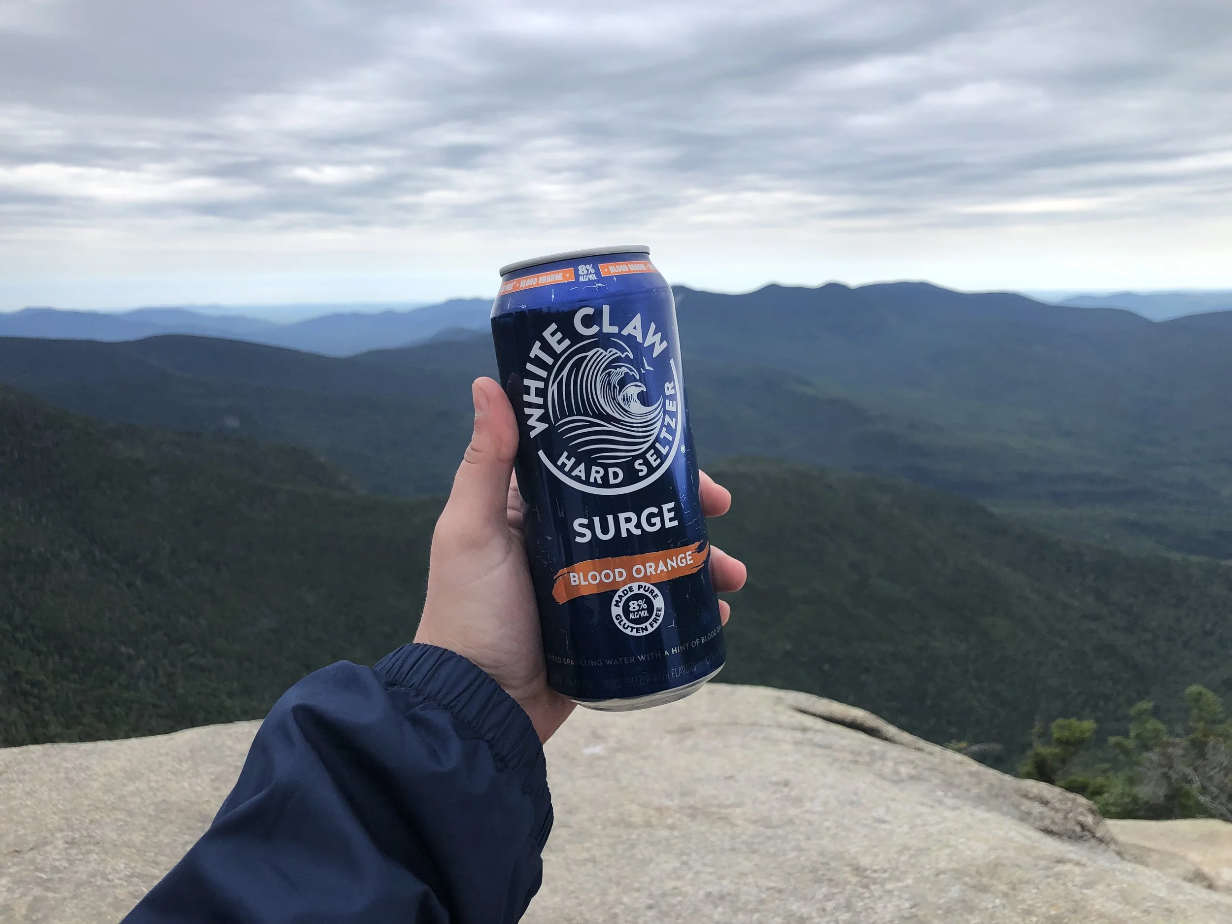
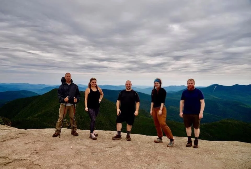
A section of trail I’d been looking forward to after I’d done some research was a steep, narrow rock scramble nicknamed ‘the Chimney’ between the two peaks. It was a fun challenge going down, but as a (former) rock climber, I was looking forward to what it took to get back up. East Peak was a steep drop and climb back up to a tree-covered summit with a large rock cairn. From the opposite direction, a group of hikers emerged to the summit. One of the guys, a photographer, offered to take my picture next to the cairn as proof I’d made it to the top. We all got to talking and they seemed like a fun group, so I was sort of absorbed into the rest of their hike since we were going the same way anyway. Just as I’d suspected, the Chimney was even more fun clambering back up with friends. Shortly after, I’d re-summited Main Peak and sat down for lunch and a celebratory summit White Claw with my new friends. We took a group photo and started back down a little more tipsy than when we started to the Tripoli Rd lot where they had one of their car-spots. We all exchanged Facebook information and upon seeing the edited photos, I’ve decided we just have to drop an album with our group picture as the cover. I hope to hike with them again very soon.
NH 1 and 2/48
New England 6 and 7/67
New England 7 and 8/100 Highest
Northeast 7 and 8/115


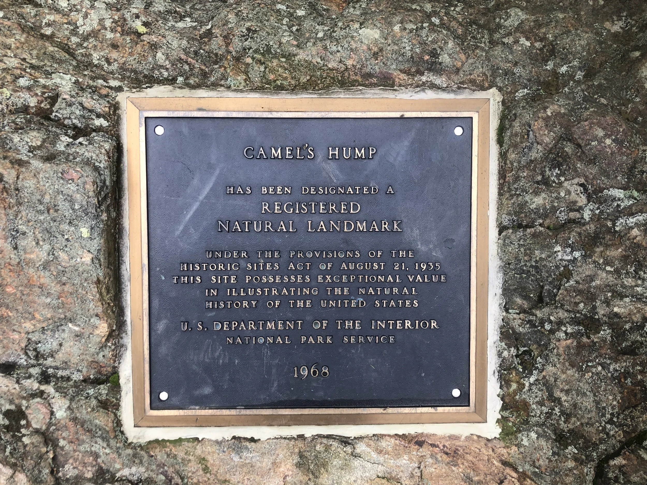
Camel's Hump (4,083')
If my dedication to this whole list thing was ever in question, let this be the day to debunk any doubts. Today, I turned 24. I also woke up at 3:50 am, loaded up my daypack, threw on my brandy-new trail runners (had to see what the Altra hype was about - happy birthday to me!), and jumped in the truck for 2 and 1/2 hours to Huntington for my 5th and final Vermont four thousand footer. I arrived at a misty 6:45 am after getting a bit turned around from spotty service and got right to work. There was only one other car in the lot of the Burrows trailhead, I figured must be a Long Trail section hiker as not many people would be hiking at this hour on a Monday morning.
The trail seemed to split into two sides for the majority of the way; do you prefer slick rocks or twisted roots? Take your pick! I have to say, these shoes are amazing. Recently, I’d been having a hard time retiring 3 pairs of trail runners in lieu of trying out the new, trendy zero-drop shoes. The Salomon X-Mission 3s were my go-to hiker for the last 6 years and I’d busted through my last pair on my way down from Pico two days before. I’d also been noticing some radiating knee and back pain, especially coming down steep sections, so I did my research and opted to try the Altra Lone Peak 5 - arguably their most popular model. Science dictates that humans aren’t meant to be walking with a heel drop - it’s just not natural - and with most shoes featuring an average 12mm drop, it doesn’t seem like much, but that drop rocks you onto the ball of your feet and places unnecessary stress on your knees (putting my EMS Footwear Guru training to use here!) The wide toe box and super grippy soles made them infinitely more comfortable than a standard, cramped trail runner. I moving faster and more securely, especially because of how damp the air was, making everything slippery.
Not a soul on trail today which meant an eerie dichotomy of my nerves - so many things can go wrong when out in the wilderness - and enjoying the comfort of my own company. I set my start time, my pace, everything was up to me and I thrive given that independence. Burrows trail was incredibly straightforward; you are going straight up a mountain, it will be steep but manageable. At just over 2 miles, I joined up with the Long Trail south to reach the summit at around 8:20 am. There are supposed to be stunning views of the area and that iconic rock formation that makes The Hump, The Hump, but due to wind currents blowing wildfire smoke down through Canada from the western U.S. and seemingly imminent rain, I could hardly see 10 ft in front of me. Though disappointed, I couldn’t help but think how cool it was to be up there all alone in the mist, surrounded by salamanders just doing their thing. I put on the album I’d downloaded, Cornell 5/8/77, and stayed up there waiting out to see if the clouds would give for about an hour. It just wasn’t meant to be that day, so I somehow found those white blazes and started my climb down.
I began to see other hikers about two thirds of the way down, all of them so kind and pleasant, even for an “I hate Mondays” type of morning. The trail community in the Northeast is simply unrivaled and I’m so glad to be a part of it. I made it back to the truck around 11 and started my drive back to Clarendon, that other-worldly landscape still buzzing around in my head. The sun started to peer out as I was leaving Camel’s Hump State Park; I glanced up at where I’d just been sitting about an hour and a half prior and thought - what if I’d just started a little later, waited a little longer? No. If we’re constantly bothered with all the “what if’s”, we can never appreciate the “be here, now’s.”
Anyway, I’m off to Gringo Jack’s for some tacos and margaritas.
NH 0/48
New England 5/67
New England 6/100 Highest
Northeast 6/115


Pico Peak (3,967')
The off season had not been so good to me; after having COVID and moving out of a terrible living situation weeks before, I was back up in Vermont for my grandfather’s funeral. It’d been a long haul with my mother as his caretaker while he suffered from dementia - a lot of uncertainty remained moving forward, so mom and I took to the hills to get away and rest our minds for a while. I wanted to ease my way in after being sick so we chose Pico; it’s close and on the New England Hundred Highest list at just under four thousand feet.
We ascended via the Sherburne Pass which meandered up from VT Rt. 4 and used to be a part of the Long Trail before it was re-routed, sharing stories of my grandfather and his love for animals and the outdoors, pondering on what the future might hold. About 2 miles in, the trail joined with a ski slope allowing for some nice views and wildflower patches. It was somber, yet serene as we basked in the quietness; I suppose life sort of is just that way, always bouncing back and forth between sunshine and hurricanes. We can’t control the weather, but I was thankful for this clear day for a change.
The last 1/2 mile up was the more traditional high peak terrain; lots of steeper climbing, rock scrambles, and even an immaculately maintained shelter (the Green Mountain Club chapters do such a fantastic job keeping up with trails through the state - so very thankful for all they do!) Another summit atop a ski slope that overlooked some familiar landmarks including the city of Rutland; Chittenden Reservoir, which I hiked around as a child with my mom and grandparents - quite full circle, if you ask me; and just behind the trees near the ski patrol lodge stood Killington. Had a nice conversation with an older couple with their daughter and dog from Windsor and enjoyed a snack before climbing down. Today was a peaceful day, despite it all. It got me thinking about a common saying among hikers and backpackers:
If you can’t carry it in your pack or in your soul, you probably don’t need it.
NH 0/48
New England 4/67
New England 5/100 Highest
Northeast 5/115


Mount Abraham (4,006′) and Mount Ellen (4,083′)
In true weekend warrior fashion, we booked a room last minute in Waitsfield during peak leaf-peeping season and left at 6am Saturday morning to beat the traffic heading north for our impromptu autumnal ‘Tour du Vert Mont’. Appropriately, we stopped at Drop-In Brewing in Middlebury before some boozy apple picking just down the road at Happy Valley Orchards. We ate lunch by the creek and found our way to our little ski lodge near Sugarbush Resort.
Waking up just as early the next day, we parked at Lincoln Gap and hit the Long Trail going north for a short, brisk 2.4 miles to the summit of Abraham - a very popular day hike and for good reason. It was a steep segment of trail, but the morning light peering through the trees and the creeping winter frost kept us moving. After a final push up the rock slab to the summit, we were greeted with incredible panoramic views from the top. Fire orange, deep rust reds, and golden yellows rustled through the trees overlooking the Adirondacks and Lake Champlain to the west; Green Mountain National Forest to the south; the Whites to the east; and the Canadian border to the north. I sat atop the summit in a rock circle for a while before the chill set in once again, I threw on my puffy, and continued north while my partner rested before making his way back down.
It’s a relatively flat (for northern Long Trail standards anyway) 3.3 or so miles on a ridge to Ellen, which shares its summit with Sugarbush as a ski slope. I was a bit pressed for time with dinner reservations at a brewery for 6pm, so with the wind behind me, I hurried along back under tree line in search of a glimpse at the remnants of a plane crash from the early 70s. After that, it was smooth sailing over Little Abe and Lincoln Peak before the trees opened once again and the ski lift lined the mountain. I snapped a quick photo, thanked Ellen for a picture-perfect moment, and headed back toward Abe.
The way back simply always feels longer - maybe it’s the fatigue, perhaps the wistful sadness of returning home after an adventure, but rambling down the way we came seemed an eternity. With aching knees, we found the truck, happy to have started when we did as cars from all down the eastern seaboard (and even some from the western one) dotted the dirt road up to the trailhead. My biggest peak-bagging day clocking in at 11.2 miles, wrapped up with beer cheese nachos and a (Lawson’s) Sip of Sunshine.
NH 0/48
New England 3 and 4/67
New England 3 and 4/100 Highest
Northeast 4 and 5/115


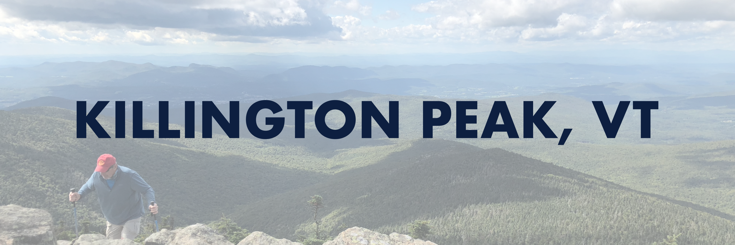
Killington Peak (4,229')
A quick trip up to visit my mom for Labor Day weekend meant poking around for something to do right in her theoretical backyard. My grandfather was born in West Rutland and eventually made his way back semi-permanently to build a vacation home in Clarendon in the early 1970s with Killington ski resorts right around 20 mins away. While I’ve never been skiing (definitely someday!), my mom had hit the slopes there dozens of times. No one in my family, however, had ever hiked up it. I somehow convinced my mom it would be a good idea to come with me.
We started around 9:30 am up the Bucklin trail, the sloping first 2 miles were misleading for what was to come as it was straight up from there. As we climbed, the trail conjoined with a grassy summer ski path - I’m not sure if the lack of roots and rocks made the ascent easier or harder, but it was a welcome change of pace as we began to see the cascading green and lots of familiar places like VT Rt. 4 and Killington village. Nearing the top, there’s a wooden stairway up to where the trail meets the gondola where visitors can take a ride to the restaurant and tourism center around a third of a mile down from the actual summit which is only accessible by a rocky spur trail.
It was a windy, chilly bluebird day and it meant so much to be able to share it with my mom. We spent around 20 minutes at the top admiring the near 360°, wishing the fire tower was still accessible to climb up and smiling over the fact that this was my mom’s first ever four thousand footer. She didn’t need to check off any lists, but I could tell the trip meant a lot to her too. I’m so thankful to have her as a mom - she has inspired and fostered my independence, love of the outdoors, and so many other positive qualities I’ve found in myself. We exchanged pictures and spoke with a few other hikers, then headed back towards the lodge and back down to the parking lot. That night, we cooked veggie burgers out on the grill and raised a pint of The Shed Mountain Ale by the fire pit - it doesn’t get much better than that.
NH 0/48
New England 2/67
New England 2/100 Highest
Northeast 3/115


Slide Mountain (4,190')
The pandemic has proven a strange and difficult time in a lot of ways. One of them for me, plain and simple, being overworked to the point of not really being able to take any time off and leave my computer at home for the weekend. I was determined to do things differently this weekend, it was my birthday after all.
Not particularly in a position to spend a lot of money, we hightailed it up from central NJ to a shoddy motel in the Catskills near Ulster County to check off one of the only two four thousand footers there. We got a late start up the Phoenicia East Branch trail on a muggy, humid, bug-infested sort of day. Branching to the left, we took the clockwise loop up the mountain. Short mileage, only around 2.8 to the top, but stumbling over little ankle-breakers (a term I first heard from an AT thru-hiker at Delaware Water Gap coming out of “Rocksylvania”) made for an interesting ascent. I could only think of the reason it was called Slide Mountain, imagining myself busting my butt sliding down all the loose rock on my descent in an hour or two.
The heat made for a migraine flare-up, so the summit really couldn’t have come any sooner as we were being eaten alive by black flies. Few were the moments of peering through trees at the green rolling ranges of the Catskills, famously known for their wooded summits. At last, we made it to the top and took a long re-hydration and morale-boosting break before heading back down. Parting ways with our original footpath and opting for the more gentle decline of the Curtis Ormsbee trail; we needed the change of scenery (albeit still in the green tunnel) and it was far easier on the ‘ole knees.
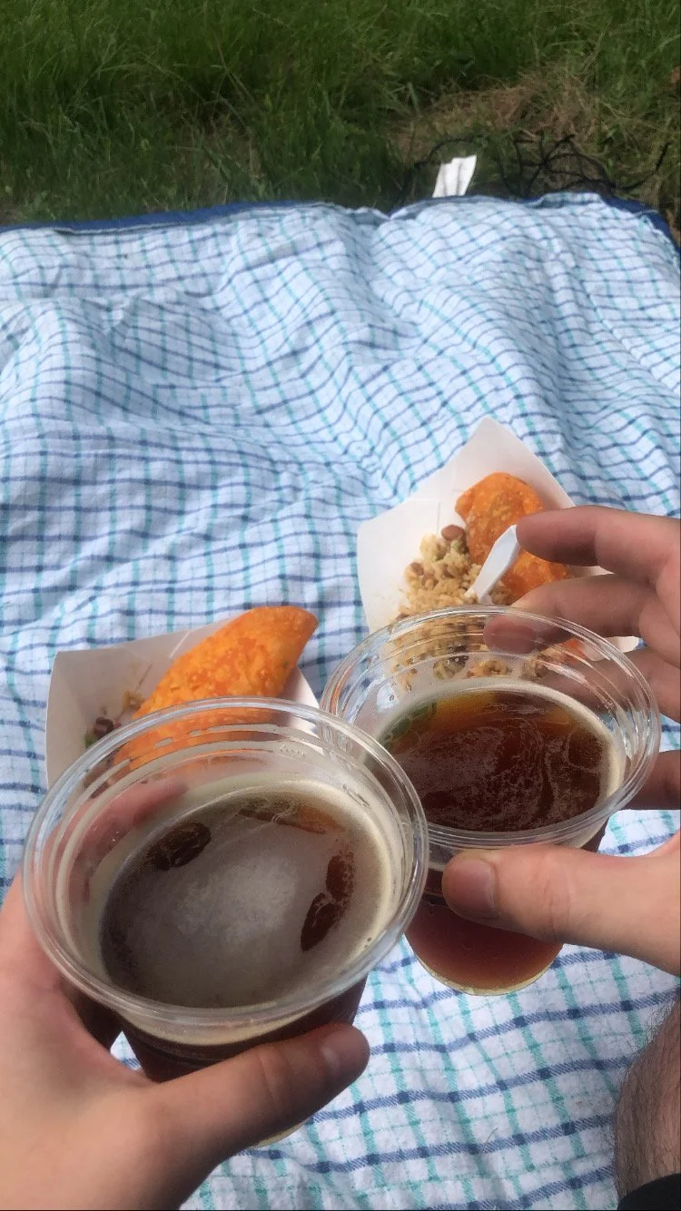
We stopped for delicious beer and food trucks at West Kill Brewing a few miles away, but popped a flat on the Thruway going home. You win some and you lose some. I walked away with holes in my shoes and the realization that not every hike could be my favorite, but they were - in one way or another - always worth doing.
NH 0/48
New England 1/5
New England 1/100 Highest
Northeast 2/115


Mount Mansfield (4,395′)
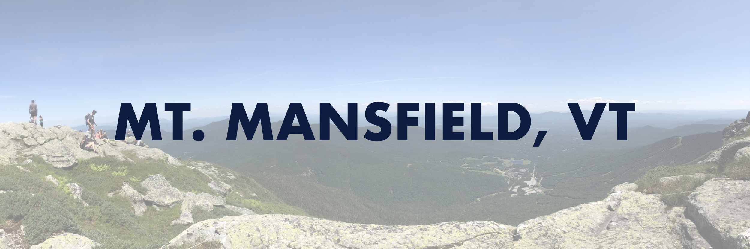
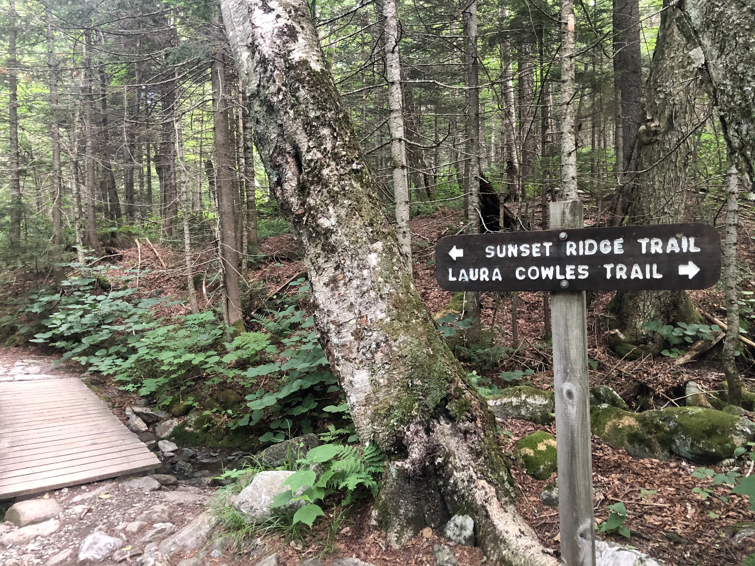
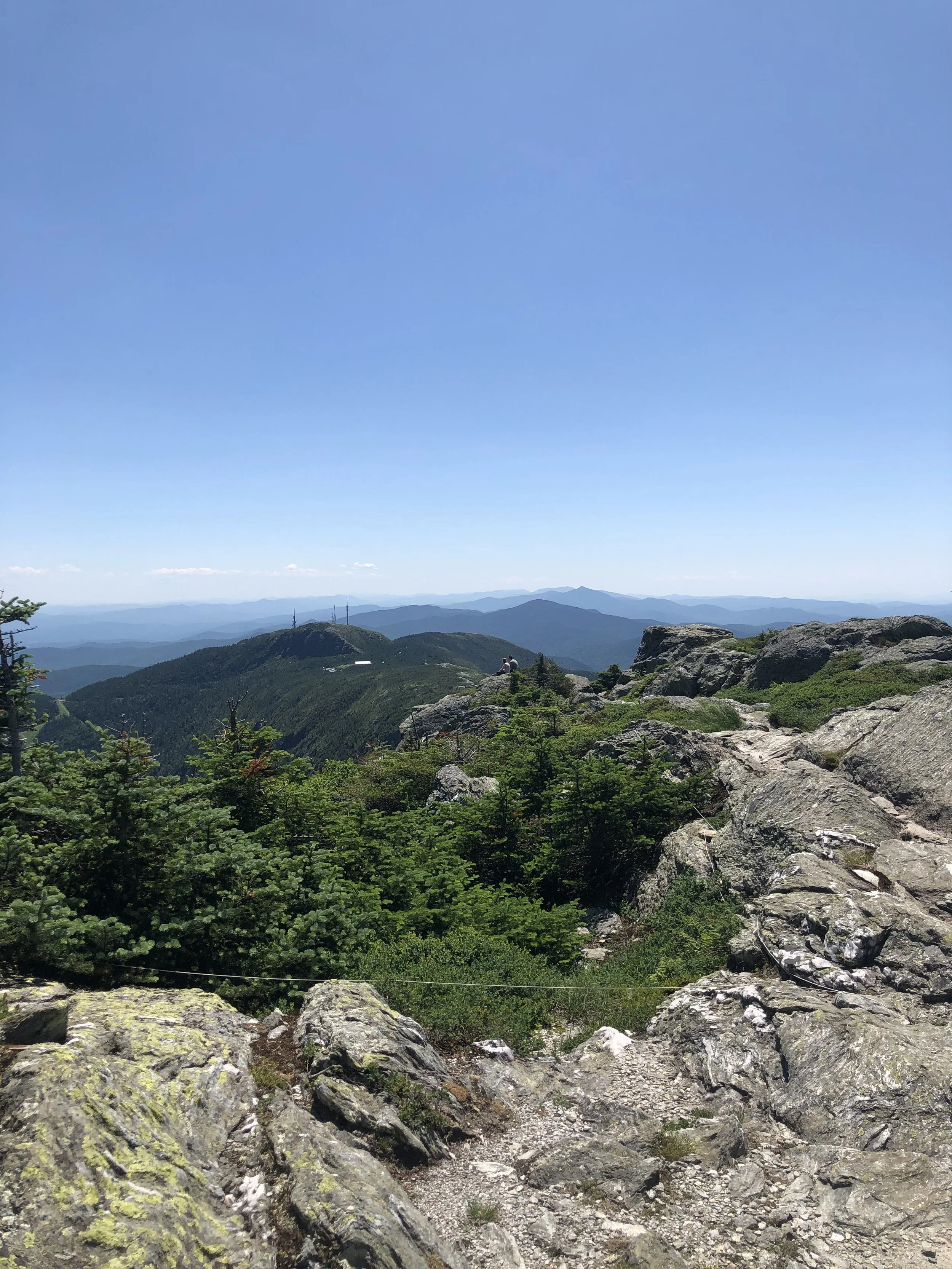
I’d be lying if I said with 100% certainty I knew what I was getting myself into. After a day of researching, much of it from others’ recommendations in a Facebook group, I made my way from my mom’s place outside of Rutland, VT up to Underhill State Park around 2 hours away. I decided to ascend via the Laura Cowles trail starting around 8:30 am - this was the shorter and steeper 2.6 mi route directly up to The Chin, the highest point of the mountain.
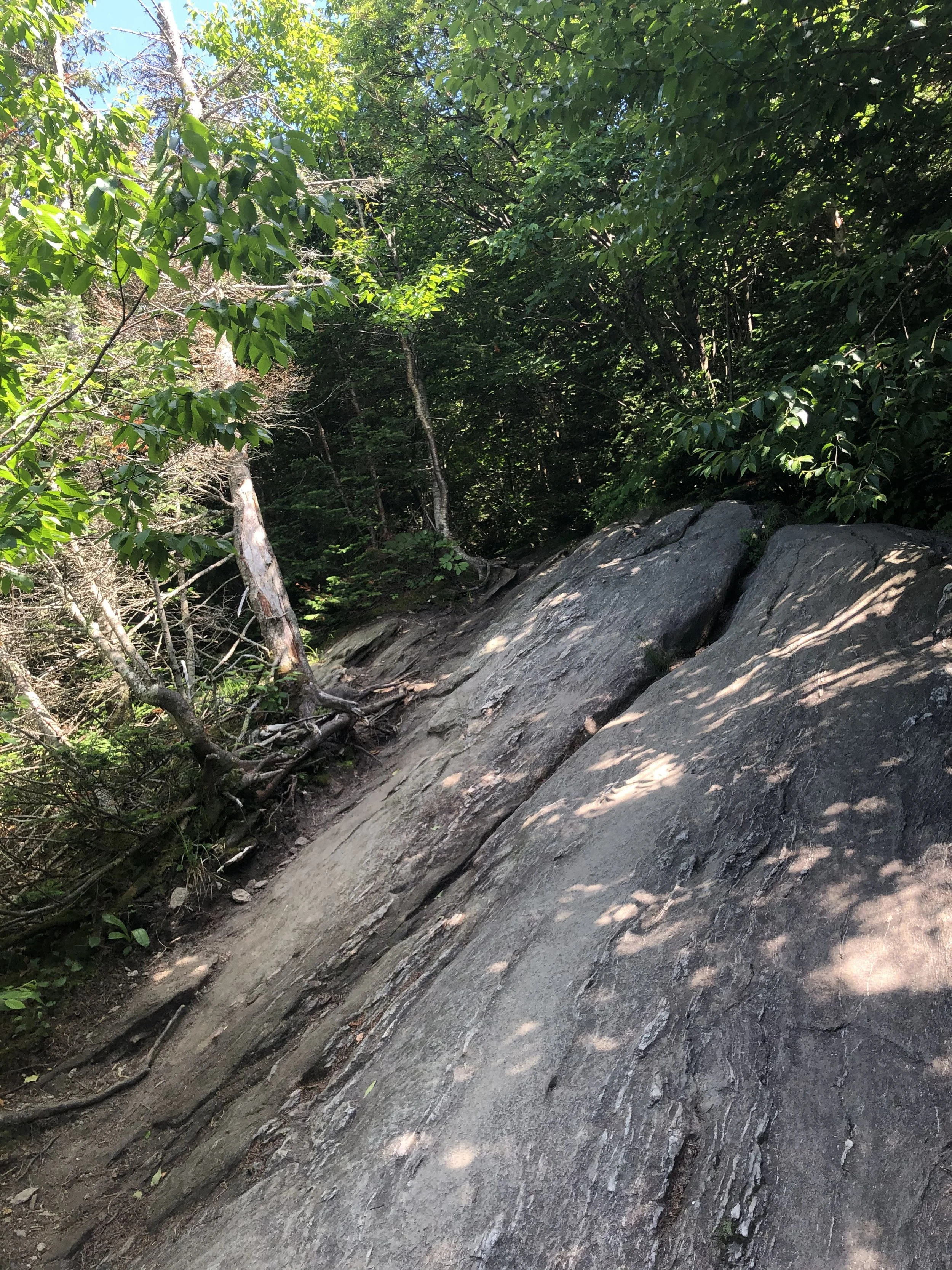
The first mile or so of trail is an old logging road, which felt pretty gentle. Once officially on the Laura Cowles trail, the terrain became more and more rugged the way up. Roots, slabs of granite, small boulder fields - it felt like a big outdoor playground. Soon, the trees grew smaller and smaller until they practically disappeared for the last 3/4 of a mile to the summit. This was my first time entering the Alpine Zone, a biome that exists in higher elevations with fragile vegetation that takes years to grow and seconds of misplaced footsteps to be totally destroyed.
There was something about crawling up that rock scramble nearing the top that just made me feel small and insignificant, but not in a negative way. I was just grateful and humbled by the fact I was able to exist under those conditions in that moment. A ‘Carole King’ sense of feeling the earth move beneath your feet, it just keeps turning while we’re all trying to get somewhere because we’re human and that’s what we do. Despite the scorching July heat, sun exposure, and (what I would later find out to be) expired sunscreen, I pushed on and joined up with the Long Trail (LT) to summit Mansfield. Along the LT were the additional prominences of the mountain; to the north, the Adam’s Apple and to the south, the Nose and the Forehead.
I can’t say it was an emotional event, I’m just not that kind of person. I was exhausted and low on water, so I laid down on a rock and basked in the late morning sun like a lizard, content and feeling as though I was simply meant to be there. I snacked on half a protein bar, took some photos, peered down at (from where I was standing) the small town of Stowe, and began my descent down the Sunset Ridge trail. My legs felt like jello and I was ‘lobstah’ red upon returning to the car from my day above tree line, but I was filled with such immense pride in my accomplishment. I stopped at a packie on the way back and celebrated with a Snickers bar, Dilly Bites, and a cold Long Trail Ale - that’s just the hiker way - and began planning my next trip.
NH 0/48
New England 1/5
New England 1/100 Highest
Northeast 1/115